
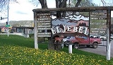
El Jebel, Colorado
Encyclopedia
El Jebel is a census-designated place
(CDP) in Eagle County
, Colorado
, United States
. The population was 3,801 at the 2010 census
.
The community is located in the Roaring Fork Valley
, between Carbondale
and Basalt
, along the north side of State Highway 82
. The community grew rapidly in the last two decades of the 20th century with the population increase in the valley downstream from Aspen
. It consists largely of a group of commercial establishments just off State Highway 82
, approximately 3 miles (4.8 km) northwest of Basalt, as well as several housing subdivisions nearby. The Carbondale
Post Office (ZIP Code
81623) serves the El Jebel postal addresses.
"El Jebel" means "The Mountain" in Arabic.
According to the United States Census Bureau
, the CDP has a total area of 6.7 square miles (17.4 km²), of which, 6.7 square miles (17.4 km²) of it is land and 0.15% is water.
of 2000, there were 4,488 people, 1,433 households, and 1,071 families residing in the CDP. The population density
was 667.0 people per square mile (257.5/km²). There were 1,483 housing units at an average density of 220.4 per square mile (85.1/km²). The racial makeup of the CDP was 87.79% White, 0.09% African American, 0.27% Native American, 0.96% Asian, 0.02% Pacific Islander, 8.98% from other races
, and 1.89% from two or more races. Hispanic or Latino of any race were 29.84% of the population.
There were 1,433 households out of which 49.1% had children under the age of 18 living with them, 61.5% were married couples
living together, 7.9% had a female householder with no husband present, and 25.2% were non-families. 13.9% of all households were made up of individuals and 1.5% had someone living alone who was 65 years of age or older. The average household size was 3.12 and the average family size was 3.38.
In the CDP the population was spread out with 30.6% under the age of 18, 8.1% from 18 to 24, 38.3% from 25 to 44, 20.5% from 45 to 64, and 2.6% who were 65 years of age or older. The median age was 32 years. For every 100 females there were 108.5 males. For every 100 females age 18 and over, there were 112.1 males.
The median income for a household in the CDP was $60,685, and the median income for a family was $62,047. Males had a median income of $37,073 versus $29,688 for females. The per capita income
for the CDP was $21,261. About 6.0% of families and 9.4% of the population were below the poverty line, including 8.0% of those under age 18 and 15.9% of those age 65 or over.
Census-designated place
A census-designated place is a concentration of population identified by the United States Census Bureau for statistical purposes. CDPs are delineated for each decennial census as the statistical counterparts of incorporated places such as cities, towns and villages...
(CDP) in Eagle County
Eagle County, Colorado
Eagle County is the thirteenth most populous of the 64 counties of the State of Colorado in the United States. The county is named for the Eagle River. The county population was 41,659 at U.S. Census 2000. The county seat is the Town of Eagle...
, Colorado
Colorado
Colorado is a U.S. state that encompasses much of the Rocky Mountains as well as the northeastern portion of the Colorado Plateau and the western edge of the Great Plains...
, United States
United States
The United States of America is a federal constitutional republic comprising fifty states and a federal district...
. The population was 3,801 at the 2010 census
United States Census, 2010
The Twenty-third United States Census, known as Census 2010 or the 2010 Census, is the current national census of the United States. National Census Day was April 1, 2010 and is the reference date used in enumerating individuals...
.
The community is located in the Roaring Fork Valley
Roaring Fork Valley
The Roaring Fork Valley is a geographical region in western Colorado in the United States. The Roaring Fork Valley is one of the most affluent regions in Colorado as well as one of the most populous and economically vital areas of the Colorado Western Slope. The Valley is defined by the valley of...
, between Carbondale
Carbondale, Colorado
Carbondale is a Home Rule Municipality in Garfield County, Colorado, United States. The population was 5,196 at the 2000 census. The town is located in the mid valley of the Roaring Fork River, downstream from Aspen and upstream from the mouth of the Roaring Fork at Glenwood Springs. The town...
and Basalt
Basalt, Colorado
Basalt is a Statutory Town in Eagle and Pitkin counties in the U.S. state of Colorado. The population was 2,681 at the 2000 census.-Geography:...
, along the north side of State Highway 82
Colorado State Highway 82
State Highway 82 is an 85.29 mile long state highway in the U.S. state of Colorado.-Route description:SH 82 provides the principal transportation artery of the Roaring Fork Valley on the Colorado Western Slope, running from Interstate 70 at Glenwood Springs southeast past Carbondale, Basalt...
. The community grew rapidly in the last two decades of the 20th century with the population increase in the valley downstream from Aspen
Aspen, Colorado
The City of Aspen is a Home Rule Municipality that is the county seat and the most populous city of Pitkin County, Colorado, United States. The United States Census Bureau estimates that the city population was 5,804 in 2005...
. It consists largely of a group of commercial establishments just off State Highway 82
Colorado State Highway 82
State Highway 82 is an 85.29 mile long state highway in the U.S. state of Colorado.-Route description:SH 82 provides the principal transportation artery of the Roaring Fork Valley on the Colorado Western Slope, running from Interstate 70 at Glenwood Springs southeast past Carbondale, Basalt...
, approximately 3 miles (4.8 km) northwest of Basalt, as well as several housing subdivisions nearby. The Carbondale
Carbondale, Colorado
Carbondale is a Home Rule Municipality in Garfield County, Colorado, United States. The population was 5,196 at the 2000 census. The town is located in the mid valley of the Roaring Fork River, downstream from Aspen and upstream from the mouth of the Roaring Fork at Glenwood Springs. The town...
Post Office (ZIP Code
ZIP Code
ZIP codes are a system of postal codes used by the United States Postal Service since 1963. The term ZIP, an acronym for Zone Improvement Plan, is properly written in capital letters and was chosen to suggest that the mail travels more efficiently, and therefore more quickly, when senders use the...
81623) serves the El Jebel postal addresses.
"El Jebel" means "The Mountain" in Arabic.
Geography
El Jebel is located at 39°23′47"N 107°5′13"W (39.396380, -107.087016).According to the United States Census Bureau
United States Census Bureau
The United States Census Bureau is the government agency that is responsible for the United States Census. It also gathers other national demographic and economic data...
, the CDP has a total area of 6.7 square miles (17.4 km²), of which, 6.7 square miles (17.4 km²) of it is land and 0.15% is water.
Demographics
As of the censusCensus
A census is the procedure of systematically acquiring and recording information about the members of a given population. It is a regularly occurring and official count of a particular population. The term is used mostly in connection with national population and housing censuses; other common...
of 2000, there were 4,488 people, 1,433 households, and 1,071 families residing in the CDP. The population density
Population density
Population density is a measurement of population per unit area or unit volume. It is frequently applied to living organisms, and particularly to humans...
was 667.0 people per square mile (257.5/km²). There were 1,483 housing units at an average density of 220.4 per square mile (85.1/km²). The racial makeup of the CDP was 87.79% White, 0.09% African American, 0.27% Native American, 0.96% Asian, 0.02% Pacific Islander, 8.98% from other races
Race (United States Census)
Race and ethnicity in the United States Census, as defined by the Federal Office of Management and Budget and the United States Census Bureau, are self-identification data items in which residents choose the race or races with which they most closely identify, and indicate whether or not they are...
, and 1.89% from two or more races. Hispanic or Latino of any race were 29.84% of the population.
There were 1,433 households out of which 49.1% had children under the age of 18 living with them, 61.5% were married couples
Marriage
Marriage is a social union or legal contract between people that creates kinship. It is an institution in which interpersonal relationships, usually intimate and sexual, are acknowledged in a variety of ways, depending on the culture or subculture in which it is found...
living together, 7.9% had a female householder with no husband present, and 25.2% were non-families. 13.9% of all households were made up of individuals and 1.5% had someone living alone who was 65 years of age or older. The average household size was 3.12 and the average family size was 3.38.
In the CDP the population was spread out with 30.6% under the age of 18, 8.1% from 18 to 24, 38.3% from 25 to 44, 20.5% from 45 to 64, and 2.6% who were 65 years of age or older. The median age was 32 years. For every 100 females there were 108.5 males. For every 100 females age 18 and over, there were 112.1 males.
The median income for a household in the CDP was $60,685, and the median income for a family was $62,047. Males had a median income of $37,073 versus $29,688 for females. The per capita income
Per capita income
Per capita income or income per person is a measure of mean income within an economic aggregate, such as a country or city. It is calculated by taking a measure of all sources of income in the aggregate and dividing it by the total population...
for the CDP was $21,261. About 6.0% of families and 9.4% of the population were below the poverty line, including 8.0% of those under age 18 and 15.9% of those age 65 or over.