

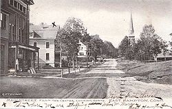
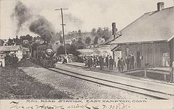
East Hampton, Connecticut
Encyclopedia
East Hampton is a town
in Middlesex County
, Connecticut
, United States
. The population was 13,352 at the 2000 census. The town center village is listed as a census-designated place
(CDP). East Hampton includes the villages of Cobalt, Middle Haddam, and Lake Pocotopaug.
The southern trailhead of the Shenipsit Trail
is in Cobalt, and the Airline State Park
(a rail trail
) has its southern trailhead in East Hampton, at Smith Street. The 884 acres (357.7 ha) Hurd State Park, Meshomasic State Forest
, and Salmon River State Forest
are located in town. Comstock's Bridge
, more commonly known as the Comstock Covered Bridge and the only remaining covered bridge
in eastern Connecticut, spans the Salmon River
near Route 16
in East Hampton. Local legend says that the bridge is haunted.
The Chatham Historical Society Museum and the Joseph N. Goff House Museum and Cultural Center are located in the town.
, Massachusetts
. They traveled up the Connecticut River
to Middle Haddam parish
between the two adjacent towns of Middletown
and Haddam
. Led by Isaac Smith, some of these settlers went on to the hills near Lake Pocotopaug, the present-day location of East Hampton. In 1746, the settlers named their community Easthampton parish after their former home of Eastham. In 1767, the community was separated from Middletown incorporated by the Connecticut General Assembly
as the township of Chatham, after Chatham, Medway
due to the important shipbuilding industries that both places had in common. In the 19th century, East Hampton became the center of the manufacturing of bells, with the first factory being constructed in 1808. During this period, thirty firms were known to have built and run factories producing these bell products, the four most prominent being Bevin Brothers Manufacturing Company
, Starr, Hill, and Gong Bell. In 1841, the East Middletown parish, which had been a part of Chatham, separated and became a new township called Conway (later renamed to Portland
).
 Chatham was renamed to East Hampton in 1915, which had long been a second name for the township. The name "East Hampton", however, is confusing, since the town is, in fact, approximately 30 miles (48.3 km) southwest of Hampton
, Connecticut
. In addition, there is often confusion between East Hampton and the contiguous town of East Haddam
, which was named in 1734. The bell companies that dominated the economy of East Hampton continued to flourish until The Great Depression. Today, the only remaining company is Bevin Brothers Manufacturing Company
, at a much reduced scale. Many of the brick factories from this remain untouched in the center of the town, due to heavy metal poisoning. Others have been converted into offices, stores, and other small businesses.
Capt. Jesse Hurd was a master ship builder in Middle Haddam after the Revolutionary War until his death in 1839. Interest in ship building in Middle Haddam dwindled thereafter. Captain Hurd was also the owner and creator of the New York Screw Dock Company, a "dry dock" facility for ship repairs.
, the town has a total area of 36.8 square miles (95.3 km²), of which, 35.6 square miles (92.2 km²) of it is land and 1.2 square miles (3.1 km²) of it (3.37%) is water, due to the large Lake Pocotopaug, which used to be inhabited by Native American
tribes. The town center CDP has a total area of 2.6 square miles (6.7 km²). 2.5 square miles (6.5 km²) of it is land and 0.04 square mile (0.1035995244 km²) of it (0.78%) is water.
of 2000, there were 13,352 people, 4,126 households, and 3,003 families residing in the town. The population density
was 375.2 people per square mile (144.9/km²). There were 4,412 housing units at an average density of 124.0 per square mile (47.9/km²). The racial makeup of the town was 93.36% White, 2.04% Black or African American
, 0.19% Native American, 2.39% Asian, 0.05% Pacific Islander, 0.44% from other races
, and 1.51% from two or more races. Hispanic or Latino of any race were 1.69% of the population.
There were 4,126 households out of which 36.6% had children under the age of 18 living with them, 60.7% were married couples
living together, 8.5% had a female householder with no husband present, and 27.2% were non-families. 20.5% of all households were made up of individuals and 5.5% had someone living alone who was 65 years of age or older. The average household size was 2.63 and the average family size was 3.07.
In the town the population was spread out with 21.4% under the age of 18, 22.4% from 18 to 24, 27.0% from 25 to 44, 21.3% from 45 to 64, and 7.9% who were 65 years of age or older. The median age was 32 years. For every 100 females there were 99.0 males. For every 100 females age 18 and over, there were 96.8 males.
The median income for a household in the town was $66,326, and the median income for a family was $74,409. Males had a median income of $50,157 versus $35,867 for females. The per capita income
for the town was $22,769. About 2.2% of families and 3.7% of the population were below the poverty line, including 2.7% of those under age 18 and 8.0% of those age 65 or over.
2 of 2000, there were 2,254 people, 821 households, and 596 families residing in the CDP. The population density
was 883.0 inhabitants per square mile (341.3/km²). There were 858 housing units at an average density of 336.1 per square mile (129.9/km²). The racial makeup of the CDP was 97.96% White, 0.80% Black or African American
, 0.13% Native American, 0.58% Asian, 0.04% from other races
, and 0.49% from two or more races. Hispanic or Latino of any race were 0.67% of the population.
There were 821 households out of which 37.1% had children under the age of 18 living with them, 58.6% were married couples
living together, 9.9% had a female householder with no husband present, and 27.3% were non-families. 20.0% of all households were made up of individuals and 5.2% had someone living alone who was 65 years of age or older. The average household size was 2.70 and the average family size was 3.15.
In the CDP the population was spread out with 27.3% under the age of 18, 6.0% from 18 to 24, 33.4% from 25 to 44, 23.3% from 45 to 64, and 9.9% who were 65 years of age or older. The median age was 37 years. For every 100 females there were 96.9 males. For every 100 females age 18 and over, there were 93.2 males.
The median income for a household in the CDP was $53,464, and the median income for a family was $64,150. Males had a median income of $50,727 versus $31,181 for females. The per capita income
for the CDP was $25,207. About 1.2% of families and 4.1% of the population were below the poverty line, including 2.7% of those under age 18 and 2.8% of those age 65 or over.
New England town
The New England town is the basic unit of local government in each of the six New England states. Without a direct counterpart in most other U.S. states, New England towns are conceptually similar to civil townships in other states, but are incorporated, possessing powers like cities in other...
in Middlesex County
Middlesex County, Connecticut
Middlesex County is a county located in the south central part of the U.S. state of Connecticut. It was created in 1785 from portions of Hartford and New London counties. As of 2010, the population was 165,676....
, Connecticut
Connecticut
Connecticut is a state in the New England region of the northeastern United States. It is bordered by Rhode Island to the east, Massachusetts to the north, and the state of New York to the west and the south .Connecticut is named for the Connecticut River, the major U.S. river that approximately...
, United States
United States
The United States of America is a federal constitutional republic comprising fifty states and a federal district...
. The population was 13,352 at the 2000 census. The town center village is listed as a census-designated place
Census-designated place
A census-designated place is a concentration of population identified by the United States Census Bureau for statistical purposes. CDPs are delineated for each decennial census as the statistical counterparts of incorporated places such as cities, towns and villages...
(CDP). East Hampton includes the villages of Cobalt, Middle Haddam, and Lake Pocotopaug.
The southern trailhead of the Shenipsit Trail
Shenipsit Trail
The Shenipsit Trail is a Blue-Blazed hiking trail located in Central Connecticut between 3.5 and 7 miles east of the Connecticut River. It runs 41 miles in a north-south direction. The southern trailhead is on Gadpouch Road in Cobalt, CT on the southern end of the Meshomasic State Forest...
is in Cobalt, and the Airline State Park
Airline State Park
The Airline State Park is a rail trail located in Connecticut.-History:It follows a rail line that was known as the Air Line. It was conceived as a high speed passenger rail line from Boston to New York City, shaving off the old route...
(a rail trail
Rail trail
A rail trail is the conversion of a disused railway easement into a multi-use path, typically for walking, cycling and sometimes horse riding. The characteristics of former tracks—flat, long, frequently running through historical areas—are appealing for various development. The term sometimes also...
) has its southern trailhead in East Hampton, at Smith Street. The 884 acres (357.7 ha) Hurd State Park, Meshomasic State Forest
Meshomasic State Forest
The Meshomasic State Forest is located in East Hampton, Portland, and Marlborough with smaller sections located in Glastonbury and Hebron. It is popular for mountain biking, hiking, and hunting. The Rangers Headquarters are located on Gadpouch Road in East Hampton.-History:Meshomasic State Forest...
, and Salmon River State Forest
Salmon River State Forest
Salmon River State Forest is one of the state forests of Connecticut.-History:The first purchase of lands which comprise the Salmon River State Forest was made by the State Board of Fisheries and Game in 1934. The Forest now contains nearly located in the towns of Hebron, Marlborough, Colchester,...
are located in town. Comstock's Bridge
Comstock's Bridge
Comstock's Bridge, also known as the Comstock Covered Bridge, is located in East Hampton, Connecticut. The bridge was built in 1840 to span the Salmon River and was added to the National Register of Historic Places on January 1, 1976....
, more commonly known as the Comstock Covered Bridge and the only remaining covered bridge
Covered bridge
A covered bridge is a bridge with enclosed sides and a roof, often accommodating only a single lane of traffic. Most covered bridges are wooden; some newer ones are concrete or metal with glass sides...
in eastern Connecticut, spans the Salmon River
Salmon River (Connecticut)
The Salmon River is formed at the confluence of the Blackledge and Jeremy rivers about one mile west of North Westchester, Connecticut. It runs for to Salmon Cove near Moodus where it flows into the Connecticut River....
near Route 16
Route 16 (Connecticut)
Route 16 is a primary state route connecting Middletown and Colchester via Route 66. It begins in East Hampton at Route 66 then has an interchange with Route 2 in Colchester. It then runs through Colchester center, then goes to the outskirts of Lebanon town as a rural collector...
in East Hampton. Local legend says that the bridge is haunted.
The Chatham Historical Society Museum and the Joseph N. Goff House Museum and Cultural Center are located in the town.
History
The first settlers of the area arrived in 1739 by sea from EasthamEastham, Massachusetts
Eastham is a town in Barnstable County, Massachusetts, United States, Barnstable County being coextensive with Cape Cod. The population was 5,453 at the 2000 census....
, Massachusetts
Massachusetts
The Commonwealth of Massachusetts is a state in the New England region of the northeastern United States of America. It is bordered by Rhode Island and Connecticut to the south, New York to the west, and Vermont and New Hampshire to the north; at its east lies the Atlantic Ocean. As of the 2010...
. They traveled up the Connecticut River
Connecticut River
The Connecticut River is the largest and longest river in New England, and also an American Heritage River. It flows roughly south, starting from the Fourth Connecticut Lake in New Hampshire. After flowing through the remaining Connecticut Lakes and Lake Francis, it defines the border between the...
to Middle Haddam parish
Parish
A parish is a territorial unit historically under the pastoral care and clerical jurisdiction of one parish priest, who might be assisted in his pastoral duties by a curate or curates - also priests but not the parish priest - from a more or less central parish church with its associated organization...
between the two adjacent towns of Middletown
Middletown, Connecticut
Middletown is a city located in Middlesex County, Connecticut, along the Connecticut River, in the central part of the state, 16 miles south of Hartford. In 1650, it was incorporated as a town under its original Indian name, Mattabeseck. It received its present name in 1653. In 1784, the central...
and Haddam
Haddam, Connecticut
Haddam is a town in Middlesex County, Connecticut, United States. The population was 7,157 at the 2000 census. The town was also home to the now decommissioned Connecticut Yankee Nuclear Reactor.-Geography:...
. Led by Isaac Smith, some of these settlers went on to the hills near Lake Pocotopaug, the present-day location of East Hampton. In 1746, the settlers named their community Easthampton parish after their former home of Eastham. In 1767, the community was separated from Middletown incorporated by the Connecticut General Assembly
Connecticut General Assembly
The Connecticut General Assembly is the state legislature of the U.S. state of Connecticut. It is a bicameral body composed of the 151-member House of Representatives and the 36-member Senate. It meets in the state capital, Hartford. There are no term limits for either chamber.During...
as the township of Chatham, after Chatham, Medway
Chatham, Medway
Chatham is one of the Medway towns located within the Medway unitary authority, in North Kent, in South East England.Although the dockyard has long been closed and is now being redeveloped into a business and residential community as well as a museum featuring the famous submarine, HMS Ocelot,...
due to the important shipbuilding industries that both places had in common. In the 19th century, East Hampton became the center of the manufacturing of bells, with the first factory being constructed in 1808. During this period, thirty firms were known to have built and run factories producing these bell products, the four most prominent being Bevin Brothers Manufacturing Company
Bevin Brothers Manufacturing Company
Also called Bevin Brothers was founded by brothers William Bevin, Chauncey Bevin, and Abner Bevin in 1832 in East Hampton, Connecticut. Later joined by a fourth brother, Philo Bevin, Bevin Brothers continued to grow against the competition from nearly thirty other bell companies at different times...
, Starr, Hill, and Gong Bell. In 1841, the East Middletown parish, which had been a part of Chatham, separated and became a new township called Conway (later renamed to Portland
Portland, Connecticut
Portland is a town in Middlesex County, Connecticut, United States. The population was 8,732 at the 2000 census. The town center is listed as a census-designated place . It is situated across the Connecticut River from Middletown....
).
Hampton, Connecticut
Hampton is a town in Windham County, Connecticut, United States. The population was 1,758 at the 2000 census.-Geography:According to the United States Census Bureau, the town has a total area of , of which, of it is land and of it is water....
, Connecticut
Connecticut
Connecticut is a state in the New England region of the northeastern United States. It is bordered by Rhode Island to the east, Massachusetts to the north, and the state of New York to the west and the south .Connecticut is named for the Connecticut River, the major U.S. river that approximately...
. In addition, there is often confusion between East Hampton and the contiguous town of East Haddam
East Haddam, Connecticut
East Haddam is a town in Middlesex County, Connecticut, United States. The population was 8,333 at the 2000 census.-Geography:According to the United States Census Bureau, the town has a total area of , of which, of it is land and of it is water....
, which was named in 1734. The bell companies that dominated the economy of East Hampton continued to flourish until The Great Depression. Today, the only remaining company is Bevin Brothers Manufacturing Company
Bevin Brothers Manufacturing Company
Also called Bevin Brothers was founded by brothers William Bevin, Chauncey Bevin, and Abner Bevin in 1832 in East Hampton, Connecticut. Later joined by a fourth brother, Philo Bevin, Bevin Brothers continued to grow against the competition from nearly thirty other bell companies at different times...
, at a much reduced scale. Many of the brick factories from this remain untouched in the center of the town, due to heavy metal poisoning. Others have been converted into offices, stores, and other small businesses.
Capt. Jesse Hurd was a master ship builder in Middle Haddam after the Revolutionary War until his death in 1839. Interest in ship building in Middle Haddam dwindled thereafter. Captain Hurd was also the owner and creator of the New York Screw Dock Company, a "dry dock" facility for ship repairs.
Geography
According to the United States Census BureauUnited States Census Bureau
The United States Census Bureau is the government agency that is responsible for the United States Census. It also gathers other national demographic and economic data...
, the town has a total area of 36.8 square miles (95.3 km²), of which, 35.6 square miles (92.2 km²) of it is land and 1.2 square miles (3.1 km²) of it (3.37%) is water, due to the large Lake Pocotopaug, which used to be inhabited by Native American
Native Americans in the United States
Native Americans in the United States are the indigenous peoples in North America within the boundaries of the present-day continental United States, parts of Alaska, and the island state of Hawaii. They are composed of numerous, distinct tribes, states, and ethnic groups, many of which survive as...
tribes. The town center CDP has a total area of 2.6 square miles (6.7 km²). 2.5 square miles (6.5 km²) of it is land and 0.04 square mile (0.1035995244 km²) of it (0.78%) is water.
Demographics
As of the censusCensus
A census is the procedure of systematically acquiring and recording information about the members of a given population. It is a regularly occurring and official count of a particular population. The term is used mostly in connection with national population and housing censuses; other common...
of 2000, there were 13,352 people, 4,126 households, and 3,003 families residing in the town. The population density
Population density
Population density is a measurement of population per unit area or unit volume. It is frequently applied to living organisms, and particularly to humans...
was 375.2 people per square mile (144.9/km²). There were 4,412 housing units at an average density of 124.0 per square mile (47.9/km²). The racial makeup of the town was 93.36% White, 2.04% Black or African American
Race (United States Census)
Race and ethnicity in the United States Census, as defined by the Federal Office of Management and Budget and the United States Census Bureau, are self-identification data items in which residents choose the race or races with which they most closely identify, and indicate whether or not they are...
, 0.19% Native American, 2.39% Asian, 0.05% Pacific Islander, 0.44% from other races
Race (United States Census)
Race and ethnicity in the United States Census, as defined by the Federal Office of Management and Budget and the United States Census Bureau, are self-identification data items in which residents choose the race or races with which they most closely identify, and indicate whether or not they are...
, and 1.51% from two or more races. Hispanic or Latino of any race were 1.69% of the population.
There were 4,126 households out of which 36.6% had children under the age of 18 living with them, 60.7% were married couples
Marriage
Marriage is a social union or legal contract between people that creates kinship. It is an institution in which interpersonal relationships, usually intimate and sexual, are acknowledged in a variety of ways, depending on the culture or subculture in which it is found...
living together, 8.5% had a female householder with no husband present, and 27.2% were non-families. 20.5% of all households were made up of individuals and 5.5% had someone living alone who was 65 years of age or older. The average household size was 2.63 and the average family size was 3.07.
In the town the population was spread out with 21.4% under the age of 18, 22.4% from 18 to 24, 27.0% from 25 to 44, 21.3% from 45 to 64, and 7.9% who were 65 years of age or older. The median age was 32 years. For every 100 females there were 99.0 males. For every 100 females age 18 and over, there were 96.8 males.
The median income for a household in the town was $66,326, and the median income for a family was $74,409. Males had a median income of $50,157 versus $35,867 for females. The per capita income
Per capita income
Per capita income or income per person is a measure of mean income within an economic aggregate, such as a country or city. It is calculated by taking a measure of all sources of income in the aggregate and dividing it by the total population...
for the town was $22,769. About 2.2% of families and 3.7% of the population were below the poverty line, including 2.7% of those under age 18 and 8.0% of those age 65 or over.
Town center
As of the censusCensus
A census is the procedure of systematically acquiring and recording information about the members of a given population. It is a regularly occurring and official count of a particular population. The term is used mostly in connection with national population and housing censuses; other common...
2 of 2000, there were 2,254 people, 821 households, and 596 families residing in the CDP. The population density
Population density
Population density is a measurement of population per unit area or unit volume. It is frequently applied to living organisms, and particularly to humans...
was 883.0 inhabitants per square mile (341.3/km²). There were 858 housing units at an average density of 336.1 per square mile (129.9/km²). The racial makeup of the CDP was 97.96% White, 0.80% Black or African American
Race (United States Census)
Race and ethnicity in the United States Census, as defined by the Federal Office of Management and Budget and the United States Census Bureau, are self-identification data items in which residents choose the race or races with which they most closely identify, and indicate whether or not they are...
, 0.13% Native American, 0.58% Asian, 0.04% from other races
Race (United States Census)
Race and ethnicity in the United States Census, as defined by the Federal Office of Management and Budget and the United States Census Bureau, are self-identification data items in which residents choose the race or races with which they most closely identify, and indicate whether or not they are...
, and 0.49% from two or more races. Hispanic or Latino of any race were 0.67% of the population.
There were 821 households out of which 37.1% had children under the age of 18 living with them, 58.6% were married couples
Marriage
Marriage is a social union or legal contract between people that creates kinship. It is an institution in which interpersonal relationships, usually intimate and sexual, are acknowledged in a variety of ways, depending on the culture or subculture in which it is found...
living together, 9.9% had a female householder with no husband present, and 27.3% were non-families. 20.0% of all households were made up of individuals and 5.2% had someone living alone who was 65 years of age or older. The average household size was 2.70 and the average family size was 3.15.
In the CDP the population was spread out with 27.3% under the age of 18, 6.0% from 18 to 24, 33.4% from 25 to 44, 23.3% from 45 to 64, and 9.9% who were 65 years of age or older. The median age was 37 years. For every 100 females there were 96.9 males. For every 100 females age 18 and over, there were 93.2 males.
The median income for a household in the CDP was $53,464, and the median income for a family was $64,150. Males had a median income of $50,727 versus $31,181 for females. The per capita income
Per capita income
Per capita income or income per person is a measure of mean income within an economic aggregate, such as a country or city. It is calculated by taking a measure of all sources of income in the aggregate and dividing it by the total population...
for the CDP was $25,207. About 1.2% of families and 4.1% of the population were below the poverty line, including 2.7% of those under age 18 and 2.8% of those age 65 or over.
| Voter Registration and Party Enrollment as of October 25, 2005 | |||||||||||||||||||||||||
|---|---|---|---|---|---|---|---|---|---|---|---|---|---|---|---|---|---|---|---|---|---|---|---|---|---|
| Party | Active Voters | Inactive Voters | Total Voters | Percentage |
Democratic Democratic Party (United States) The Democratic Party is one of two major contemporary political parties in the United States, along with the Republican Party. The party's socially liberal and progressive platform is largely considered center-left in the U.S. political spectrum. The party has the lengthiest record of continuous... |
2,185 | 85 | 2,270 | 27.49% |
Republican Republican Party (United States) The Republican Party is one of the two major contemporary political parties in the United States, along with the Democratic Party. Founded by anti-slavery expansion activists in 1854, it is often called the GOP . The party's platform generally reflects American conservatism in the U.S... |
1,648 | 75 | 1,723 | 20.86% |
Unaffiliated | 4,036 | 212 | 4,248 | 51.44% |
Minor Parties | 15 | 2 | 17 | 0.21% | |
| Total | 7,884 | 374 | 8,258 | 100% | |||||||||||||||||||||
Historic sites
Historic sites in East Hampton include the following three sites listed on the National Register of Historic Places:- Comstock's BridgeComstock's BridgeComstock's Bridge, also known as the Comstock Covered Bridge, is located in East Hampton, Connecticut. The bridge was built in 1840 to span the Salmon River and was added to the National Register of Historic Places on January 1, 1976....
, southeast of East Hampton off CT 16 - Middle Haddam Historic DistrictMiddle Haddam Historic DistrictMiddle Haddam Historic District is a historic district in the town of East Hampton, Connecticut.It was listed on the National Register of Historic Places in 1984....
, Moodus and Long Hill Rds. - Rapallo ViaductRapallo ViaductThe Rapallo Viaduct is a filled-in former railroad bridge in East Hampton, Connecticut which carries the Air Line Trail across Flat Brook.The bridge was built as part of the New Haven, Middletown and Willimantic Railroad's line from New Haven to Willimantic, forming part of a more or less direct...
, Flat Brook and former Air Line railroad right-of-way
Notable residents
- William A. O'Neill (1930–2007), Governor of Connecticut, 1980-1991, native and lifelong resident of East Hampton
- Mark MulcahyMark MulcahyMark Mulcahy is an American musician and former front-man for the New Haven, Connecticut-based band Miracle Legion in the 1980s to mid 1990s. The band earned modest renown, especially in their native New England region, but disbanded after a sad turn of events with their record label, Morgan Creek...
, former front-man for the New Haven-based band Miracle LegionMiracle LegionMiracle Legion was an American college rock band formed in 1983 in New Haven, Connecticut. They earned modest renown, especially in their native New England region. The original lineup consisted of singer/guitarist Mark Mulcahy, lead guitarist Mr. Ray Neal, drummer Jeff Wiederschall, and bassist...
and current solo recording artist, a native of East Hampton - Eleanor Hoyt BrainerdEleanor Hoyt BrainerdEleanor Hoyt Brainerd was an American author of the early 20th century. She published at least 10 novels, mostly written for young women.- Childhood :...
, novelist, lived at "Faraway Farm" near East Hampton in the early 20th century