
Dundonald, Saskatoon
Encyclopedia
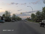
Dundonald is one of many subdivisions of the city of Saskatoon
, Saskatchewan
which was built in the 1980s, and until recently was the farthest northwest quarter of the city of Saskatoon
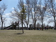
. The North West Development area is some of the latest land to be annexed by the city of Saskatoon, however is still zoned DAG1,2, and 3, which is agricultural land as of 2007. Dundonald surrounds a large landscaped park which hosts many soccer and baseball games. Most of the population works in sales & service, followed closely by those employed in the trades, transport, equipment operator, business, finance, and administration. In comparison the neighbourhood of Dundonald with a 2001 census population of 5,285 is larger than the Saskatchewan city of Melville
which had a population of 4,149 in 2006, and 4,453 in 2001 and Dundonald is also larger than the provincial city of Humboldt
which was 4,998 in 2006, and 5,161 in 2001. In Saskatchewan
rural towns must maintain a population above 5,000 to apply for city status.
; Route 4 Dundonald/Confederation Terminal/Willowgrove.
In the neighbouring subdivisions there is also these retail experiences.
Saskatoon
Saskatoon is a city in central Saskatchewan, Canada, on the South Saskatchewan River. Residents of the city of Saskatoon are called Saskatonians. The city is surrounded by the Rural Municipality of Corman Park No. 344....
, Saskatchewan
Saskatchewan
Saskatchewan is a prairie province in Canada, which has an area of . Saskatchewan is bordered on the west by Alberta, on the north by the Northwest Territories, on the east by Manitoba, and on the south by the U.S. states of Montana and North Dakota....
which was built in the 1980s, and until recently was the farthest northwest quarter of the city of Saskatoon
Saskatoon
Saskatoon is a city in central Saskatchewan, Canada, on the South Saskatchewan River. Residents of the city of Saskatoon are called Saskatonians. The city is surrounded by the Rural Municipality of Corman Park No. 344....
. The North West Development area is some of the latest land to be annexed by the city of Saskatoon, however is still zoned DAG1,2, and 3, which is agricultural land as of 2007. Dundonald surrounds a large landscaped park which hosts many soccer and baseball games. Most of the population works in sales & service, followed closely by those employed in the trades, transport, equipment operator, business, finance, and administration. In comparison the neighbourhood of Dundonald with a 2001 census population of 5,285 is larger than the Saskatchewan city of Melville
Melville, Saskatchewan
Melville is a small Canadian city located in the east-central portion of Saskatchewan. It was declared a city by the province in 1960. The city is north east of the provincial capital of Regina and south west of Yorkton. According to The World Gazetteer, it has a 2004 population of approximately...
which had a population of 4,149 in 2006, and 4,453 in 2001 and Dundonald is also larger than the provincial city of Humboldt
Humboldt, Saskatchewan
Humboldt is a Canadian city located in the province of Saskatchewan, 113 km east of Saskatoon at the junction of Highway 5 and Highway 20. The city is surrounded by the Rural Municipality of Humboldt No...
which was 4,998 in 2006, and 5,161 in 2001. In Saskatchewan
Saskatchewan
Saskatchewan is a prairie province in Canada, which has an area of . Saskatchewan is bordered on the west by Alberta, on the north by the Northwest Territories, on the east by Manitoba, and on the south by the U.S. states of Montana and North Dakota....
rural towns must maintain a population above 5,000 to apply for city status.
History
The land was annexed for Dundonald between 1975–1979, and shortly thereafter construction began. The street names honour former City councillors.| List of Dundonald Roads | |
|---|---|
| Road name | City Councillor |
| Bowman Lane, Crt, Crescent | Bowman, Aden (1941–1952) Bowman, Lillie F. (1955–1964) |
| Carrothers Court | Carrothers, W.A. (1930) |
| Flavelle Court, Crescent | Flavelle, W.T.A. (1953–54, 1961–66) |
| George Road | Alexander, George |
| Heggie Court, Crescent | Heggie, Robert A. (1954–1963) |
| Hughes Drive | Hughes, Helen (1976–1980) |
| Hunt Road | Hunt, George L. (1952–1954) |
| Junor Avenue | Junor, Donald (1968–1979) |
| Kirkpatrick Court, Crescent | Kirkpatrick, W.P. (1923–1924) |
| Latrace Road | Latrace, Harold (1964–1967) |
| Lennon Crescent | Lennon, Thomas George (1973–1976) |
| Makaroff Road | Makaroff, P.G. (1939) |
| Manning Crescent, Lane | Manning, W.G. (1947–1951, 1954–1957) |
| McCann Way | McCann, Peter (1982–85, 1991–2000) |
| Murray Place | Murray, George (1928–1929) |
| Nesbitt Lane, Way, Crescent | Nesbitt, W.G. (1948–1957) |
| Nixon Crescent | Nixon, Howard (1982–1985) |
| O'Regan Court, Crescent | O'Regan, W.B. (1931–1934) |
| Robinson Crescent | Robinson, Gladys (1965) |
| Stacey Court, Crescent | Stacey, Francis L. (1954–1956) |
| Sumner Place, Lane, Crescent | Sumner, A.J.E. (1943–1945) |
| Ward Road, Court | Ward, George (1968–1970) |
| Wedge Road | Wedge, J.B. (1961–68, 1971–72) |
Education
- Dundonald School
- St. Peter School
City Transit
Dundonald is serviced by the City Transit Bus Route Saskatoon TransitSaskatoon Transit
Saskatoon Transit is the public transport arm of the City of Saskatoon, Saskatchewan, Canada. It operates a fleet of diesel buses. A total of 23 bus routes serve every area of the city, carrying approximately 11 million passengers in 2008...
; Route 4 Dundonald/Confederation Terminal/Willowgrove.
Layout
33rd Street is to the south and 37th Street to the north, and whereas these two streets run parallel to each other, there are no other numbered streets throughout the neighbourhood, Originally the grid layout was going to continue before the city decided to develop with the crescents and cul-de-sac layout instead. This neighbourhood constructed in the 1980s abandoned the grid style of road layout, leaving 33rd & 37th Streets the remaining numeric ones in the neighbourhood. Junor Avenue marks the eastern boundary and Hughes Drive serves as the western boundary, while 37th Street is the northern boundary and 33rd Street serves as the southern boundary.Shopping
- Dundonald Neighbourhood Commercial Centre (located at Wedge & George Roads)
- Confederation Park MallConfederation MallConfederation Mall is a shopping mall located at 22nd Street and Circle Drive in Saskatoon, Saskatchewan. The mall was originally named Confederation Park Plaza when it opened in the early 1970s, at which time its anchor tenants were Canada Safeway and Woolco....
In the neighbouring subdivisions there is also these retail experiences.
- Confederation Park Suburban Centre
- 22nd Street Arterial Commercial District
- 33rd Street Arterial Commercial District
- Blairmore Suburban Centre under construction
Recreation
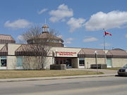
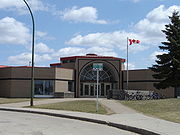
In the neighbouring subdivision this facility is very nearby.- Cosmo Civic Centre & Ice Arena and Carlyle King Branch Library
Life
Dundonald Community Association maintains the ice rink in Dundonald Park, as well as provides leisure activities at both schools.External links
- Dundonald Community Association Website
- Local Area Planning
- Saskatoon Neighbourhoods Word Search Puzzle
- City of Saskatoon · Departments · Community Services · City Planning · ZAM Maps
- Populace Spring 2006
| North: North West Development Area | Hampton Village Hampton Village, Saskatoon -External links:****- References :*Bill Barry, Geographic Names of Saskatchewan... | ||
| West: North West Development Area | Dundonald | East: Westview Westview, Saskatoon Westview is a suburban community in the Confederation Suburban Development Area of Saskatoon, Saskatchewan. Originally named "Tuxedo Park" by real estate developers in 1912, the area remained undeveloped until the 1960s... |
| South: Confederation Park Confederation Park, Saskatoon The Confederation Park subdivision of Saskatoon, Saskatchewan, Canada, is located west of the South Saskatchewan River, Saskatoon's west side.-History:The community first appeared on city maps in the late 1960s, with development commencing in the early 1970s... | Massey Place Massey Place, Saskatoon Massey Place, is a geographically localised subdivision of the Confederation Suburban Development Area in the city of Saskatoon, Saskatchewan which is nestled around Archibald McDonald Park. Mcdonald Park is centrally located along the northern perimeter of 33rd Street East... |