
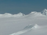
Dimov Gate
Encyclopedia

South Shetland Islands
The South Shetland Islands are a group of Antarctic islands, lying about north of the Antarctic Peninsula, with a total area of . By the Antarctic Treaty of 1959, the Islands' sovereignty is neither recognized nor disputed by the signatories and they are free for use by any signatory for...
, Antarctica and bounded by Rayna Knyaginya Peak
Rayna Knyaginya Peak
Rayna Knyaginya Peak is a peak of elevation 680 m in western Bowles Ridge, Livingston Island in the South Shetland Islands, Antarctica...
in Bowles Ridge
Bowles Ridge
Bowles Ridge is the central ridge of eastern Livingston Island. The ridge extends 6.5 km in the east-west direction and is 1.5 km wide. The summit of the ridge is Mount Bowles which rises to 822m and is located 9.77 km northwest of Great Needle Peak, 6.08 km north by west of...
to the southeast and by Hemus Peak
Hemus Peak
Hemus Peak is an ice-covered peak rising to 636 m off the northwest extremity of Bowles Ridge in eastern Livingston Island. The feature is breast-shaped, 850 m long in east-west direction and 550 m wide, and overlooks Kaliakra Glacier to the northeast and Perunika Glacier to the southwest...
to the northwest. The pass separates the glacial catchments of Kaliakra Glacier
Kaliakra Glacier
Kaliakra Glacier is a glacier in northeastern Livingston Island, Antarctica extending 7 km in east-west direction and 8 km in north-south direction...
, and the tributary glacier draining the area between Hemus Peak and Bowles West Peak
Bowles West Peak
Bowles West Peak is a peak rising to 678 m at the western extremity of Bowles Ridge in eastern Livingston Island in Antarctica...
and flowing west-southwestwards into Perunika Glacier
Perunika Glacier
Perunika Glacier is an 8 km long and 3 km wide roughly crescent-shaped glacier in eastern Livingston Island in the South Shetland Islands, Antarctica....
. It affords overland access from Perunika Glacier to the northern slopes of Bowles Ridge and to upper Kaliakra Glacier.
The pass is named after Dimo Dimov, geologist at St. Kliment Ohridski
St. Kliment Ohridski Base
St. Kliment Ohridski Base is a Bulgarian Antarctic base on Livingston Island in the South Shetland Islands.The base, originally known as Sofia University Refuge, was named in 1993 "for St...
in several seasons since 1993.
Location
The midpoint is located at 62°36′27"S 60°12′50"W which is 3.86 km northeast by south of Rezen KnollRezen Knoll
Rezen Knoll is a knoll rising to 433 m in eastern Livingston Island in the South Shetland Islands, Antarctica. The knoll is bounded to the east, north and west by Perunika Glacier, and linked to Burdick Ridge by Rezen Saddle. The feature is 250 m wide, extending 500 m in east-west direction....
, 1.34 km west-northwest of Mount Bowles
Mount Bowles
Mount Bowles is an ice-covered mountain of elevation 822 m, the summit of Bowles Ridge in eastern Livingston Island, South Shetland Islands. Situated 3 mi north of Mount Friesland to which it is linked by Wörner Gap. Coordinates and elevation given according to 2003 Australian GPS survey...
, 2.6 km west of Yankov Gap
Yankov Gap
Yankov Gap is an ice-covered saddle linking Melnik Ridge and Bowles Ridge in eastern Livingston Island in the South Shetland Islands, Antarctica. The gap is at an elevation of 575 m and extends 1 km in the north-south direction from Samokov Knoll in Melnik Ridge to Asparuh Peak in Bowles...
and 3.87 km south of Elhovo Gap
Elhovo Gap
Elhovo Gap is a 420 m high saddle extending 1 km in westsouthwest-eastnortheast direction from Gleaner Heights to Leslie Hill, Livingston Island in the South Shetland Islands, Antarctica which forms part of the overland route between Bowles Ridge and Vidin Heights...
. (UK Directorate of Overseas Surveys mapping in 1968, Spanish mapping in 1991, and Bulgarian in 2005 and 2009. Co-ordinates, elevation and distances given according to a 1995-96 Bulgarian topographic survey.
Maps
- L.L. Ivanov. Livingston Island: Central-Eastern Region. Scale 1:25000 topographic map. Sofia: Antarctic Place-names Commission of Bulgaria, 1996.
- L.L. Ivanov et al. Antarctica: Livingston Island and Greenwich Island, South Shetland Islands. Scale 1:100000 topographic map. Sofia: Antarctic Place-names Commission of Bulgaria, 2005.
- L.L. Ivanov. Antarctica: Livingston Island and Greenwich, Robert, Snow and Smith Islands. Scale 1:120000 topographic map. Troyan: Manfred Wörner Foundation, 2009. ISBN 978-954-92032-6-4