Dhanaulti
Encyclopedia
Dhanaulti also known as Dhanolti, is a hill station 24 km (14.9 mi) from the popular hill station of Mussoorie
, and 29 km (18 mi) from Chamba
, as it is situated between the two.
It is situated at an altitude of 2286m, and is known for its quiet environs amidst the alpine forests of Deodar, Rhododendron and Oak.

, an 8-9 hrs drive away. The nearest Airport is Jolly Grant Airport
82 km (51 mi) away, near Dehradun
, and nearest railway head is at Dehradun
, 66 km (41 mi) away.
Mussoorie
Mussoorie is a city and a municipal board in the Dehradun District of the northern Indian state of Uttarakhand. It is located about 35 km from the state capital of Dehradun and 290 km north from the national capital of New Delhi...
, and 29 km (18 mi) from Chamba
Chamba, Uttarakhand
Chamba is a town and a nagar panchayat in Tehri Garhwal district in the state of Uttarakhand, India. It is situated at the junction of roads leading from Mussoorie, Rishikesh, Tehri Dam/ Lake and New Tehri....
, as it is situated between the two.
It is situated at an altitude of 2286m, and is known for its quiet environs amidst the alpine forests of Deodar, Rhododendron and Oak.
Climate
The summer temperatures in the town, range from 32°C to 7.5°C, while winter temperatures remain between 7°C and 1°C.Places of interest
- ECO-Park.It is the main attraction of Dhanaulti. It has been developed recently. It houses a protected patch of small forest containing Deodar Trees.There is an entry fee of Rs 15 For Adults and Rs 10 for Children.

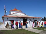
- Surkanda Devi TempleSurkanda DeviSurkanda Devi is a Hindu temple situated close to the small resort hamlet of Dhanaulti in Tehri District. It is at an altitude of about 2,757 metres, or 9500 ft; lies close to nearby hill stations of Dhanaulti and Chamba ....
- 8 km (5 mi). From Dhanaulti, on the road towards Chamba lies the Surkanda DeviSurkanda DeviSurkanda Devi is a Hindu temple situated close to the small resort hamlet of Dhanaulti in Tehri District. It is at an altitude of about 2,757 metres, or 9500 ft; lies close to nearby hill stations of Dhanaulti and Chamba ....
Temple, famous for its Ganga Dussehra fair in autumn. It is part of the Devi Darshan triangle, which offers trekking opportunities around Dhanaulti - Surkanda Devi, Chandrabadni and Kunjapuri.
- Himalayan Weavers. Located on Mussoorie-Dhanaulti Road are the Himalayan Weavers who produce hand-woven shawls, stoles, scarves and throws using only natural dyes and wool, eri silk and pashmina. Their aim is to produce high quality handloom products, popularize the use of environmentally friendly natural dyeNatural dyeNatural dyes are dyes or colorants derived from plants, invertebrates, or minerals. The majority of natural dyes are vegetable dyes from plant sources – roots, berries, bark, leaves, and wood — and other organic sources such as fungi and lichens....
s and provide a market for craft products made in the Himalayan region. http://www.himalayanweavers.org
- Aaloo Khet (Potato Farm)– a Government Potato Farm, also a popular sunrise view point.
Transport
It is 325 km (201.9 mi) from DelhiDelhi
Delhi , officially National Capital Territory of Delhi , is the largest metropolis by area and the second-largest by population in India, next to Mumbai. It is the eighth largest metropolis in the world by population with 16,753,265 inhabitants in the Territory at the 2011 Census...
, an 8-9 hrs drive away. The nearest Airport is Jolly Grant Airport
Jolly Grant Airport
Jolly Grant Airport , also known as Dehradun Airport, is an airport serving Dehradun, Uttarakhand, India.-Overview:The airport is located about southeast of the city of Dehradun. Nestled in the foothills of the Himalayas, the airport, after a runway extension to accommodate larger aircraft,...
82 km (51 mi) away, near Dehradun
Dehradun
- Geography :The Dehradun district has various types of physical geography from Himalayan mountains to Plains. Raiwala is the lowest point at 315 meters above sea level, and the highest points are within the Tiuni hills, rising to 3700 m above sea level...
, and nearest railway head is at Dehradun
Dehradun
- Geography :The Dehradun district has various types of physical geography from Himalayan mountains to Plains. Raiwala is the lowest point at 315 meters above sea level, and the highest points are within the Tiuni hills, rising to 3700 m above sea level...
, 66 km (41 mi) away.

