

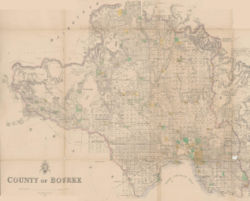
Dendy's Special Survey
Encyclopedia
Henry Dendy
Henry Dendy was born in Abinger, Surrey, England.He is best known for his purchase in 1841 of, or eight square miles, of land approximately 12 km south-east of Melbourne, Victoria, Australia. The land, known as Dendy's Special Survey, was purchased from the Crown for one pound an acre under the...
purchased 8 square miles (20.7 km²) of land approximately 12 km south-east of Melbourne
Melbourne
Melbourne is the capital and most populous city in the state of Victoria, and the second most populous city in Australia. The Melbourne City Centre is the hub of the greater metropolitan area and the Census statistical division—of which "Melbourne" is the common name. As of June 2009, the greater...
, Victoria
Victoria (Australia)
Victoria is the second most populous state in Australia. Geographically the smallest mainland state, Victoria is bordered by New South Wales, South Australia, and Tasmania on Boundary Islet to the north, west and south respectively....
, Australia
Australia
Australia , officially the Commonwealth of Australia, is a country in the Southern Hemisphere comprising the mainland of the Australian continent, the island of Tasmania, and numerous smaller islands in the Indian and Pacific Oceans. It is the world's sixth-largest country by total area...
. The land was purchased from the Crown for one pound an acre under the terms of the short-lived Special Survey
Port Phillip District Special Surveys
In August 1840, the Colonial Land and Emigration Commissioners of the British Government decided to allow the purchase of land anywhere in the Port Phillip District of New South Wales – now Victoria, Australia. Special Surveys could be requested to enable the purchase of , or eight square...
regulations.
Dendy's Special Survey formed the basis for the settlement of Brighton
Brighton, Victoria
Brighton is a suburb of Melbourne, Victoria, Australia, 11 km south-east from Melbourne's central business district. Its Local Government Area is the City of Bayside. At the 2006 Census, Brighton had a population of 20,651...
. It covered the area now bounded by North Road; South Road; on the west by the Port Phillip Bay; and on the east by East Boundary Road. It includes: all of the Melbourne suburbs of Bentleigh
Bentleigh, Victoria
Bentleigh is a suburb in Melbourne, Victoria, Australia, 13 km south-east from Melbourne's central business district. Its Local Government Area is the City of Glen Eira. At the 2006 Census, Bentleigh had a population of 14,271.-History:...
, Brighton East
Brighton East, Victoria
Brighton East is a suburb in Melbourne, Victoria, Australia, 11 km south-east from Melbourne's central business district. Its Local Government Area is the City of Bayside. At the 2006 Census, Brighton East had a population of 15,167....
, Ormond
Ormond, Victoria
Ormond is a suburb in Melbourne, Victoria, Australia, 12 km south-east from Melbourne's central business district. Its Local Government Area is the City of Glen Eira. At the 2006 Census, Ormond had a population of 7152....
; and parts of Brighton
Brighton, Victoria
Brighton is a suburb of Melbourne, Victoria, Australia, 11 km south-east from Melbourne's central business district. Its Local Government Area is the City of Bayside. At the 2006 Census, Brighton had a population of 20,651...
, Bentleigh East
Bentleigh East, Victoria
Bentleigh East is a suburb in Melbourne, Victoria, Australia, 14 km south-east from Melbourne's central business district. Its Local Government Area is the City of Glen Eira. At the 2006 Census, Bentleigh East had a population of 24,520....
and McKinnon
McKinnon, Victoria
McKinnon is a suburb in Melbourne, Victoria, Australia, 12 km south-east from Melbourne's central business district. Its Local Government Area is the City of Glen Eira...
.
The Special Survey regulations determined that the land should:
- be at least five miles (8 km) from MelbourneMelbourneMelbourne is the capital and most populous city in the state of Victoria, and the second most populous city in Australia. The Melbourne City Centre is the hub of the greater metropolitan area and the Census statistical division—of which "Melbourne" is the common name. As of June 2009, the greater...
: North Roard runs east-west on the survey Section line five miles (8 km) south of Batman's HillBatman's HillBatman's Hill in Melbourne, Australia was named for the Vandemonian adventurer and grazier John Batman. Now removed, the 18 metre high hill was located to the south of today's Collins Street and Southern Cross railway station, and is the site of a steel marker the same height as the original... - have no more than two miles (3 km) of water-frontage: South Road runs east-west two miles (3 km) south of North Road
- have an area of eight square miles: so East Boundary Road runs north-south four miles (6 km) from the coast
As the alignment of East Boundary Road is determined by the coastline, it does not lie on a survey Section line and therefore isn't aligned with the Melbourne one-mile (1.6 km) survey grid.