

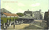
Danielson, Connecticut
Encyclopedia
Danielson is a borough
in the town of Killingly
in Windham County
, Connecticut
. The population was 4,265 at the 2000 census.
, the borough has a total area of 1.2 square miles (3.1 km²), of which 1.1 square miles (2.8 km²) is land and 0.1 square mile (0.258998811 km²) (9.02%) is water.
 As of the census
of 2000, there were 4,265 people, 1,699 households, and 1,029 families residing in the borough. The population density
was 3,860.7 people per square mile (1,497.0/km²). There were 1,859 housing units at an average density of 1,682.8/sq mi (652.5/km²). The racial makeup of the borough was 89.40% White, 2.63% African American, 0.61% Native American, 2.74% Asian, 1.83% from other races
, and 2.79% from two or more races. Hispanic or Latino of any race were 5.09% of the population.
The borough of Danielson and the town of Killingly are home to a small but significant Laotian
community. Both Danielson and Killingly are on the nation's list of top 50 cities with the highest percentage of citizens claiming Laotian ancestry.
There were 1,699 households out of which 33.3% had children under the age of 18 living with them, 37.1% were married couples
living together, 17.2% had a female householder with no husband present, and 39.4% were non-families. 29.8% of all households were made up of individuals and 10.4% had someone living alone who was 65 years of age or older. The average household size was 2.45 and the average family size was 3.01.
In the borough the population was spread out with 27.2% under the age of 18, 10.8% from 18 to 24, 32.8% from 25 to 44, 18.6% from 45 to 64, and 10.6% who were 65 years of age or older. The median age was 32 years. For every 100 females there were 95.2 males. For every 100 females age 18 and over, there were 90.0 males.
The median income for a household in the borough was $31,969, and the median income for a family was $40,990. Males had a median income of $31,315 versus $23,988 for females. The per capita income
for the borough was $16,042. About 9.8% of families and 13.1% of the population were below the poverty line, including 11.8% of those under age 18 and 13.8% of those age 65 or over.
s listed on the National Register of Historic Places:
Borough (Connecticut)
In the U.S. state of Connecticut, a borough is an incorporated section of a town. Borough governments are not autonomous and are subordinate to the government of the town to which they belong...
in the town of Killingly
Killingly, Connecticut
Killingly is a town in Windham County, Connecticut, United States. The population was 16,472 at the 2000 census. It consists of the borough of Danielson and the villages of Attawaugan, Ballouville, Dayville, East Killingly, Rogers, and South Killingly....
in Windham County
Windham County, Connecticut
Windham County is a county located in the northeastern corner of the U.S. state of Connecticut. As of 2010, the population was 118,428.The entire county is within the Quinebaug and Shetucket Rivers Valley National Heritage Corridor, as designated by the National Park Service.-History:Windham...
, Connecticut
Connecticut
Connecticut is a state in the New England region of the northeastern United States. It is bordered by Rhode Island to the east, Massachusetts to the north, and the state of New York to the west and the south .Connecticut is named for the Connecticut River, the major U.S. river that approximately...
. The population was 4,265 at the 2000 census.
Geography
According to the United States Census BureauUnited States Census Bureau
The United States Census Bureau is the government agency that is responsible for the United States Census. It also gathers other national demographic and economic data...
, the borough has a total area of 1.2 square miles (3.1 km²), of which 1.1 square miles (2.8 km²) is land and 0.1 square mile (0.258998811 km²) (9.02%) is water.
Demographics
Census
A census is the procedure of systematically acquiring and recording information about the members of a given population. It is a regularly occurring and official count of a particular population. The term is used mostly in connection with national population and housing censuses; other common...
of 2000, there were 4,265 people, 1,699 households, and 1,029 families residing in the borough. The population density
Population density
Population density is a measurement of population per unit area or unit volume. It is frequently applied to living organisms, and particularly to humans...
was 3,860.7 people per square mile (1,497.0/km²). There were 1,859 housing units at an average density of 1,682.8/sq mi (652.5/km²). The racial makeup of the borough was 89.40% White, 2.63% African American, 0.61% Native American, 2.74% Asian, 1.83% from other races
Race (United States Census)
Race and ethnicity in the United States Census, as defined by the Federal Office of Management and Budget and the United States Census Bureau, are self-identification data items in which residents choose the race or races with which they most closely identify, and indicate whether or not they are...
, and 2.79% from two or more races. Hispanic or Latino of any race were 5.09% of the population.
The borough of Danielson and the town of Killingly are home to a small but significant Laotian
Laos
Laos Lao: ສາທາລະນະລັດ ປະຊາທິປະໄຕ ປະຊາຊົນລາວ Sathalanalat Paxathipatai Paxaxon Lao, officially the Lao People's Democratic Republic, is a landlocked country in Southeast Asia, bordered by Burma and China to the northwest, Vietnam to the east, Cambodia to the south and Thailand to the west...
community. Both Danielson and Killingly are on the nation's list of top 50 cities with the highest percentage of citizens claiming Laotian ancestry.
There were 1,699 households out of which 33.3% had children under the age of 18 living with them, 37.1% were married couples
Marriage
Marriage is a social union or legal contract between people that creates kinship. It is an institution in which interpersonal relationships, usually intimate and sexual, are acknowledged in a variety of ways, depending on the culture or subculture in which it is found...
living together, 17.2% had a female householder with no husband present, and 39.4% were non-families. 29.8% of all households were made up of individuals and 10.4% had someone living alone who was 65 years of age or older. The average household size was 2.45 and the average family size was 3.01.
In the borough the population was spread out with 27.2% under the age of 18, 10.8% from 18 to 24, 32.8% from 25 to 44, 18.6% from 45 to 64, and 10.6% who were 65 years of age or older. The median age was 32 years. For every 100 females there were 95.2 males. For every 100 females age 18 and over, there were 90.0 males.
The median income for a household in the borough was $31,969, and the median income for a family was $40,990. Males had a median income of $31,315 versus $23,988 for females. The per capita income
Per capita income
Per capita income or income per person is a measure of mean income within an economic aggregate, such as a country or city. It is calculated by taking a measure of all sources of income in the aggregate and dividing it by the total population...
for the borough was $16,042. About 9.8% of families and 13.1% of the population were below the poverty line, including 11.8% of those under age 18 and 13.8% of those age 65 or over.
Historic districts
Danielson is the site of two historic districtHistoric district
A historic district or heritage district is a section of a city which contains older buildings considered valuable for historical or architectural reasons. In some countries, historic districts receive legal protection from development....
s listed on the National Register of Historic Places:
- Danielson Main Street Historic DistrictDanielson Main Street Historic DistrictDanielson Main Street Historic District is a historic district representing the commercial business district of the borough of Danielson in the town of Killingly, Connecticut....
is a 20 acres (80,937.2 m²) historic district along Main Street, from Water Street to Spring Street. Architectural styles in the district include Colonial Revival and Italianate, as well as others. The Danielson Main Street Historic District was added to the National Register of Historic PlacesNational Register of Historic PlacesThe National Register of Historic Places is the United States government's official list of districts, sites, buildings, structures, and objects deemed worthy of preservation...
on April 8, 1992.
- Broad Street-Davis Park Historic District – roughly along Broad Street, from Dorrane Street to Winter Street. Various architectural styles are represented, including Stick/Eastlake, Queen Anne, and Colonial Revival. It was added to the National Register of Historic Places on December 31, 1998.