

D'Iberville, Mississippi
Encyclopedia
D'Iberville is a city in Harrison County
, Mississippi
, United States
, immediately north of Biloxi
, across the back bay. It is part of the Gulfport
–Biloxi
, Mississippi Metropolitan Statistical Area
.
It is named after Pierre Le Moyne d'Iberville
who arrived at the area in 1699. Nearly 300 years later, D'Iberville officially became a city in 1988.
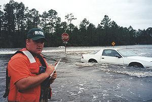
The City of D’Iberville was one of the Gulf-Coast cities hit by Hurricane Katrina in 2005. As a result of an initiative by the Congress for the New Urbanism
under the sponsorship of Governor Haley Barbour and the State of Mississippi, the City of D’Iberville received town design consulting services from some of the most prestigious urban designers in the country. Since then, the City of D’Iberville has been working with Jaime Correa
and Associates on the implementation of its master plan, on a full fledge New Urbanism SmartCode for its downtown area, and on the implementation of mixed-use neighborhood and main street.
According to the United States Census Bureau
, the city has a total area of 4.7 square miles (12.2 km²), all of it land.
 As of the census
of 2000, there were 7,608 people, 2,827 households, and 1,976 families residing in the city. The population density
was 1,604.1 people per square mile (619.7/km²). There were 3,088 housing units at an average density of 651.1 per square mile (251.5/km²). The racial makeup of the city was 78.21% White, 11.40% African American, 0.37% Native American, 7.03% Asian, 0.01% Pacific Islander, 0.85% from other races
, and 2.13% from two or more races. Hispanic or Latino of any race were 2.64% of the population.
There were 2,827 households out of which 34.1% had children under the age of 18 living with them, 49.6% were married couples
living together, 15.2% had a female householder with no husband present, and 30.1% were non-families. 23.0% of all households were made up of individuals and 5.6% had someone living alone who was 65 years of age or older. The average household size was 2.69 and the average family size was 3.17.
In the city the population was spread out with 27.0% under the age of 18, 9.6% from 18 to 24, 32.3% from 25 to 44, 22.5% from 45 to 64, and 8.6% who were 65 years of age or older. The median age was 34 years. For every 100 females there were 99.5 males. For every 100 females age 18 and over, there were 96.9 males.
The median income for a household in the city was $34,700, and the median income for a family was $40,347. Males had a median income of $26,774 versus $22,259 for females. The per capita income
for the city was $15,846. About 9.0% of families and 11.7% of the population were below the poverty line, including 16.9% of those under age 18 and 9.5% of those age 65 or over.
As of July 2009, the mayor of D'Iberville is Russell "Rusty" Quave.
.
Harrison County, Mississippi
-National protected areas:* De Soto National Forest * Gulf Islands National Seashore - Demographics :As of the census of 2000, there were 189,601 people, 71,538 households, and 48,574 families residing in the county. The population density was 326 people per square mile . There were 79,636 housing...
, Mississippi
Mississippi
Mississippi is a U.S. state located in the Southern United States. Jackson is the state capital and largest city. The name of the state derives from the Mississippi River, which flows along its western boundary, whose name comes from the Ojibwe word misi-ziibi...
, United States
United States
The United States of America is a federal constitutional republic comprising fifty states and a federal district...
, immediately north of Biloxi
Biloxi, Mississippi
Biloxi is a city in Harrison County, Mississippi, in the United States. The 2010 census recorded the population as 44,054. Along with Gulfport, Biloxi is a county seat of Harrison County....
, across the back bay. It is part of the Gulfport
Gulfport, Mississippi
Gulfport is the second largest city in Mississippi after the state capital Jackson. It is the larger of the two principal cities of the Gulfport-Biloxi, Mississippi Metropolitan Statistical Area, which is included in the Gulfport-Biloxi-Pascagoula, Mississippi Combined Statistical Area. As of the...
–Biloxi
Biloxi, Mississippi
Biloxi is a city in Harrison County, Mississippi, in the United States. The 2010 census recorded the population as 44,054. Along with Gulfport, Biloxi is a county seat of Harrison County....
, Mississippi Metropolitan Statistical Area
Gulfport-Biloxi metropolitan area
The Gulfport-Biloxi Metropolitan Statistical Area is a metropolitan area in the Mississippi Gulf Coast region that covers three counties - Hancock, Harrison, and Stone. As of the 2000 census, the MSA had a population of 246,190. The area was significantly impacted by Hurricane Katrina in 2005. A...
.
It is named after Pierre Le Moyne d'Iberville
Pierre Le Moyne d'Iberville
Pierre Le Moyne d'Iberville pronounced as described in note] Pierre Le Moyne d'Iberville pronounced as described in note] Pierre Le Moyne d'Iberville pronounced as described in note] (16 July 1661 – 9 July 1702 (probable)was a soldier, ship captain, explorer, colonial administrator, knight of...
who arrived at the area in 1699. Nearly 300 years later, D'Iberville officially became a city in 1988.
The City of D’Iberville was one of the Gulf-Coast cities hit by Hurricane Katrina in 2005. As a result of an initiative by the Congress for the New Urbanism
New urbanism
New Urbanism is an urban design movement, which promotes walkable neighborhoods that contain a range of housing and job types. It arose in the United States in the early 1980s, and has gradually continued to reform many aspects of real estate development, urban planning, and municipal land-use...
under the sponsorship of Governor Haley Barbour and the State of Mississippi, the City of D’Iberville received town design consulting services from some of the most prestigious urban designers in the country. Since then, the City of D’Iberville has been working with Jaime Correa
Jaime Correa
Jaime Correa is an urban planner, architect, and professor at the University of Miami.Correa is a respected authority in the fields of architecture, town design, and sustainable development...
and Associates on the implementation of its master plan, on a full fledge New Urbanism SmartCode for its downtown area, and on the implementation of mixed-use neighborhood and main street.
Geography
D'Iberville is located at 30.437048°N 88.897619°W.According to the United States Census Bureau
United States Census Bureau
The United States Census Bureau is the government agency that is responsible for the United States Census. It also gathers other national demographic and economic data...
, the city has a total area of 4.7 square miles (12.2 km²), all of it land.
Demographics
Census
A census is the procedure of systematically acquiring and recording information about the members of a given population. It is a regularly occurring and official count of a particular population. The term is used mostly in connection with national population and housing censuses; other common...
of 2000, there were 7,608 people, 2,827 households, and 1,976 families residing in the city. The population density
Population density
Population density is a measurement of population per unit area or unit volume. It is frequently applied to living organisms, and particularly to humans...
was 1,604.1 people per square mile (619.7/km²). There were 3,088 housing units at an average density of 651.1 per square mile (251.5/km²). The racial makeup of the city was 78.21% White, 11.40% African American, 0.37% Native American, 7.03% Asian, 0.01% Pacific Islander, 0.85% from other races
Race (United States Census)
Race and ethnicity in the United States Census, as defined by the Federal Office of Management and Budget and the United States Census Bureau, are self-identification data items in which residents choose the race or races with which they most closely identify, and indicate whether or not they are...
, and 2.13% from two or more races. Hispanic or Latino of any race were 2.64% of the population.
There were 2,827 households out of which 34.1% had children under the age of 18 living with them, 49.6% were married couples
Marriage
Marriage is a social union or legal contract between people that creates kinship. It is an institution in which interpersonal relationships, usually intimate and sexual, are acknowledged in a variety of ways, depending on the culture or subculture in which it is found...
living together, 15.2% had a female householder with no husband present, and 30.1% were non-families. 23.0% of all households were made up of individuals and 5.6% had someone living alone who was 65 years of age or older. The average household size was 2.69 and the average family size was 3.17.
In the city the population was spread out with 27.0% under the age of 18, 9.6% from 18 to 24, 32.3% from 25 to 44, 22.5% from 45 to 64, and 8.6% who were 65 years of age or older. The median age was 34 years. For every 100 females there were 99.5 males. For every 100 females age 18 and over, there were 96.9 males.
The median income for a household in the city was $34,700, and the median income for a family was $40,347. Males had a median income of $26,774 versus $22,259 for females. The per capita income
Per capita income
Per capita income or income per person is a measure of mean income within an economic aggregate, such as a country or city. It is calculated by taking a measure of all sources of income in the aggregate and dividing it by the total population...
for the city was $15,846. About 9.0% of families and 11.7% of the population were below the poverty line, including 16.9% of those under age 18 and 9.5% of those age 65 or over.
As of July 2009, the mayor of D'Iberville is Russell "Rusty" Quave.
Public schools
The City of D'Iberville is served by the Harrison County School DistrictHarrison County School District
The Harrison County School District is a public school district based in Gulfport, Mississippi .In addition to serving portions of Gulfport, the district also serves the city of D'Iberville, the communities of Lyman and Saucier, and portions of Biloxi as well as most of rural Harrison...
.
- D'Iberville High SchoolD'Iberville High SchoolD'Iberville Senior High School is a public high school in D'Iberville, Mississippi . A new high school was dedicated on March 15, 2009, at 15625 Lamey Bridge Road in D'Iberville. The former high school building that is located at 3320 Warrior Drive is now serving as the D'Iberville Middle School;...
- D'Iberville Middle School
- D'Iberville Elementary School