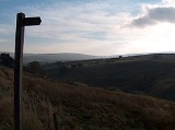
Cowshill
Encyclopedia
Cowshill is a village in County Durham
, in England
. It is situated at the top of Weardale
, between Lanehead
and Wearhead
.
County Durham
County Durham is a ceremonial county and unitary district in north east England. The county town is Durham. The largest settlement in the ceremonial county is the town of Darlington...
, in England
England
England is a country that is part of the United Kingdom. It shares land borders with Scotland to the north and Wales to the west; the Irish Sea is to the north west, the Celtic Sea to the south west, with the North Sea to the east and the English Channel to the south separating it from continental...
. It is situated at the top of Weardale
Weardale
Weardale is a dale, or valley, of the east side of the Pennines in County Durham, in England. Large parts of Weardale fall within the North Pennines Area of Outstanding Natural Beauty - the second largest AONB in England and Wales. The upper valley is surrounded by high fells and heather grouse...
, between Lanehead
Lanehead
Lanehead is a hamlet in County Durham, England, located at the head of Weardale, approximately 2 km west of Cowshill. It is also located near to Killhope, and the border of the county Cumbria. The primary industry in the area is farming, and the River Wear runs through the area. It is the...
and Wearhead
Wearhead
Wearhead is a village in County Durham, in England. It is situated at the top of Weardale between Cowshill and Ireshopeburn. It is named after the nearby source of the River Wear which runs eastwards for approx 40 miles to Sunderland....
.

