
Connecticut Route 94
Encyclopedia
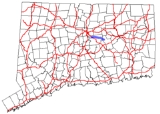
Route 94 is an east–west state highway
in Connecticut
running for 9.33 miles (15 km) from Route 2
(Exit 8) in Glastonbury
to Route 85
in Hebron
.
in western Glastonbury
(in the Addison section of town). It turns east on Hebron Avenue and crosses under the Route 17
expressway without an interchange, and then under Route 2 (about 330 yards (301.8 m) east of the end of the eastbound offramp). Hebron Avenue continues eastward through Glastonbury for another 3.75 miles (6 km), meeting with Route 83
(which heads for Manchester
and East Glastonbury). After another 1.1 miles (1.8 km), it crosses Roaring Brook
and becomes mainly a rural collector road as it heads towards the town of Hebron
. Along the way it passes by the Macclain Earth Products factory as it traverses the rural part of Glastonbury. Route 94 crosses into the town of Hebron about 3.3 miles (5.3 km) east of Roaring Brook becoming known as Gilead Street, where it ends 0.8 miles (1.3 km) east of the town line at an intersection with Route 85
. Gilead Street continues further east as southbound Route 85 towards the town center of Hebron.
, modern Route 94 was created from the entire length of former Highway 165 as well as an eastward extension to newly established Route 85 in Hebron. In 1957, when after the portion of the Route 2 expressway in Glastonbury opened, Route 2 was relocated to the new expressway and the western terminus of Route 94 was also moved to the current location. There have also been several curves straightened in Glastonbury between 1958 and 2004.
State highway
State highway, state road or state route can refer to one of three related concepts, two of them related to a state or provincial government in a country that is divided into states or provinces :#A...
in Connecticut
Connecticut
Connecticut is a state in the New England region of the northeastern United States. It is bordered by Rhode Island to the east, Massachusetts to the north, and the state of New York to the west and the south .Connecticut is named for the Connecticut River, the major U.S. river that approximately...
running for 9.33 miles (15 km) from Route 2
Route 2 (Connecticut)
Route 2 is a state highway in Connecticut and is in length. It is a primary state route, with a freeway section connecting Hartford to Norwich and a non-freeway section extending to Stonington.-Route description:...
(Exit 8) in Glastonbury
Glastonbury, Connecticut
Glastonbury is a town in Hartford County, Connecticut, United States, founded in 1693. The population was 31,876 at the 2000 census. The town was named after Glastonbury in Somerset, England. Glastonbury is located on the banks of the Connecticut River, 7 miles southeast of Hartford. The town...
to Route 85
Route 85 (Connecticut)
Route 85 a north–south state highway in the east-central portion of the U.S. state of Connecticut linking the city of New London to the town of Bolton.-Route description:...
in Hebron
Hebron, Connecticut
Hebron is a town in Tolland County, Connecticut, United States. The population was 8,610 at the 2000 census. Hebron was incorporated May 26, 1708....
.
Route description
Route 94 officially begins as the Exit 8 offramp of eastbound Route 2Route 2 (Connecticut)
Route 2 is a state highway in Connecticut and is in length. It is a primary state route, with a freeway section connecting Hartford to Norwich and a non-freeway section extending to Stonington.-Route description:...
in western Glastonbury
Glastonbury, Connecticut
Glastonbury is a town in Hartford County, Connecticut, United States, founded in 1693. The population was 31,876 at the 2000 census. The town was named after Glastonbury in Somerset, England. Glastonbury is located on the banks of the Connecticut River, 7 miles southeast of Hartford. The town...
(in the Addison section of town). It turns east on Hebron Avenue and crosses under the Route 17
Route 17 (Connecticut)
Route 17 is a primary north–south state route beginning in New Haven, through Middletown, and ending in Glastonbury, with a length of .-Route description:...
expressway without an interchange, and then under Route 2 (about 330 yards (301.8 m) east of the end of the eastbound offramp). Hebron Avenue continues eastward through Glastonbury for another 3.75 miles (6 km), meeting with Route 83
Route 83 (Connecticut)
Route 83 is a north–south state highway in the Greater Hartford and Greater Springfield areas of the U.S. states of Connecticut and Massachusetts. It serves as the main north–south artery for the towns of Manchester, Vernon, and Ellington and continues through East Longmeadow center...
(which heads for Manchester
Manchester, Connecticut
Manchester is a township and city in Hartford County, Connecticut, United States. As of the 2010 census, the town had a total population of 58,241.- History :...
and East Glastonbury). After another 1.1 miles (1.8 km), it crosses Roaring Brook
Roaring Brook
The Roaring Brook is a tributary of the Cruser Brook. It is found in Somerset county, New Jersey, United States.-Course:The Roaring Brook starts at , on Sourland Mountain. It flows southeast until it joins the Cruser Brook at the edge of Sourland Mountain at .-External links:*...
and becomes mainly a rural collector road as it heads towards the town of Hebron
Hebron, Connecticut
Hebron is a town in Tolland County, Connecticut, United States. The population was 8,610 at the 2000 census. Hebron was incorporated May 26, 1708....
. Along the way it passes by the Macclain Earth Products factory as it traverses the rural part of Glastonbury. Route 94 crosses into the town of Hebron about 3.3 miles (5.3 km) east of Roaring Brook becoming known as Gilead Street, where it ends 0.8 miles (1.3 km) east of the town line at an intersection with Route 85
Route 85 (Connecticut)
Route 85 a north–south state highway in the east-central portion of the U.S. state of Connecticut linking the city of New London to the town of Bolton.-Route description:...
. Gilead Street continues further east as southbound Route 85 towards the town center of Hebron.
Special Designations
Route 94 is designated the 94th Infantry Division Memorial Highway from Route 2 to the Glastonbury-Hebron town line.History
In the early 1920s, State Highway 165 was designated as the road from Main Street in Glastonbury center (at New England Route 17), through Addison, to then State Highway 164 (now Route 83). In the 1932 state highway renumbering1932 state highway renumbering (Connecticut)
In 1932, the Highway Department of the U.S. state of Connecticut , decided to completely renumber all its state highways. The only exceptions were the U.S. Highways and some of the New England Interstate Routes. Between 1922 and 1932, Connecticut used a state highway numbering system shared with...
, modern Route 94 was created from the entire length of former Highway 165 as well as an eastward extension to newly established Route 85 in Hebron. In 1957, when after the portion of the Route 2 expressway in Glastonbury opened, Route 2 was relocated to the new expressway and the western terminus of Route 94 was also moved to the current location. There have also been several curves straightened in Glastonbury between 1958 and 2004.
Junction list
| Town | Road names | Major junctions | Milepost |
|---|---|---|---|
| Glastonbury Glastonbury, Connecticut Glastonbury is a town in Hartford County, Connecticut, United States, founded in 1693. The population was 31,876 at the 2000 census. The town was named after Glastonbury in Somerset, England. Glastonbury is located on the banks of the Connecticut River, 7 miles southeast of Hartford. The town... (8.53 miles) |
Route 94, Hebron Avenue | (Exit 8) | 0.39 (ramp as main line) |
| 4.14 | |||
| Hebron Hebron, Connecticut Hebron is a town in Tolland County, Connecticut, United States. The population was 8,610 at the 2000 census. Hebron was incorporated May 26, 1708.... (0.80 miles) |
Gilead Road | 9.33 |