
Connecticut Route 73
Encyclopedia
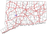
Route 73 is an east–west state highway
in Connecticut
connecting the town center of Watertown
to the Route 8
expressway in Waterbury
via the village of Oakville
. The road is classified as an urban principal arterial road and carries traffic volumes of about 16,400 vehicles per day.
. It begins as Main Street, splitting off to the east from Route 63. It travels east southeast, crossing over Steele Brook, into the Oakville
section of town. In Oakville, it has a junction with Buckingham Street, an unsigned state road linking Route 73 to Route 262. Route 73 soon enters the city limits of Waterbury
as Watertown Avenue, crossing over Steele Brook again. East of the intersection with Irvington Avenue, Route 73 widens to four lanes. After about 0.2 mile (0.321868 km), Route 73 leaves Watertown Avenue and uses an expressway alignment for its final 0.6 mile (0.965604 km) length. Route 73 ends as it merges with southbound Route 8 (at Exit 35).
, old Highway 339 was renumbered to Route 73. At that time, the Route 8 expressway had not yet been built and Route 73 had a slightly different alignment in Waterbury. Originally, Route 73 entered Waterbury on Watertown Avenue as it does today. However, east of Windsor Street, instead of heading directly onto the Route 8 expressway, Route 73 continued to follow Watertown Avenue southeast to West Main Street then turned east along West Main Street to end at the intersection with Thomaston Avenue, which was the original alignment of Route 8. In the 1960s, there were plans to build a short expressway connector between Route 8 in Waterbury and the Route 63/US 6 junction in Watertown. As part of this plan, a partial interchange was built for Route 73, which opened in 1968. Route 73 was soon relocated to the expressway approach and ramps. The original route into downtown Waterbury became an unsigned state highway with designation State Road 846. However, no additional construction or right of way acquisition has taken place since then and the Route 73 expressway had been removed from the state's long range transportation plans since the mid-1970s.
State highway
State highway, state road or state route can refer to one of three related concepts, two of them related to a state or provincial government in a country that is divided into states or provinces :#A...
in Connecticut
Connecticut
Connecticut is a state in the New England region of the northeastern United States. It is bordered by Rhode Island to the east, Massachusetts to the north, and the state of New York to the west and the south .Connecticut is named for the Connecticut River, the major U.S. river that approximately...
connecting the town center of Watertown
Watertown, Connecticut
Watertown is a town in Litchfield County, Connecticut, United States. The population was 21,661 at the 2000 census. The zip code for Watertown is 06795. It is a suburb of Waterbury. It borders the towns of Woodbury, Middlebury, Litchfield, Plymouth, Bethlehem, and Thomaston.-Founding History:More...
to the Route 8
Route 8 (Connecticut)
Route 8 is the portion of the multistate New England Route 8 within the state of Connecticut. It is a state highway running north–south from Bridgeport, through Waterbury, all the way to the Massachusetts state line where it continues as Route 8...
expressway in Waterbury
Waterbury, Connecticut
Waterbury is a city in New Haven County, Connecticut, on the Naugatuck River, 33 miles southwest of Hartford and 77 miles northeast of New York City...
via the village of Oakville
Oakville, Connecticut
Oakville is a census-designated place and neighborhood section of Watertown, Connecticut. in Litchfield County, Connecticut, United States. The population was 8,618 at the 2000 census. The zip code for Oakville, Connecticut is 06779.-Geography:...
. The road is classified as an urban principal arterial road and carries traffic volumes of about 16,400 vehicles per day.
Route description
Route 73 begins at an instersection with Route 63 in the town center of WatertownWatertown, Connecticut
Watertown is a town in Litchfield County, Connecticut, United States. The population was 21,661 at the 2000 census. The zip code for Watertown is 06795. It is a suburb of Waterbury. It borders the towns of Woodbury, Middlebury, Litchfield, Plymouth, Bethlehem, and Thomaston.-Founding History:More...
. It begins as Main Street, splitting off to the east from Route 63. It travels east southeast, crossing over Steele Brook, into the Oakville
Oakville, Connecticut
Oakville is a census-designated place and neighborhood section of Watertown, Connecticut. in Litchfield County, Connecticut, United States. The population was 8,618 at the 2000 census. The zip code for Oakville, Connecticut is 06779.-Geography:...
section of town. In Oakville, it has a junction with Buckingham Street, an unsigned state road linking Route 73 to Route 262. Route 73 soon enters the city limits of Waterbury
Waterbury, Connecticut
Waterbury is a city in New Haven County, Connecticut, on the Naugatuck River, 33 miles southwest of Hartford and 77 miles northeast of New York City...
as Watertown Avenue, crossing over Steele Brook again. East of the intersection with Irvington Avenue, Route 73 widens to four lanes. After about 0.2 mile (0.321868 km), Route 73 leaves Watertown Avenue and uses an expressway alignment for its final 0.6 mile (0.965604 km) length. Route 73 ends as it merges with southbound Route 8 (at Exit 35).
History
In 1922, the route between Watertown center and downtown Waterbury via the village of Oakville was designated as a secondary state highway known as State Highway 339. In the 1932 state highway renumbering1932 state highway renumbering (Connecticut)
In 1932, the Highway Department of the U.S. state of Connecticut , decided to completely renumber all its state highways. The only exceptions were the U.S. Highways and some of the New England Interstate Routes. Between 1922 and 1932, Connecticut used a state highway numbering system shared with...
, old Highway 339 was renumbered to Route 73. At that time, the Route 8 expressway had not yet been built and Route 73 had a slightly different alignment in Waterbury. Originally, Route 73 entered Waterbury on Watertown Avenue as it does today. However, east of Windsor Street, instead of heading directly onto the Route 8 expressway, Route 73 continued to follow Watertown Avenue southeast to West Main Street then turned east along West Main Street to end at the intersection with Thomaston Avenue, which was the original alignment of Route 8. In the 1960s, there were plans to build a short expressway connector between Route 8 in Waterbury and the Route 63/US 6 junction in Watertown. As part of this plan, a partial interchange was built for Route 73, which opened in 1968. Route 73 was soon relocated to the expressway approach and ramps. The original route into downtown Waterbury became an unsigned state highway with designation State Road 846. However, no additional construction or right of way acquisition has taken place since then and the Route 73 expressway had been removed from the state's long range transportation plans since the mid-1970s.