
Connecticut Route 61
Encyclopedia
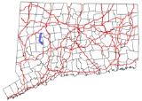
Route 61 is a secondary state highway in rural northwestern Connecticut
connecting the towns of Woodbury
and Morris
. It serves as the main north–south highway within the towns of Bethlehem
and Morris.
in the northeastern corner of Woodbury
, heading in a northwest direction then crossing the Nonewaug River before entering the town of Bethlehem
. It heads directly into the Bethlehem town center and is locally known as Main Street South and Main Street North. Route 61 has a junction with Route 132 in the town center.
The road continues north, heading into the town of Morris
, where it becomes known as South Street and North Street. After passing through the Morris town center, where it intersects with Route 109, the road changes name to County Road. Route 61 ends at an intersection with Route 63 in the northeastern part of the town of Morris. Route 61 is a two-lane rural collector road
for its entire length.
via Bethlehem and Morris was designated as State Highway 130. The road connected the various town centers of the towns it passed through. Modern Route 61 was established in the 1932 state highway renumbering
from old State Highway 130, with the exception of the section to Woodbury center that is now modern US 6. The original Route 61 extended north past Goshen center to near the Canaan
-Cornwall
town line (at modern Route 43
). In 1943, Route 61 was shortened to its current length, with the northern segment reassigned to an extension of Route 63
.
Connecticut
Connecticut is a state in the New England region of the northeastern United States. It is bordered by Rhode Island to the east, Massachusetts to the north, and the state of New York to the west and the south .Connecticut is named for the Connecticut River, the major U.S. river that approximately...
connecting the towns of Woodbury
Woodbury, Connecticut
Woodbury is a town in Litchfield County, Connecticut, United States. The population was 9,198 at the 2000 census. The town center is also designated by the U.S. Census Bureau as a census-designated place . Woodbury was founded in 1672....
and Morris
Morris, Connecticut
Morris is a town in Litchfield County, Connecticut, United States. The population was 2,301 at the 2000 census. The town consists of rolling hill country surrounding Bantam Lake, the largest natural lake in the State, covering about .-History:...
. It serves as the main north–south highway within the towns of Bethlehem
Bethlehem, Connecticut
Bethlehem is a town in Litchfield County, Connecticut, United States. The population was 3,422 at the 2000 census. The town center was designated in the 2000 census as a census-designated place ....
and Morris.
Route description
Route 61 begins as Bethlehem Road at an intersection with US 6U.S. Route 6 in Connecticut
U.S. Route 6 is the portion of the cross-country U.S. Route 6 within the state of Connecticut. West of Hartford, the route either closely parallels or runs along Interstate 84. Interstate 84 has largely supplanted Route 6 as a through route in western Connecticut. East of Hartford, the route serves...
in the northeastern corner of Woodbury
Woodbury, Connecticut
Woodbury is a town in Litchfield County, Connecticut, United States. The population was 9,198 at the 2000 census. The town center is also designated by the U.S. Census Bureau as a census-designated place . Woodbury was founded in 1672....
, heading in a northwest direction then crossing the Nonewaug River before entering the town of Bethlehem
Bethlehem, Connecticut
Bethlehem is a town in Litchfield County, Connecticut, United States. The population was 3,422 at the 2000 census. The town center was designated in the 2000 census as a census-designated place ....
. It heads directly into the Bethlehem town center and is locally known as Main Street South and Main Street North. Route 61 has a junction with Route 132 in the town center.
The road continues north, heading into the town of Morris
Morris, Connecticut
Morris is a town in Litchfield County, Connecticut, United States. The population was 2,301 at the 2000 census. The town consists of rolling hill country surrounding Bantam Lake, the largest natural lake in the State, covering about .-History:...
, where it becomes known as South Street and North Street. After passing through the Morris town center, where it intersects with Route 109, the road changes name to County Road. Route 61 ends at an intersection with Route 63 in the northeastern part of the town of Morris. Route 61 is a two-lane rural collector road
Collector road
A collector road or distributor road is a low to moderate-capacity road which serve to move traffic from local streets to arterial roads. Unlike arterials, collectors are also designed to provide access to residential properties...
for its entire length.
History
In the 1920s, the road connecting Woodbury to GoshenGoshen, Connecticut
Goshen is a town in Litchfield County, Connecticut, United States. The population was 2,697 at the 2000 census.Each July, the Connecticut Agricultural Fair is held in town. It is also home to the Goshen players.-Geography:...
via Bethlehem and Morris was designated as State Highway 130. The road connected the various town centers of the towns it passed through. Modern Route 61 was established in the 1932 state highway renumbering
1932 state highway renumbering (Connecticut)
In 1932, the Highway Department of the U.S. state of Connecticut , decided to completely renumber all its state highways. The only exceptions were the U.S. Highways and some of the New England Interstate Routes. Between 1922 and 1932, Connecticut used a state highway numbering system shared with...
from old State Highway 130, with the exception of the section to Woodbury center that is now modern US 6. The original Route 61 extended north past Goshen center to near the Canaan
Canaan, Connecticut
Canaan is a town in Litchfield County, Connecticut, United States. The population was 1,081 at the 2000 census. The town of Canaan is often referred to locally by the name of its principal constituent village, Falls Village.-Geography:...
-Cornwall
Cornwall, Connecticut
Cornwall is a town in Litchfield County, Connecticut, United States. The population was 1,434 at the 2000 census.In 1939 poet Mark Van Doren wrote "The Hills of Little Cornwall", a short poem in which the beauties of the countryside were portrayed as seductive:The town was also home to the Foreign...
town line (at modern Route 43
Connecticut Route 43
Route 43 is a Connecticut state highway. It is long and runs north–south within the town of Cornwall. It connects the town center with the village of Cornwall Hollow near the Canaan town line.- Route description:...
). In 1943, Route 61 was shortened to its current length, with the northern segment reassigned to an extension of Route 63
Route 63 (Connecticut)
Route 63 is a secondary state highway in the U.S. state of Connecticut, from New Haven up to Canaan, running for . It connects the Greater New Haven area to Northwestern Connecticut via the western suburbs of Waterbury.-Route description:...
.