
Connecticut Route 49
Encyclopedia
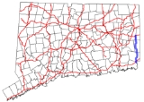
Route 49 is a Connecticut
state highway from Route 2 in Stonington
to Route 14A in Sterling
, in the southeast part of the state. It is a scenic route that runs 21.74 miles (35 km) through the Pachaug State Forest
.
. It proceeds north into the town of North Stonington
as Pendleton Hill Road, intersecting with Interstate 95 and Route 184. Route 49 continues north, soon intersecting Route 216
. As it enters the town of Voluntown
, Route 49 then becomes Westerly Road, while still on a northward track. Route 49 briefly overlaps with Route 165
and Route 138 within the town center. North of the overlap, Route 49 continues as Ekonk Hill Road, crossing the Pachaug River
and running through the Pachaug State Forest
, before reaching its end at Route 14A in the Sterling Hill Historic District of the town of Sterling
.
(at New England Route 17) heading north through North Stonington
and Voluntown
to the Sterling Hill section of Sterling
was designated as State Highway 216. In the 1932 state highway renumbering
, State Highway 216 was renumbered to Route 95. In 1950, Route 95 was extended east along modern Route 14A up to the Rhode Island state line. In 1958, Interstate 95 was formally designated in Connecticut, and Route 95 was in need of a new designation due to the numbering conflict. The new designation chosen was Route 49. In 1963, as a result of the Route Reclassification Act, Route 14A was created and the north end of Route 49 was relocated to its current terminus.
In early 2003, work on Route 49 and Route 14A Corridor Management Plan was started, funded by the FHWA
and ConnDOT
. The concerns are speed along Route 49, stone walls, and the surrounding scenery. Since state budget constraints preclude adding more police, one idea was to repaint the fog line so that the lanes are 11 feet (3.4 m) wide. In October of 2003, the state turned down a N. Stonington request to lower the speed limit from 45 mi/h to 35 and 30 mi/h.
Connecticut
Connecticut is a state in the New England region of the northeastern United States. It is bordered by Rhode Island to the east, Massachusetts to the north, and the state of New York to the west and the south .Connecticut is named for the Connecticut River, the major U.S. river that approximately...
state highway from Route 2 in Stonington
Stonington, Connecticut
The Town of Stonington is located in New London County, Connecticut, in the state's southeastern corner. It includes the borough of Stonington, the villages of Pawcatuck, Lords Point, Wequetequock, the eastern halves of the villages of Mystic and Old Mystic...
to Route 14A in Sterling
Sterling, Connecticut
Sterling is a town in Windham County, Connecticut, United States. The population was 3,099 at the 2000 census.-Local History:The town was incorporated in 1794 following approval of the CT Assembly, and was carved from northern part of the Town of Voluntown...
, in the southeast part of the state. It is a scenic route that runs 21.74 miles (35 km) through the Pachaug State Forest
Pachaug State Forest
Pachaug State Forest is the largest forest in the Connecticut state forest system, encompassing over 27,000 acres of land. It is located on the Rhode Island border in New London County, and parcels of the forest lie in the towns of Voluntown, Griswold, Plainfield, Sterling, North Stonington, and...
.
Route description
Route 49 begins as North Street at an intersection with Route 2 in the northeastern corner of the town of StoningtonStonington, Connecticut
The Town of Stonington is located in New London County, Connecticut, in the state's southeastern corner. It includes the borough of Stonington, the villages of Pawcatuck, Lords Point, Wequetequock, the eastern halves of the villages of Mystic and Old Mystic...
. It proceeds north into the town of North Stonington
North Stonington, Connecticut
North Stonington is a town in New London County, Connecticut, United States. The population was 4,991 at the 2000 census. North Stonington was split off from Stonington in 1724.-Geography:...
as Pendleton Hill Road, intersecting with Interstate 95 and Route 184. Route 49 continues north, soon intersecting Route 216
Connecticut Route 216
Route 216 is a state highway in southeastern Connecticut, running entirely within the town of North Stonington. It connects Route 49 to the Rhode Island state line and serves the village of Clarks Falls.-Route description:...
. As it enters the town of Voluntown
Voluntown, Connecticut
Voluntown is a town in New London County, Connecticut, United States. The population was 2,528 at the 2000 census. From 1726 to 1881 Voluntown had been part of Windham County.-Geography:...
, Route 49 then becomes Westerly Road, while still on a northward track. Route 49 briefly overlaps with Route 165
Connecticut Route 165
Route 165 is a state highway in southeastern Connecticut running from Norwich to the Rhode Island state line in Voluntown, and continuing as RI Route 165.-Route description:...
and Route 138 within the town center. North of the overlap, Route 49 continues as Ekonk Hill Road, crossing the Pachaug River
Pachaug River
The Pachaug River is a river arising from the Pachaug State Forest at the Connecticut - Rhode Island border and draining into the Quinebaug River....
and running through the Pachaug State Forest
Pachaug State Forest
Pachaug State Forest is the largest forest in the Connecticut state forest system, encompassing over 27,000 acres of land. It is located on the Rhode Island border in New London County, and parcels of the forest lie in the towns of Voluntown, Griswold, Plainfield, Sterling, North Stonington, and...
, before reaching its end at Route 14A in the Sterling Hill Historic District of the town of Sterling
Sterling, Connecticut
Sterling is a town in Windham County, Connecticut, United States. The population was 3,099 at the 2000 census.-Local History:The town was incorporated in 1794 following approval of the CT Assembly, and was carved from northern part of the Town of Voluntown...
.
Special designations
Route 49 is designated as a scenic road from Route 184 (milepost 2.09) in North Stonington to milepost 12.95 (south of Route 165) in Voluntown and from the Voluntown boat launch (milepost 13.84) to the northern terminus in Sterling.History
In the 1920s, the road from the northeast corner of StoningtonStonington, Connecticut
The Town of Stonington is located in New London County, Connecticut, in the state's southeastern corner. It includes the borough of Stonington, the villages of Pawcatuck, Lords Point, Wequetequock, the eastern halves of the villages of Mystic and Old Mystic...
(at New England Route 17) heading north through North Stonington
North Stonington, Connecticut
North Stonington is a town in New London County, Connecticut, United States. The population was 4,991 at the 2000 census. North Stonington was split off from Stonington in 1724.-Geography:...
and Voluntown
Voluntown, Connecticut
Voluntown is a town in New London County, Connecticut, United States. The population was 2,528 at the 2000 census. From 1726 to 1881 Voluntown had been part of Windham County.-Geography:...
to the Sterling Hill section of Sterling
Sterling, Connecticut
Sterling is a town in Windham County, Connecticut, United States. The population was 3,099 at the 2000 census.-Local History:The town was incorporated in 1794 following approval of the CT Assembly, and was carved from northern part of the Town of Voluntown...
was designated as State Highway 216. In the 1932 state highway renumbering
1932 state highway renumbering (Connecticut)
In 1932, the Highway Department of the U.S. state of Connecticut , decided to completely renumber all its state highways. The only exceptions were the U.S. Highways and some of the New England Interstate Routes. Between 1922 and 1932, Connecticut used a state highway numbering system shared with...
, State Highway 216 was renumbered to Route 95. In 1950, Route 95 was extended east along modern Route 14A up to the Rhode Island state line. In 1958, Interstate 95 was formally designated in Connecticut, and Route 95 was in need of a new designation due to the numbering conflict. The new designation chosen was Route 49. In 1963, as a result of the Route Reclassification Act, Route 14A was created and the north end of Route 49 was relocated to its current terminus.
In early 2003, work on Route 49 and Route 14A Corridor Management Plan was started, funded by the FHWA
Federal Highway Administration
The Federal Highway Administration is a division of the United States Department of Transportation that specializes in highway transportation. The agency's major activities are grouped into two "programs," the Federal-aid Highway Program and the Federal Lands Highway Program...
and ConnDOT
Connecticut Department of Transportation
The Connecticut Department of Transportation is responsible for the development and operation of highways, railroads, mass transit systems, ports, waterways and aviation facilities in the U.S. state of Connecticut. The current Commissioner of ConnDOT is Jeffrey Parker...
. The concerns are speed along Route 49, stone walls, and the surrounding scenery. Since state budget constraints preclude adding more police, one idea was to repaint the fog line so that the lanes are 11 feet (3.4 m) wide. In October of 2003, the state turned down a N. Stonington request to lower the speed limit from 45 mi/h to 35 and 30 mi/h.