Connecticut Route 120
Encyclopedia
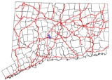
Route 120 is a state highway
in Connecticut
, running entirely in the town of Southington
. It serves as a more direct connection between the town center of Southington and the city of Meriden
.
in southeastern Southington, just west of the Meriden
city line and about 0.3 mile (0.482802 km) from an interchange with I-691. It heads in a northwest direction, crossing Misery Brook about 1.5 miles (2.4 km) later, passing by the St. Thomas Cemetery, then intersecting with Route 364 after another 1.5 miles (2.4 km). Route 120 ends at an intersection with Route 10
in the center of town after another 0.2 mile (0.321868 km). The entire length of Route 120 is two lanes wide and is known as Meriden Avenue. Route 120 is classified as an urban major collector road
and carries an average daily traffic volume of 8,900.
. The route has remained mostly unchanged since then.
State highway
State highway, state road or state route can refer to one of three related concepts, two of them related to a state or provincial government in a country that is divided into states or provinces :#A...
in Connecticut
Connecticut
Connecticut is a state in the New England region of the northeastern United States. It is bordered by Rhode Island to the east, Massachusetts to the north, and the state of New York to the west and the south .Connecticut is named for the Connecticut River, the major U.S. river that approximately...
, running entirely in the town of Southington
Southington, Connecticut
Southington is a town in Hartford County, Connecticut, United States. It is part of Connecticut's 1st congressional district. It is situated about 20 miles southwest of Hartford, about 80 miles northeast of New York City, 105 miles southwest of Boston and 77 miles west of Providence...
. It serves as a more direct connection between the town center of Southington and the city of Meriden
Meriden, Connecticut
Meriden is a city in New Haven County, Connecticut, United States. According to 2005 Census Bureau estimates, the population of the city is 59,653.-History:...
.
Route description
Route 120 begins at an intersection with Route 322Connecticut Route 322
Route 322 is a state highway in west central Connecticut, running from Wolcott to Southington.-Route description:Route 322 begins at an intersection with Route 69 in Wolcott and curves east, southeast, and south to the southeast corner of the town, then turns east into Southington...
in southeastern Southington, just west of the Meriden
Meriden, Connecticut
Meriden is a city in New Haven County, Connecticut, United States. According to 2005 Census Bureau estimates, the population of the city is 59,653.-History:...
city line and about 0.3 mile (0.482802 km) from an interchange with I-691. It heads in a northwest direction, crossing Misery Brook about 1.5 miles (2.4 km) later, passing by the St. Thomas Cemetery, then intersecting with Route 364 after another 1.5 miles (2.4 km). Route 120 ends at an intersection with Route 10
Connecticut Route 10
Connecticut Route 10 is a state highway that runs between New Haven and the state line near Granby.-Route description:Route 10 begins at Interstate 95 as Ella T. Grasso Boulevard in the city of New Haven. It then passes by Southern Connecticut State University before entering the town of Hamden...
in the center of town after another 0.2 mile (0.321868 km). The entire length of Route 120 is two lanes wide and is known as Meriden Avenue. Route 120 is classified as an urban major collector road
Collector road
A collector road or distributor road is a low to moderate-capacity road which serve to move traffic from local streets to arterial roads. Unlike arterials, collectors are also designed to provide access to residential properties...
and carries an average daily traffic volume of 8,900.
History
In the 1920s, the direct Southington-Meriden route was designated as a secondary state highway known as Highway 326. The old highway was renumbered to Route 120 as part of the 1932 state highway renumbering1932 state highway renumbering (Connecticut)
In 1932, the Highway Department of the U.S. state of Connecticut , decided to completely renumber all its state highways. The only exceptions were the U.S. Highways and some of the New England Interstate Routes. Between 1922 and 1932, Connecticut used a state highway numbering system shared with...
. The route has remained mostly unchanged since then.

