
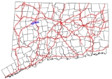
Connecticut Route 118
Encyclopedia
Route 118 is a state highway
in northwestern Connecticut
, running from the borough of Litchfield
via the village of East Litchfield to the town center of Harwinton
.
before the expressway was built. It then crosses the Naugatuck River
into the town of Harwinton
where it immediately has a junction with Route 8 (Exit 42). Within Harwinton, Route 118 is known as Litchfield Road. Route 118 continues for another 2.6 miles (4.2 km) as it heads towards Harwinton center, where it ends at the junction with Route 4
. Litchfield Road continues beyond Harwinton center as Route 4.
, where it connected to the Farmington and Bristol Turnpike. The turnpike used modern Route 118 then continued past Harwinton along modern Route 4 to the Avon town line. As part of the 1932 state highway renumbering
, Route 116 was established along part of the old Litchfield and Harwinton Turnpike alignment between Route 8 in East Litchfield and Canton Road (Route 4) in Burlington. In 1956, the rest of the old turnpike alignment to the Litchfield green was added to Route 116. This section of Route 116 was upgraded to a partially access controlled road in 1961. The old alignment is now East Litchfield Road. In 1963, Route 4 was relocated to its modern alignment and the east end of Route 116 was truncated to Harwinton. In 1966, Route 116 was renumbered to Route 118 because the number 116 was used for a route in Ridgefield that was renumbered to match the number in New York.
State highway
State highway, state road or state route can refer to one of three related concepts, two of them related to a state or provincial government in a country that is divided into states or provinces :#A...
in northwestern Connecticut
Connecticut
Connecticut is a state in the New England region of the northeastern United States. It is bordered by Rhode Island to the east, Massachusetts to the north, and the state of New York to the west and the south .Connecticut is named for the Connecticut River, the major U.S. river that approximately...
, running from the borough of Litchfield
Litchfield (borough), Connecticut
Litchfield is a borough in, and the village center of, the town of Litchfield in Litchfield County, Connecticut. The population was 1,328 at the 2000 census. The entire borough was designated a Connecticut historic district in 1959 by special act of the state General Assembly and is listed on the...
via the village of East Litchfield to the town center of Harwinton
Harwinton, Connecticut
Harwinton is a town in Litchfield County, Connecticut, United States. The population was 5,283 at the 2000 census. The name of the town is a portmanteau of Hartford and Windsor, which is where its settlers came from.-Geography:...
.
Route description
Route 118 begins at the corner of South Street and East Street in the Litchfield green at the center of the borough at an intersection with Route 63. It heads east as the southern branch of East Street, crosses the Bantam River, then intersects with Route 254 (the road to the village of Northfield). Route 118 then enters the village of East Litchfield, where there is a junction with Thomaston Road, an old alignment of Route 8Route 8 (Connecticut)
Route 8 is the portion of the multistate New England Route 8 within the state of Connecticut. It is a state highway running north–south from Bridgeport, through Waterbury, all the way to the Massachusetts state line where it continues as Route 8...
before the expressway was built. It then crosses the Naugatuck River
Naugatuck River
The Naugatuck River is a river in the US state of Connecticut. It carves out the Naugatuck River Valley. The river flows from northwest Connecticut southward into the Housatonic River in Derby, Connecticut. One of the river's main uses is hydropower, which is used to power industrial plants...
into the town of Harwinton
Harwinton, Connecticut
Harwinton is a town in Litchfield County, Connecticut, United States. The population was 5,283 at the 2000 census. The name of the town is a portmanteau of Hartford and Windsor, which is where its settlers came from.-Geography:...
where it immediately has a junction with Route 8 (Exit 42). Within Harwinton, Route 118 is known as Litchfield Road. Route 118 continues for another 2.6 miles (4.2 km) as it heads towards Harwinton center, where it ends at the junction with Route 4
Route 4 (Connecticut)
Route 4 is an east–west primary state highway connecting rural Litchfield County to the Greater Hartford area of the U.S. state of Connecticut...
. Litchfield Road continues beyond Harwinton center as Route 4.
Special designations
Route 118 is a scenic road at both ends. The 2.8 miles (4.5 km) section from the western terminus at the Litchfield green to the village of East Litchfield, and the 0.1 mile (0.160934 km) section within the town center of Harwinton have both been designated by the state as scenic roads.History
The Litchfield and Harwinton Turnpike company was chartered in October 1798 to improve and maintain the road between the villages of Litchfield, Harwinton, and BurlingtonBurlington, Connecticut
Burlington is a town in Hartford County, Connecticut, United States.Situated at the foot of the Berkshires and bordering the Farmington River, Burlington is a scenic hill town, rural in nature, located west of Hartford. Incorporated in 1806, the population was 8,190 at the 2000 census. Burlington...
, where it connected to the Farmington and Bristol Turnpike. The turnpike used modern Route 118 then continued past Harwinton along modern Route 4 to the Avon town line. As part of the 1932 state highway renumbering
1932 state highway renumbering (Connecticut)
In 1932, the Highway Department of the U.S. state of Connecticut , decided to completely renumber all its state highways. The only exceptions were the U.S. Highways and some of the New England Interstate Routes. Between 1922 and 1932, Connecticut used a state highway numbering system shared with...
, Route 116 was established along part of the old Litchfield and Harwinton Turnpike alignment between Route 8 in East Litchfield and Canton Road (Route 4) in Burlington. In 1956, the rest of the old turnpike alignment to the Litchfield green was added to Route 116. This section of Route 116 was upgraded to a partially access controlled road in 1961. The old alignment is now East Litchfield Road. In 1963, Route 4 was relocated to its modern alignment and the east end of Route 116 was truncated to Harwinton. In 1966, Route 116 was renumbered to Route 118 because the number 116 was used for a route in Ridgefield that was renumbered to match the number in New York.