
Connecticut Route 114
Encyclopedia
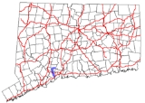
Route 114 is a Connecticut
state highway
in the western suburbs of New Haven
, running from Orange
to Woodbridge
.
in Orange
and heads north. It intersects with Route 34
in northern Orange 2.3 miles (3.7 km) from the south end and continues northward into the town of Woodbridge
. In Woodbridge, it passes over the Wilbur Cross Parkway
without a junction, then intersects with Route 243 1.1 miles (1.8 km) later and with Route 313 another 1.4 miles (2.3 km) after that. As Route 114 approaches Woodbridge center, it shifts to Center Road making a sharp right turn then crossing the Wepawaug River. Route 114 continues east for another 1.6 miles (2.6 km) before ending at an intersection with Route 63.
. It originally ran in a "C" pattern within the town of Woodbridge, connecting at both ends with Route 63
(then Route 67) and serving Woodbridge center. The original route used modern Route 114 from its north end until the intersection with Route 243. Then it proceeded east along Route 243 (Ansonia Road/Fountain Street) until it met Route 63 again in the Westville
neighborhood of New Haven
. In 1951, the southern segment of Route 114 was relocated and extended south to its current terminus at Route 1 using former SR 442. The old alignment became an unsigned state-maintained road (part of reconfigured SR 552).
Connecticut
Connecticut is a state in the New England region of the northeastern United States. It is bordered by Rhode Island to the east, Massachusetts to the north, and the state of New York to the west and the south .Connecticut is named for the Connecticut River, the major U.S. river that approximately...
state highway
State highway
State highway, state road or state route can refer to one of three related concepts, two of them related to a state or provincial government in a country that is divided into states or provinces :#A...
in the western suburbs of New Haven
New Haven, Connecticut
New Haven is the second-largest city in Connecticut and the sixth-largest in New England. According to the 2010 Census, New Haven's population increased by 5.0% between 2000 and 2010, a rate higher than that of the State of Connecticut, and higher than that of the state's five largest cities, and...
, running from Orange
Orange, Connecticut
Orange is a town in New Haven County, Connecticut, United States. The population was 13,233 at the 2000 census. A 2007 Census Bureau estimate puts the population at 13,813. The town is governed by a Board of Selectmen.-History:...
to Woodbridge
Woodbridge, Connecticut
Woodbridge is a town in New Haven County, Connecticut, United States. The population was 8,983 at the 2000 census. It is one of the wealthiest towns in Connecticut, ranking 16th in the state in terms of per capita income, and is home to many of the faculty of Yale University...
.
Route description
Route 114 begins as Racebrook Road at an intersection with US 1U.S. Route 1 in Connecticut
In the U.S. state of Connecticut, U.S. Route 1 is a major east–west state highway along Long Island Sound. It has been replaced by Interstate 95 as a through route, which it closely parallels, and now primarily serves as a local business route...
in Orange
Orange, Connecticut
Orange is a town in New Haven County, Connecticut, United States. The population was 13,233 at the 2000 census. A 2007 Census Bureau estimate puts the population at 13,813. The town is governed by a Board of Selectmen.-History:...
and heads north. It intersects with Route 34
Route 34 (Connecticut)
Route 34 is a primary state highway in the U.S. state of Connecticut. Route 34 is long, and extends from Washington Street near I-84/US 6 in Newtown to the junction of I-95 and I-91 in New Haven. The highways connects the New Haven and Danbury areas via the Lower Naugatuck River Valley...
in northern Orange 2.3 miles (3.7 km) from the south end and continues northward into the town of Woodbridge
Woodbridge, Connecticut
Woodbridge is a town in New Haven County, Connecticut, United States. The population was 8,983 at the 2000 census. It is one of the wealthiest towns in Connecticut, ranking 16th in the state in terms of per capita income, and is home to many of the faculty of Yale University...
. In Woodbridge, it passes over the Wilbur Cross Parkway
Wilbur Cross Parkway
The Wilbur Cross Parkway is a limited access road in Connecticut, comprising the portion of Route 15 between Milford and Meriden. It is named after Wilbur Lucius Cross, a former governor of the state...
without a junction, then intersects with Route 243 1.1 miles (1.8 km) later and with Route 313 another 1.4 miles (2.3 km) after that. As Route 114 approaches Woodbridge center, it shifts to Center Road making a sharp right turn then crossing the Wepawaug River. Route 114 continues east for another 1.6 miles (2.6 km) before ending at an intersection with Route 63.
History
Route 114 was established as part of the 1932 state highway renumbering1932 state highway renumbering (Connecticut)
In 1932, the Highway Department of the U.S. state of Connecticut , decided to completely renumber all its state highways. The only exceptions were the U.S. Highways and some of the New England Interstate Routes. Between 1922 and 1932, Connecticut used a state highway numbering system shared with...
. It originally ran in a "C" pattern within the town of Woodbridge, connecting at both ends with Route 63
Route 63 (Connecticut)
Route 63 is a secondary state highway in the U.S. state of Connecticut, from New Haven up to Canaan, running for . It connects the Greater New Haven area to Northwestern Connecticut via the western suburbs of Waterbury.-Route description:...
(then Route 67) and serving Woodbridge center. The original route used modern Route 114 from its north end until the intersection with Route 243. Then it proceeded east along Route 243 (Ansonia Road/Fountain Street) until it met Route 63 again in the Westville
Westville, Connecticut
Westville is a neighborhood of the city of New Haven, Connecticut located in the western part of the city west of the West River. The official neighborhood planning area for Westville is defined to be the area bordered by the neighboring town of Woodbridge, Connecticut on the west , by the Amity...
neighborhood of New Haven
New Haven, Connecticut
New Haven is the second-largest city in Connecticut and the sixth-largest in New England. According to the 2010 Census, New Haven's population increased by 5.0% between 2000 and 2010, a rate higher than that of the State of Connecticut, and higher than that of the state's five largest cities, and...
. In 1951, the southern segment of Route 114 was relocated and extended south to its current terminus at Route 1 using former SR 442. The old alignment became an unsigned state-maintained road (part of reconfigured SR 552).
Junction list
| Town | Road names | Junction | Milepost |
|---|---|---|---|
| Orange Orange, Connecticut Orange is a town in New Haven County, Connecticut, United States. The population was 13,233 at the 2000 census. A 2007 Census Bureau estimate puts the population at 13,813. The town is governed by a Board of Selectmen.-History:... (3.17 miles) |
Racebrook Road | 0.00 | |
| 2.34 | |||
| Woodbridge Woodbridge, Connecticut Woodbridge is a town in New Haven County, Connecticut, United States. The population was 8,983 at the 2000 census. It is one of the wealthiest towns in Connecticut, ranking 16th in the state in terms of per capita income, and is home to many of the faculty of Yale University... (4.75 miles) |
Racebrook Road, Center Road |
4.43 | |
| 5.83 | |||
| 7.92 |