

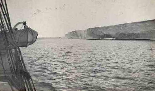
Coats Land
Encyclopedia
Queen Maud Land
Queen Maud Land is a c. 2.7 million-square-kilometre region of Antarctica claimed as a dependent territory by Norway. The territory lies between 20° west and 45° east, between the British Antarctic Territory to the west and the Australian Antarctic Territory to the east. The latitudinal...
and forms the eastern shore of the Weddell Sea
Weddell Sea
The Weddell Sea is part of the Southern Ocean and contains the Weddell Gyre. Its land boundaries are defined by the bay formed from the coasts of Coats Land and the Antarctic Peninsula. The easternmost point is Cape Norvegia at Princess Martha Coast, Queen Maud Land. To the east of Cape Norvegia is...
, extending in a general northeast-southwest direction between 20º00´W and 36º00´W. The northeast part was discovered from the Scotia by William S. Bruce, leader of the Scottish National Antarctic Expedition, 1902-04. He gave the name Coats Land for James Coats, Jr., and Major Andrew Coats, the two chief supporters of the expedition.
See also
- Caird CoastCaird CoastCaird Coast is that portion of the coast of Coats Land lying between the terminus of Stancomb-Wills Glacier, in 20º00´W, and the vicinity of the Hayes Glacier, in 27º54´W...
- Luitpold CoastLuitpold CoastLuitpold Coast is that portion of the coast of Coats Land extending from the vicinity of Hayes Glacier, at 27° 54' W, to 36° W, which is regarded as the east limit of the Filchner Ice Shelf. It was discovered by Wilhelm Filchner, leader of the German Antarctic Expedition, 1911-12, and named for...