Charles C. Deam Wilderness Area
Encyclopedia
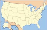
The Charles C. Deam Wilderness Area is located close to the city of Bloomington, Indiana
. Lake Monroe
forms the northern boundary. It was established as wilderness in 1982 and is managed by the Hoosier National Forest
. It covers approximately 13,000 acres (53 km²). It was named in honor of former State Forester Charles C. Deam.
The area is a fine example of Karst topography
, with its flat-topped ridges, geode
-laden streambeds, and occasional caves. Squirrels, deer, and other game are plentiful, attracting many hunters every fall. Hikers, backpackers, and horseback riders are also drawn to the wilderness and its 39 miles of trails.
In contrast to relatively virgin wilderness areas elsewhere in the country, the entire area now known as the "Deam" was once inhabited by white settlers. Most of the trails follow old roadbeds, and a bit of exploration off the main trails will bring visitors past other shadows of the past, including house foundations, domestic plants, old fences, and the occasional cemetery (five cemeteries exist within the wilderness boundary). The narrow, rocky ridges made for marginally productive farmland, but the inhabitants were able to scrape by until the Great Depression. As the economy forced them out, the U.S. Forest Service acquired their property and, with the help of the Civilian Conservation Corps
, began rehabilitating the area and managing it for recreation. "Improvements" included constructing ponds, replanting trees, and building the Hickory Ridge Fire Tower
that still stands, open to the public, at the Hickory Ridge Trailhead. After it was designated as wilderness under Ronald Reagan
, the only improvements came in the form of trail maintenance and nature's own management plan.
Bloomington, Indiana
Bloomington is a city in and the county seat of Monroe County in the southern region of the U.S. state of Indiana. The population was 80,405 at the 2010 census....
. Lake Monroe
Lake Monroe (Indiana)
Lake Monroe is a reservoir located about 10 miles southeast of Bloomington, Indiana, United States. The lake is the largest in Indiana with of water spread over the counties of Monroe and Brown. It is also home to of protected forest and three recreational areas . Indiana's only federally...
forms the northern boundary. It was established as wilderness in 1982 and is managed by the Hoosier National Forest
Hoosier National Forest
The Hoosier National Forest, in the hills of south central Indiana, is a property managed by the United States Forest Service. Composed of four separate sections, it has a total area of . It is headquartered in Bedford, with a regional office in Tell City...
. It covers approximately 13,000 acres (53 km²). It was named in honor of former State Forester Charles C. Deam.
The area is a fine example of Karst topography
Karst topography
Karst topography is a geologic formation shaped by the dissolution of a layer or layers of soluble bedrock, usually carbonate rock such as limestone or dolomite, but has also been documented for weathering resistant rocks like quartzite given the right conditions.Due to subterranean drainage, there...
, with its flat-topped ridges, geode
Geode
Geodes are geological secondary sedimentary structures which occur in sedimentary and certain volcanic rocks. Geodes are essentially spherical masses of mineral matter that were deposited sygenetically within the rock formations they are found in. Geodes have a Chalcedony shell containing...
-laden streambeds, and occasional caves. Squirrels, deer, and other game are plentiful, attracting many hunters every fall. Hikers, backpackers, and horseback riders are also drawn to the wilderness and its 39 miles of trails.
In contrast to relatively virgin wilderness areas elsewhere in the country, the entire area now known as the "Deam" was once inhabited by white settlers. Most of the trails follow old roadbeds, and a bit of exploration off the main trails will bring visitors past other shadows of the past, including house foundations, domestic plants, old fences, and the occasional cemetery (five cemeteries exist within the wilderness boundary). The narrow, rocky ridges made for marginally productive farmland, but the inhabitants were able to scrape by until the Great Depression. As the economy forced them out, the U.S. Forest Service acquired their property and, with the help of the Civilian Conservation Corps
Civilian Conservation Corps
The Civilian Conservation Corps was a public work relief program that operated from 1933 to 1942 in the United States for unemployed, unmarried men from relief families, ages 18–25. A part of the New Deal of President Franklin D...
, began rehabilitating the area and managing it for recreation. "Improvements" included constructing ponds, replanting trees, and building the Hickory Ridge Fire Tower
Hickory Ridge Fire Tower
The Hickory Ridge Fire Tower is a Fire lookout tower located in the Charles C. Deam Wilderness Area. It is an Aermotors type lookout tower.Construction of the tower began in 1936 under the auspices of the Civilian Conservation Corps...
that still stands, open to the public, at the Hickory Ridge Trailhead. After it was designated as wilderness under Ronald Reagan
Ronald Reagan
Ronald Wilson Reagan was the 40th President of the United States , the 33rd Governor of California and, prior to that, a radio, film and television actor....
, the only improvements came in the form of trail maintenance and nature's own management plan.

