

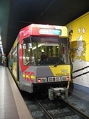
Charleroi Metro line 88
Encyclopedia
Belgium
Belgium , officially the Kingdom of Belgium, is a federal state in Western Europe. It is a founding member of the European Union and hosts the EU's headquarters, and those of several other major international organisations such as NATO.Belgium is also a member of, or affiliated to, many...
operated by TEC Charleroi, running from Parc station in downtown Charleroi
Charleroi
Charleroi is a city and a municipality of Wallonia, located in the province of Hainaut, Belgium. , the total population of Charleroi was 201,593. The metropolitan area, including the outer commuter zone, covers an area of and had a total population of 522,522 as of 1 January 2008, ranking it as...
to Anderlues
Anderlues
Anderlues is a Walloon municipality located in the Belgian province of Hainaut. On January 1, 2006 Anderlues had a total population of 11,578. The total area is 17.02 km² which gives a population density of 680 inhabitants per km². Its postcode is 6150....
(west of Charleroi), via the northern part of the downtown loop.
Line 88 was inaugurated on 30 August 1996, together with the Waterloo-Parc section of the downtown loop. It was created to duplicate the existing line 89
Charleroi Metro line 89
Line 89 is a line on the Charleroi Metro in Belgium operated by TEC Charleroi, running from Charleroi-South railway station in downtown Charleroi to Anderlues , via the southwestern part of the downtown loop....
between Anderlues
Anderlues
Anderlues is a Walloon municipality located in the Belgian province of Hainaut. On January 1, 2006 Anderlues had a total population of 11,578. The total area is 17.02 km² which gives a population density of 680 inhabitants per km². Its postcode is 6150....
and Beaux-Arts, but taking the downtown loop to the North at Beaux-Arts (as opposed to South for line 89).
Line 88 has a length of 16.35 kilometres (10.2 mi), of which 3.4 km are on a standard tram line on the street (at the Anderlues
Anderlues
Anderlues is a Walloon municipality located in the Belgian province of Hainaut. On January 1, 2006 Anderlues had a total population of 11,578. The total area is 17.02 km² which gives a population density of 680 inhabitants per km². Its postcode is 6150....
end) and the remainder on pre-metro infrastructure. It has 14 pre-metro stations and 6 tram stops, and is the longest line of the Charleroi Pre-metro network.
Trams drive on the right on the entire line, but the tram part of the line Anderlues
Anderlues
Anderlues is a Walloon municipality located in the Belgian province of Hainaut. On January 1, 2006 Anderlues had a total population of 11,578. The total area is 17.02 km² which gives a population density of 680 inhabitants per km². Its postcode is 6150....
runs on the left, right, or in the middle of the street. A couple of sections of the tram part of the line, in Anderlues
Anderlues
Anderlues is a Walloon municipality located in the Belgian province of Hainaut. On January 1, 2006 Anderlues had a total population of 11,578. The total area is 17.02 km² which gives a population density of 680 inhabitants per km². Its postcode is 6150....
, are single track.
Trams on line 88 run from 05:30 until 19:00.
- Every 30 minutes on weekdays.
- Every hour on week-ends
List of stations
Pre-metro stations :- Parc
- Janson
- Waterloo
- Beaux-Arts
- Piges
- Dampremy
- Providence
- De Cartier
- Moulin
- Morgnies
- Leernes
- Paradis
- Fontaine
- Pétria
Tram stops in Anderlues
Anderlues
Anderlues is a Walloon municipality located in the Belgian province of Hainaut. On January 1, 2006 Anderlues had a total population of 11,578. The total area is 17.02 km² which gives a population density of 680 inhabitants per km². Its postcode is 6150....
:
- Coron du Berger
- Surchiste
- Route de Thuin
- Jonction
- Route de la station
- Monument