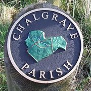
Chalgrave
Encyclopedia

Chalgrave is a civil parish in the Central Bedfordshire
Central Bedfordshire
Central Bedfordshire is a unitary authority in the ceremonial county of Bedfordshire, England. It was created from the merger of Bedfordshire County Council, Mid Bedfordshire and South Bedfordshire on 1 April 2009...
district of Bedfordshire
Bedfordshire
Bedfordshire is a ceremonial county of historic origin in England that forms part of the East of England region.It borders Cambridgeshire to the north-east, Northamptonshire to the north, Buckinghamshire to the west and Hertfordshire to the south-east....
, England
England
England is a country that is part of the United Kingdom. It shares land borders with Scotland to the north and Wales to the west; the Irish Sea is to the north west, the Celtic Sea to the south west, with the North Sea to the east and the English Channel to the south separating it from continental...
. The hamlets of Tebworth and Wingfield are in the west of the parish, with the church and manor in the east. Nearby places are Toddington
Toddington, Bedfordshire
Toddington is a large village and civil parish in the county of Bedfordshire, England which is situated 5 miles NNW of Luton, north of Dunstable, south west of Woburn and 35 miles NNW of London on the A5120 and B579. It is 0.5 miles from Junction 12 of the M1 motorway and lends its...
(to the north), Chalton
Chalton, Bedfordshire
Chalton is a village and civil parish in the Central Bedfordshire district of Bedfordshire, England, immediately north of the Luton/Dunstable conurbation and bounded to the east by the M1 motorway and the Midland Main Line railway line....
(to the east), Houghton Regis
Houghton Regis
Houghton Regis is a town and civil parish sandwiched between the major towns of Luton to the east and Dunstable to the west. The parish includes the ancient hamlets of Bidwell, Thorn and Sewell...
(to the south), and Hockliffe
Hockliffe
Hockliffe is a village and civil parish in Bedfordshire on the crossroads of the A5 road which lies upon the course of the roman road known as Watling Street and the A4012 road.It is about four miles east of Leighton Buzzard...
(to the west). Before 1929, the parish also included part of the village of Hockliffe.
Chalgrave is part of the ward of 'Heath and Reach' which sends a Councillor to Central Bedfordshire Council. The ward includes the villages of Heath and Reach, Hockliffe, Eggington, Stanbridge, Tilsworth, Tebworth, and Wingrave. The ward was created in 2011 and has since been represented by Councillor Mark Versallion
Mark Versallion
Cllr Mark Anthony Gaius Versallion is a British politician, businessman, and officer in the Royal Naval Reserve. He was Prospective Member of Parliament for Stretford and Urmston from 2007-09 and from 2009-11 was Chairman of the of the Conservative Party....
.
Chalgrave church and manor
The location now known as Chalgrave, just south of Toddington, was called East Coten (meaning "east cottages") in the year 926. Here a church and manor houseManor house
A manor house is a country house that historically formed the administrative centre of a manor, the lowest unit of territorial organisation in the feudal system in Europe. The term is applied to country houses that belonged to the gentry and other grand stately homes...
were established on well-drained soil at the top of the hill in the 11th or 12th century. At the beginning of the 13th century the church was rebuilt, and the manorial complex was moved east and then north to what is now Chalgrave Manor Farm.
Tebworth
Tebworth is a small Hamlet 1 mile west of the church, about 4½ miles east of Leighton BuzzardLeighton Buzzard
-Lower schools:*Beaudesert Lower School - Apennine Way*Clipstone Brook Lower School - Brooklands Drive*Greenleas Lower School - Derwent Road*Dovery Down Lower School - Heath Road*Heathwood Lower School - Heath Road*Leedon Lower School - Highfield Road...
, about 40 miles (64 km) north of London
London
London is the capital city of :England and the :United Kingdom, the largest metropolitan area in the United Kingdom, and the largest urban zone in the European Union by most measures. Located on the River Thames, London has been a major settlement for two millennia, its history going back to its...
, 1 mile east of Hockliffe, and 2 miles (3 km) south-west of Toddington.

