
Carrollton, Kentucky
Encyclopedia
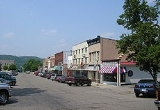
Carrollton is a town in Carroll County
, Kentucky
, at the confluence
of the Ohio River
and the Kentucky River
. Its population was 3,846 at the 2000 census. It is the county seat
of Carroll County
.
Carrollton was founded in 1794, and it was known as Port William initially. It served as the county seat of Gallatin County
until 1838 when the county was split, creating Carroll County, and Port William was renamed Carrollton and became the seat of the new county. The Louisville & Nashville Railroad was built near town in 1868 and eventually became more important to the town's economy than river traffic.
It has one of the state's largest tobacco markets, and the population has remained steady since being recorded at 3,884 in the 1970 census. See Carrollton bus disaster
for an important, and tragic, event in Carroll County's history.
According to the United States Census Bureau
, the city has a total area of 2.3 square miles (6 km²), of which, 2.2 square miles (5.7 km²) of it is land and 0.44% is water.
of 2000, there were 3,846 people, 1,598 households, and 987 families residing in the city. The population density
was 1,715.4 people per square mile (662.9/km²). There were 1,709 housing units at an average density of 762.3 per square mile (294.6/km²). The racial makeup of the city was 93.99% White, 2.24% (U.S. Census), 0.13% Native American, 0.18% Asian, 2.03% from other races
, and 1.43% from two or more races. Hispanic or Latino of any race were 4.42% of the population.
There were 1,598 households out of which 27.7% had children under the age of 18 living with them, 43.0% were married couples
living together, 14.7% had a female householder with no husband present, and 38.2% were non-families. 33.9% of all households were made up of individuals and 16.2% had someone living alone who was 65 years of age or older. The average household size was 2.29 and the average family size was 2.90.
In the city the population was spread out with 23.0% under the age of 18, 9.9% from 18 to 24, 27.3% from 25 to 44, 22.1% from 45 to 64, and 17.7% who were 65 years of age or older. The median age was 38 years. For every 100 females there were 95.4 males. For every 100 females age 18 and over, there were 90.2 males.
The median income for a household in the city was $29,818, and the median income for a family was $41,193. Males had a median income of $32,563 versus $20,000 for females. The per capita income
for the city was $14,376. About 13.9% of families and 20.2% of the population were below the poverty line, including 31.5% of those under age 18 and 26.2% of those age 65 or over.
Carroll County, Kentucky
Carroll County is a county located in the U.S. state of Kentucky and located at the confluence of the Kentucky and Ohio rivers. It was formed in 1838 and named for Charles Carroll of Carrollton, the last living signer of the Declaration of Independence. The population was 10,155 at the 2000 census...
, Kentucky
Kentucky
The Commonwealth of Kentucky is a state located in the East Central United States of America. As classified by the United States Census Bureau, Kentucky is a Southern state, more specifically in the East South Central region. Kentucky is one of four U.S. states constituted as a commonwealth...
, at the confluence
Confluence (geography)
In geography, a confluence is the meeting of two or more bodies of water. It usually refers to the point where two streams flow together, merging into a single stream...
of the Ohio River
Ohio River
The Ohio River is the largest tributary, by volume, of the Mississippi River. At the confluence, the Ohio is even bigger than the Mississippi and, thus, is hydrologically the main stream of the whole river system, including the Allegheny River further upstream...
and the Kentucky River
Kentucky River
The Kentucky River is a tributary of the Ohio River, long, in the U.S. state of Kentucky. The river and its tributaries drain much of the central region of the state, with its upper course passing through the coal-mining regions of the Cumberland Mountains, and its lower course passing through the...
. Its population was 3,846 at the 2000 census. It is the county seat
County seat
A county seat is an administrative center, or seat of government, for a county or civil parish. The term is primarily used in the United States....
of Carroll County
Carroll County, Kentucky
Carroll County is a county located in the U.S. state of Kentucky and located at the confluence of the Kentucky and Ohio rivers. It was formed in 1838 and named for Charles Carroll of Carrollton, the last living signer of the Declaration of Independence. The population was 10,155 at the 2000 census...
.
Carrollton was founded in 1794, and it was known as Port William initially. It served as the county seat of Gallatin County
Gallatin County, Kentucky
Gallatin County is a county located in the U.S. state of Kentucky along the Ohio River, which at its formation was the main transportation route. It was formed in 1799. As of 2000, the population was 7,870. Its county seat is Warsaw...
until 1838 when the county was split, creating Carroll County, and Port William was renamed Carrollton and became the seat of the new county. The Louisville & Nashville Railroad was built near town in 1868 and eventually became more important to the town's economy than river traffic.
It has one of the state's largest tobacco markets, and the population has remained steady since being recorded at 3,884 in the 1970 census. See Carrollton bus disaster
Carrollton bus disaster
The Carrollton, Kentucky bus collision was one of the deadliest bus disasters in United States history.About 11:00 p.m. EDT on Saturday May 14, 1988, Larry Mahoney, a drunk driver in a pickup truck traveling in the wrong direction on an interstate highway in a rural, unincorporated area of Carroll...
for an important, and tragic, event in Carroll County's history.
Geography
Carrollton is situated on the Ohio River at the mouth of the Kentucky River.According to the United States Census Bureau
United States Census Bureau
The United States Census Bureau is the government agency that is responsible for the United States Census. It also gathers other national demographic and economic data...
, the city has a total area of 2.3 square miles (6 km²), of which, 2.2 square miles (5.7 km²) of it is land and 0.44% is water.
Demographics
As of the censusCensus
A census is the procedure of systematically acquiring and recording information about the members of a given population. It is a regularly occurring and official count of a particular population. The term is used mostly in connection with national population and housing censuses; other common...
of 2000, there were 3,846 people, 1,598 households, and 987 families residing in the city. The population density
Population density
Population density is a measurement of population per unit area or unit volume. It is frequently applied to living organisms, and particularly to humans...
was 1,715.4 people per square mile (662.9/km²). There were 1,709 housing units at an average density of 762.3 per square mile (294.6/km²). The racial makeup of the city was 93.99% White, 2.24% (U.S. Census), 0.13% Native American, 0.18% Asian, 2.03% from other races
Race (United States Census)
Race and ethnicity in the United States Census, as defined by the Federal Office of Management and Budget and the United States Census Bureau, are self-identification data items in which residents choose the race or races with which they most closely identify, and indicate whether or not they are...
, and 1.43% from two or more races. Hispanic or Latino of any race were 4.42% of the population.
There were 1,598 households out of which 27.7% had children under the age of 18 living with them, 43.0% were married couples
Marriage
Marriage is a social union or legal contract between people that creates kinship. It is an institution in which interpersonal relationships, usually intimate and sexual, are acknowledged in a variety of ways, depending on the culture or subculture in which it is found...
living together, 14.7% had a female householder with no husband present, and 38.2% were non-families. 33.9% of all households were made up of individuals and 16.2% had someone living alone who was 65 years of age or older. The average household size was 2.29 and the average family size was 2.90.
In the city the population was spread out with 23.0% under the age of 18, 9.9% from 18 to 24, 27.3% from 25 to 44, 22.1% from 45 to 64, and 17.7% who were 65 years of age or older. The median age was 38 years. For every 100 females there were 95.4 males. For every 100 females age 18 and over, there were 90.2 males.
The median income for a household in the city was $29,818, and the median income for a family was $41,193. Males had a median income of $32,563 versus $20,000 for females. The per capita income
Per capita income
Per capita income or income per person is a measure of mean income within an economic aggregate, such as a country or city. It is calculated by taking a measure of all sources of income in the aggregate and dividing it by the total population...
for the city was $14,376. About 13.9% of families and 20.2% of the population were below the poverty line, including 31.5% of those under age 18 and 26.2% of those age 65 or over.
External links
- Carroll County Government Site
- Carroll County Kentucky History & Genealogy at Kentucky GenWeb
- Carroll County Tourism Site
- Carrollton, Kentucky at UrbanUp
- George Willick's Carroll County Kentucky Genealogy
- Historical Images and Texts of Carrollton, Kentucky at Northern Kentucky Views