

Cabeceira Grande
Encyclopedia
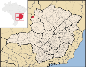
Minas Gerais
Minas Gerais is one of the 26 states of Brazil, of which it is the second most populous, the third richest, and the fourth largest in area. Minas Gerais is the Brazilian state with the largest number of Presidents of Brazil, the current one, Dilma Rousseff, being one of them. The capital is the...
. It is located just south of the boundary with the Federal District and the national capital Brasília
Brasília
Brasília is the capital city of Brazil. The name is commonly spelled Brasilia in English. The city and its District are located in the Central-West region of the country, along a plateau known as Planalto Central. It has a population of about 2,557,000 as of the 2008 IBGE estimate, making it the...
. The population was 6,294 (2007) in a total area of 1,026 km². The elevation of the municipal seat is 923 mts above sea level.
Cabeceira Grande is 11 kilometers east of state highway MG-188, which connects Patrocínio
Patrocínio
Patrocínio is a municipality in the state of Minas Gerais in Brazil. The population of the municipality in 2007 was 81,589. The area is 2,867 km² and the elevation is 965 mts.-Highway connections:...
to the national highway BR-40 near Formosa
Formosa, Goiás
Formosa is a city and municipality located in the state of Goiás, Brazil, approximately 80 kilometers east of Brasília. The population was 90,247 in a total area of 5,806.89 km² . Formosa is known for its waterfalls and natural beauty...
. It is approximately 70 km. northwest of regional center Unaí
Unaí
Unaí is a city and municipality in northern Minas Gerais state, Brazil, postal code 38610-000.-Location:Unaí is located southeast of Brasília and the Federal District and is linked to that important urban nucleus by highway BR 251, which also connects with BR 040 at Paracatu...
and is part of the statistical micro-region of Unaí.
The main economic activities are cattle raising (32,000 head in 2006) and farming, especially the growing of soybeans (7,400 ha.), sorghum (1,000 ha.), corn (5,250 ha.), and beans (4,250 ha.). There was also some planting of coffee, hearts of palm, and rice.
The biggest employers in the town were public administration and farming. In 2007 there were 167 automobiles. There were no banks.
In the school system there 1,307 students in primary school (2006) and 349 in middle school. There were 2 public health clinics.