

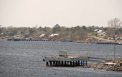
Byng Inlet (Ontario)
Encyclopedia
Georgian Bay
Georgian Bay is a large bay of Lake Huron, located entirely within Ontario, Canada...
, between Parry Sound
Parry Sound, Ontario
Parry Sound is a town in Central Ontario, Canada, located on Parry Sound on the eastern shore of Georgian Bay. Parry Sound is located south of Sudbury and north of Toronto. It is the seat of Parry Sound District, a popular cottage country region for Southern Ontario residents. It is also the...
and the mouth of the French River
French River (Ontario)
The French River is a river in Central Ontario, Canada. It flows from Lake Nipissing west to Georgian Bay. The river largely follows the boundary between the Parry Sound District and the Sudbury District, and in most contexts is considered the dividing line between Northern Ontario and Southern...
. It is a widening of the Magnetawan River
Magnetawan River
The Magnetawan River is a river in Parry Sound District, Ontario, Canada, which flows 175 km from Magnetawan Lake inside Algonquin Provincial Park to empty into Georgian Bay at the community of Britt on Byng Inlet....
, near its mouth. The name of the river "Magnetawan", meaning "long open channel" in the Ojibwa language, refers to this section of the river.
Naming of the Inlet
Byng Inlet was named in the honor former British Naval officer John ByngJohn Byng
Admiral John Byng was a Royal Navy officer. After joining the navy at the age of thirteen he participated at the Battle of Cape Passaro in 1718. Over the next thirty years he built up a reputation as a solid naval officer and received promotion to Vice-Admiral in 1747...
. It was named by Captain Henry Wolsey Bayfield
Henry Wolsey Bayfield
Admiral Henry Wolsey Bayfield was a British naval officer and surveyor.- Early life and career :Bayfield was born in Kingston-upon-Hull, to John Wolsey Bayfield and Eliza Petit. His family was an ancient one, who at one time lived at Bayfield Hall in Norfolk...
, who chart
Chart
A chart is a graphical representation of data, in which "the data is represented by symbols, such as bars in a bar chart, lines in a line chart, or slices in a pie chart"...
ed the Canadian shores of lakes Huron
Lake Huron
Lake Huron is one of the five Great Lakes of North America. Hydrologically, it comprises the larger portion of Lake Michigan-Huron. It is bounded on the east by the Canadian province of Ontario and on the west by the state of Michigan in the United States...
and Superior
Lake Superior
Lake Superior is the largest of the five traditionally-demarcated Great Lakes of North America. It is bounded to the north by the Canadian province of Ontario and the U.S. state of Minnesota, and to the south by the U.S. states of Wisconsin and Michigan. It is the largest freshwater lake in the...
, formerly involved with Admiral William Fitzwilliam Owen
William Fitzwilliam Owen
Vice Admiral William Fitzwilliam Owen , was a British naval officer and explorer. He is best known for his exploration of the west and east African coasts, discovery of the Seaflower Channel off the coast of Sumatra and for surveying the Canadian Great Lakes...
, while surveying
Surveying
See Also: Public Land Survey SystemSurveying or land surveying is the technique, profession, and science of accurately determining the terrestrial or three-dimensional position of points and the distances and angles between them...
the lower Great Lakes Erie
Lake Erie
Lake Erie is the fourth largest lake of the five Great Lakes in North America, and the tenth largest globally. It is the southernmost, shallowest, and smallest by volume of the Great Lakes and therefore also has the shortest average water residence time. It is bounded on the north by the...
and Ontario
Lake Ontario
Lake Ontario is one of the five Great Lakes of North America. It is bounded on the north and southwest by the Canadian province of Ontario, and on the south by the American state of New York. Ontario, Canada's most populous province, was named for the lake. In the Wyandot language, ontarío means...
. For surveying of this region, Bayfield made his headquarters at the Naval Establishment at Penetanguishene in 1819. In 1825, Bayfield returned to England
England
England is a country that is part of the United Kingdom. It shares land borders with Scotland to the north and Wales to the west; the Irish Sea is to the north west, the Celtic Sea to the south west, with the North Sea to the east and the English Channel to the south separating it from continental...
to prepare his charts for the engraver.
See also
- Byng Inlet, OntarioByng Inlet, OntarioByng Inlet is a ghost town in Parry Sound District, Ontario. For a period in the nineteenth century it was home to one of largest sawmill operations in Canada. The name of the town came from that of the English Admiral John Byng...
, the village on the south shore - Britt, OntarioBritt, OntarioBritt is a community in the Canadian province of Ontario, located in the unincorporated township of Wallbridge in the Parry Sound District.The community is located on the north shore of the Magnetawan River at Byng Inlet, approximately 5 kilometres west of Highway 69, at the end of Highway 526.Like...
, on the north shore.