
Boggs Mountain Demonstration State Forest
Encyclopedia
Boggs Mountain Demonstration State Forest is a state forest
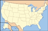
located on State Route 175, eight miles (13 km) south of Clear Lake in Lake County, California
, USA. It is one of the largest mountains in the area, with a length of 10 miles (16 km) east to west and width of 4 miles (6 km) north to south. The mountain's highest point is 3750 feet (1,143 m) elevation. Like nearby mountains such as Cobb Mountain
, Boggs is volcanic in origin. It receives heavy rainfall, winter snow and has at least two perennial springs.
Boggs Mountain State Forest is managed by the California Department of Forestry (CDF). CDF (now officially renamed Cal-Fire) purchased 3433 acres (13.9 km²) in 1949 from the Calso Company for 38,000 dollars
.
Later, the name changed to Digger Jones Mountain, then for a short time, Hawley's Mountain after Hawley who died around 1870.
, a Napa Valley farmer, merchant and former governor of the state of Missouri
.
In 1880, Henry C. bought a small lot on the eastern edge of the present forest boundary, moved his sawmill there and cut stands of Ponderosa pine
, sugar pine
and Douglas-fir
. By 1884 he had bought (and logged) most of the area of the state forest. The Farmers Savings Bank became the owners of the property in 1898.
The property was sold several times after 1898 and one of the owners was Jim McCauley, who died in 1941. His heirs then sold the timber rights to Setzer Forest Products. Setzer clearcut more than 2800 acres (11.3 km²) of the property.
by 1954, all timber interests and titles were conveyed to the state.
and madrone. Campsites consist of tables and fire rings. No water is available. Camping, campfires and use of gas stoves are limited to campgrounds.
According to data from the Boggs Mountain State Demonstration Forest brochure the timber growth rate of the forest at 300 board feet per acre (0.2 mm) per year.
Hunting is permitted under applicable State game laws. Pets are welcome but must be leashed and controlled. Horses are allowed in camp only with a special use permit.
All Terrain Vehicles (ATV) are not allowed at Boggs, only street legal vehicles which must stay on the forest roadways.
CDF also maintains a helicopter base at Boggs Mountain which was established in 1972 for fire and rescue operations and provides coverage for Mendocino National Forest
to the north, San Francisco Bay Area
to the south and the Sacramento Valley
to the east.
State forest
A state forest is a forest that is administered or protected by some agency of a sovereign state.The precise application of the term varies by jurisdiction...
located on State Route 175, eight miles (13 km) south of Clear Lake in Lake County, California
Lake County, California
Lake County is a county located in the north central portion of the U.S. state of California, north of the San Francisco Bay Area. It takes its name from Clear Lake, the dominant geographic feature in the county and the largest natural lake wholly within California...
, USA. It is one of the largest mountains in the area, with a length of 10 miles (16 km) east to west and width of 4 miles (6 km) north to south. The mountain's highest point is 3750 feet (1,143 m) elevation. Like nearby mountains such as Cobb Mountain
Cobb Mountain
Cobb Mountain is the tallest mountain in the Mayacamas Mountains of California. Its 4720+ feet, main summit is located in Lake County, west of the town of Cobb...
, Boggs is volcanic in origin. It receives heavy rainfall, winter snow and has at least two perennial springs.
Boggs Mountain State Forest is managed by the California Department of Forestry (CDF). CDF (now officially renamed Cal-Fire) purchased 3433 acres (13.9 km²) in 1949 from the Calso Company for 38,000 dollars
History
One of the earliest names given to the mountain was Harbin, from James M. Harbin who lived on the eastern side around 1856 and built the first resort in the area, still in operation today as Harbin Hot SpringsHarbin Hot Springs
Harbin Hot Springs is a non-profit hot spring retreat and workshop center in Harbin Springs, Lake County, in Northern California, about two hours northeast of the San Francisco Bay Area.-History:...
.
Later, the name changed to Digger Jones Mountain, then for a short time, Hawley's Mountain after Hawley who died around 1870.
The Boggs family
Henry C. Boggs was the son of Liburn W. BoggsLilburn Boggs
Lilburn Williams Boggs was the sixth Governor of Missouri from 1836 to 1840. He is now most widely remembered for his interactions with Joseph Smith and Porter Rockwell, and Missouri Executive Order 44, known by Mormons as the "Extermination Order", issued in response to the ongoing conflict...
, a Napa Valley farmer, merchant and former governor of the state of Missouri
Missouri
Missouri is a US state located in the Midwestern United States, bordered by Iowa, Illinois, Kentucky, Tennessee, Arkansas, Oklahoma, Kansas and Nebraska. With a 2010 population of 5,988,927, Missouri is the 18th most populous state in the nation and the fifth most populous in the Midwest. It...
.
In 1880, Henry C. bought a small lot on the eastern edge of the present forest boundary, moved his sawmill there and cut stands of Ponderosa pine
Ponderosa Pine
Pinus ponderosa, commonly known as the Ponderosa Pine, Bull Pine, Blackjack Pine, or Western Yellow Pine, is a widespread and variable pine native to western North America. It was first described by David Douglas in 1826, from eastern Washington near present-day Spokane...
, sugar pine
Sugar Pine
Pinus lambertiana, commonly known as the sugar pine or sugar cone pine, is the tallest and most massive pine, with the longest cones of any conifer...
and Douglas-fir
Douglas-fir
Douglas-fir is one of the English common names for evergreen coniferous trees of the genus Pseudotsuga in the family Pinaceae. Other common names include Douglas tree, and Oregon pine. There are five species, two in western North America, one in Mexico, and two in eastern Asia...
. By 1884 he had bought (and logged) most of the area of the state forest. The Farmers Savings Bank became the owners of the property in 1898.
The property was sold several times after 1898 and one of the owners was Jim McCauley, who died in 1941. His heirs then sold the timber rights to Setzer Forest Products. Setzer clearcut more than 2800 acres (11.3 km²) of the property.
The state steps in
Under the authority of the State Forest Purchase Act (Section 4631 of the public Resources code) California purchased the land intending the use as a demonstration forest. Setzer completed logging operations in 1950 andby 1954, all timber interests and titles were conveyed to the state.
Forestry and recreation
The forest is managed as multiple-use, so in addition to logging, there are two campgrounds and 22 miles (35 km) of dirt roads, 14 miles (23 km) of trails for hiking, mountain biking and horseback riding. There is a variety of terrain including meadows, ridge tops, and dense forests of pine, canyon live oak, black oak, Western dogwoodDogwood
The genus Cornus is a group of about 30-60 species of woody plants in the family Cornaceae, commonly known as dogwoods. Most dogwoods are deciduous trees or shrubs, but a few species are nearly herbaceous perennial subshrubs, and a few of the woody species are evergreen...
and madrone. Campsites consist of tables and fire rings. No water is available. Camping, campfires and use of gas stoves are limited to campgrounds.
According to data from the Boggs Mountain State Demonstration Forest brochure the timber growth rate of the forest at 300 board feet per acre (0.2 mm) per year.
Hunting is permitted under applicable State game laws. Pets are welcome but must be leashed and controlled. Horses are allowed in camp only with a special use permit.
All Terrain Vehicles (ATV) are not allowed at Boggs, only street legal vehicles which must stay on the forest roadways.
CDF also maintains a helicopter base at Boggs Mountain which was established in 1972 for fire and rescue operations and provides coverage for Mendocino National Forest
Mendocino National Forest
The Mendocino National Forest is located in the Coastal Mountain Range in northwestern California and comprises 913,306 acres...
to the north, San Francisco Bay Area
San Francisco Bay Area
The San Francisco Bay Area, commonly known as the Bay Area, is a populated region that surrounds the San Francisco and San Pablo estuaries in Northern California. The region encompasses metropolitan areas of San Francisco, Oakland, and San Jose, along with smaller urban and rural areas...
to the south and the Sacramento Valley
Sacramento Valley
The Sacramento Valley is the portion of the California Central Valley that lies to the north of the San Joaquin-Sacramento Delta in the U.S. state of California. It encompasses all or parts of ten counties.-Geography:...
to the east.