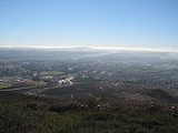
Black Mountain, New South Wales
Encyclopedia
Black Mountain is a village situated between Armidale
and Guyra
on the Northern Tablelands
in the New England
region of New South Wales
, Australia
. It is in Guyra Shire. At the 2006 census
, Black Mountain had a population of 387. Black Mountain village exists in two sections. Located on the New England Highway is the Black Mountain Roadhouse and motel at the top of notorious Devil’s Pinch, which is subject to snow falls that close the road. This marks the turn off into Black Mountain proper, a drive of 3 km.
The Black Mountain area was a well known haunt of Captain Thunderbolt
. One of his hideout caves is located 200 metres to the south of the roadhouse.
Located on a volcanic uplift of the Northern Tablelands, the town is one of the highest in Australia at about 1312 metres above sea level. The New England Highway
is the main transport link to Armidale. The Northern Railway tracks still pass through the village, but this line is now disused north of Armidale.
Sheep and beef cattle breeding is the main industry of the area.
Black Mountain Baptist Church was built there in 1902 and restored in 1992. Black Mountain has a Public School and nursery which is the home of the award winning three point linkage Youman Tree Planter machine and services.
Booroolong Railway Station Post Office opened on 8 December 1884, was renamed Black Mountain around 1886 and closed in 1985.
Armidale, New South Wales
Armidale is a city in the Northern Tablelands, New South Wales, Australia. Armidale Dumaresq Shire had a population of 19,485 people according to the 2006 census. It is the administrative centre for the Northern Tablelands region...
and Guyra
Guyra, New South Wales
-References:...
on the Northern Tablelands
Northern Tablelands, New South Wales
The Northern Tablelands, also known as the New England Tableland, is a plateau and a region of the Great Dividing Range in northern New South Wales, Australia. It includes the New England Range, the narrow highlands area of the New England region, stretching from the Moonbi Range in the south to...
in the New England
New England (Australia)
New England or New England North West is the name given to a generally undefined region about 60 kilometres inland, that includes the Northern Tablelands and the North West Slopes regions in the north of the state of New South Wales, Australia.-History:The region has been occupied by Indigenous...
region of New South Wales
New South Wales
New South Wales is a state of :Australia, located in the east of the country. It is bordered by Queensland, Victoria and South Australia to the north, south and west respectively. To the east, the state is bordered by the Tasman Sea, which forms part of the Pacific Ocean. New South Wales...
, Australia
Australia
Australia , officially the Commonwealth of Australia, is a country in the Southern Hemisphere comprising the mainland of the Australian continent, the island of Tasmania, and numerous smaller islands in the Indian and Pacific Oceans. It is the world's sixth-largest country by total area...
. It is in Guyra Shire. At the 2006 census
Census in Australia
The Australian census is administered once every five years by the Australian Bureau of Statistics. The most recent census was conducted on 9 August 2011; the next will be conducted in 2016. Prior to the introduction of regular censuses in 1961, they had also been run in 1901, 1911, 1921, 1933,...
, Black Mountain had a population of 387. Black Mountain village exists in two sections. Located on the New England Highway is the Black Mountain Roadhouse and motel at the top of notorious Devil’s Pinch, which is subject to snow falls that close the road. This marks the turn off into Black Mountain proper, a drive of 3 km.
The Black Mountain area was a well known haunt of Captain Thunderbolt
Captain Thunderbolt
Frederick Wordsworth Ward was an Australian bushranger renowned for escaping from Cockatoo Island, and also for his reputation as the "gentleman bushranger" and his lengthy survival, being the longest roaming bushranger in Australian history.-Early years:Frederick Ward was the son of convict...
. One of his hideout caves is located 200 metres to the south of the roadhouse.
Located on a volcanic uplift of the Northern Tablelands, the town is one of the highest in Australia at about 1312 metres above sea level. The New England Highway
New England Highway
The New England Highway is a highway in Australia running from Hexham near Newcastle at its southern end to Yarraman near Toowoomba at its northern end. At its southern end it connects to the Pacific Highway and at its northern end it connects to the D'Aguilar Highway. It traverses the Hunter...
is the main transport link to Armidale. The Northern Railway tracks still pass through the village, but this line is now disused north of Armidale.
Sheep and beef cattle breeding is the main industry of the area.
Black Mountain Baptist Church was built there in 1902 and restored in 1992. Black Mountain has a Public School and nursery which is the home of the award winning three point linkage Youman Tree Planter machine and services.
Booroolong Railway Station Post Office opened on 8 December 1884, was renamed Black Mountain around 1886 and closed in 1985.

