

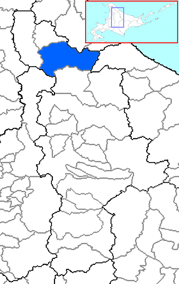
Bifuka, Hokkaido
Encyclopedia
Towns of Japan
A town is a local administrative unit in Japan. It is a local public body along with prefecture , city , and village...
located in Nakagawa (Teshio) District
Nakagawa (Teshio) District, Hokkaido
is a district located in Kamikawa Subprefecture, Hokkaidō, Japan. A district with the same name exists in Tokachi Subprefecture.As of 2004, the district has an estimated population of 9,038 and a density of 5.86 persons per km². The total area is 1,542.65 km².-Towns and...
, Kamikawa
Kamikawa Subprefecture
is a subprefecture of Hokkaidō, Japan. The name is derived from Kamikawa no hitobito no Shūraku , a translation of the Ainu Peni Unguri Kotan. Settlement began in 1867...
, Hokkaidō, Japan
Japan
Japan is an island nation in East Asia. Located in the Pacific Ocean, it lies to the east of the Sea of Japan, China, North Korea, South Korea and Russia, stretching from the Sea of Okhotsk in the north to the East China Sea and Taiwan in the south...
.
, the town has an estimated population
Population
A population is all the organisms that both belong to the same group or species and live in the same geographical area. The area that is used to define a sexual population is such that inter-breeding is possible between any pair within the area and more probable than cross-breeding with individuals...
of 5,265 and a density
Population density
Population density is a measurement of population per unit area or unit volume. It is frequently applied to living organisms, and particularly to humans...
of 8.33 persons per km². The total area is 672.14 km².
Bifuka is located in a valley setting and are surrounded by mountains. The Teshio River
Teshio River
The is a river in Hokkaido, Japan. At , it is the fourth longest river in Japan.The name of the river derives from an Ainu word meaning "fishing weir."- External links :*...
flows west of Bifuka. The town is linked with Route 40 linking Wakkanai and southern Hokkaidō. Another route the Route 275
Route 275 (Japan)
National Route 275 is a national highway of Japan connecting Chūō-ku, Sapporo and Hamatonbetsu, Hokkaidō in Japan, with a total length of 315.2 km ....
is also connected.
Bifuka has a school, a lyceum, a gymnasium or a secondary school. Bifuka also serves a train station. The nearest municipalities are Otoineppu
Otoineppu, Hokkaido
is a village located in Nakagawa District, Kamikawa, Hokkaidō, Japan.As of 2007, the village has an estimated population of 965. The total area is 275.64 km².-External links:*...
to the north and Nayoro
Nayoro, Hokkaido
- External links :...
to the south.
External links
- Official website in Japanese