

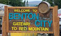
Benton City, Washington
Encyclopedia
Benton County, Washington
Benton County is a county located in the south-central portion of the U.S. state of Washington. The Columbia River makes up the north, south, and east boundaries of the county. In 2010, its population was 175,177. The county seat is Prosser, and its largest city is Kennewick...
, United States. The population was 3,038 at the 2010 census. The city is strongly associated with nearby Kiona
Kiona, Washington
Kiona is an unincorporated community in Benton County, Washington, United States. Kiona is an Indian term meaning "brown hills." Kiona and Benton City share a school district .-History:...
, with which it shares a school district
School district
School districts are a form of special-purpose district which serves to operate the local public primary and secondary schools.-United States:...
.
History
Benton City was originally platted by the Oregon Washington Railroad and Navigation Company in 1909 at the junction of the Walla Walla and Yakima lines. It took its name from Benton S. Groscup (and not the county's namesake), who was influential in the separation of Benton County from Yakima County. Freight and Passenger depots were built by the railroad in 1910.The town was officially incorporated July 2, 1945. Irrigation water was brought to the area via the Sunnyside Canal in 1947, allowing the area to grow considerably.
In 2002, the Benton City – Kiona Bridge
Benton City – Kiona Bridge
The Benton City – Kiona Bridge is a long by wide steel box girder bridge carrying two lanes of Washington State Route 225 over the Yakima River in Kiona, Benton County, Washington. The bridge was completed in 1957, replacing a bridge that was located downstream...
over the Yakima River at Benton City was added to the National Register of Historic Places.
Geography
Benton City is located at 46°16′4"N 119°29′18"W (46.267872, -119.488230).According to the United States Census Bureau
United States Census Bureau
The United States Census Bureau is the government agency that is responsible for the United States Census. It also gathers other national demographic and economic data...
, the city has a total area of 1.8 square miles (4.5 km²), of which, 1.7 square miles (4.5 km²) of it is land and 0.57% is water.
Demographics
As of the census of 2000, there were 2,624 people, 894 households, and 660 families residing in the city. The population density was 1,507.8 people per square mile (582.3/km²). There were 1,043 housing units at an average density of 599.3 per square mile (231.4/km²). The racial makeup of the city was 84.34% White, 0.15% African American, 1.14% Native American, 0.61% Asian, 0.04% Pacific Islander, 10.63% from other racesRace (United States Census)
Race and ethnicity in the United States Census, as defined by the Federal Office of Management and Budget and the United States Census Bureau, are self-identification data items in which residents choose the race or races with which they most closely identify, and indicate whether or not they are...
, and 3.09% from two or more races. Hispanic or Latino of any race were 19.51% of the population.
There were 894 households out of which 44.6% had children under the age of 18 living with them, 54.4% were married couples living together, 11.3% had a female householder with no husband present, and 26.1% were non-families. 21.5% of all households were made up of individuals and 7.2% had someone living alone who was 65 years of age or older. The average household size was 2.94 and the average family size was 3.44.
In the city the age distribution of the population shows 34.7% under the age of 18, 8.5% from 18 to 24, 28.8% from 25 to 44, 19.7% from 45 to 64, and 8.2% who were 65 years of age or older. The median age was 30 years. For every 100 females there were 104.7 males. For every 100 females age 18 and over, there were 102.5 males.
The median income for a household in the city was $33,636, and the median income for a family was $43,036. Males had a median income of $32,464 versus $22,137 for females. The per capita income
Per capita income
Per capita income or income per person is a measure of mean income within an economic aggregate, such as a country or city. It is calculated by taking a measure of all sources of income in the aggregate and dividing it by the total population...
for the city was $13,971. About 11.7% of families and 15.7% of the population were below the poverty line, including 16.5% of those under age 18 and 2.0% of those age 65 or over.