

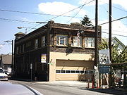
Belmont, Portland, Oregon
Encyclopedia
Portland, Oregon
Portland is a city located in the Pacific Northwest, near the confluence of the Willamette and Columbia rivers in the U.S. state of Oregon. As of the 2010 Census, it had a population of 583,776, making it the 29th most populous city in the United States...
, Oregon
Oregon
Oregon is a state in the Pacific Northwest region of the United States. It is located on the Pacific coast, with Washington to the north, California to the south, Nevada on the southeast and Idaho to the east. The Columbia and Snake rivers delineate much of Oregon's northern and eastern...
in a parallel fashion to the Hawthorne District
Hawthorne, Portland, Oregon
The Hawthorne District in Portland, Oregon is an area of Southeast Portland on SE Hawthorne Blvd., particularly between 30th and 42nd Avenues. The area has numerous retail stores, including clothing shops, restaurants, bars, brewpubs and microbreweries. Hawthorne district is known for its young,...
, 6 blocks to the south. From west to east the area extends 48 blocks, from SE 12th Ave. to SE 60th Ave., passing through the Buckman
Buckman, Portland, Oregon
Buckman is a neighborhood in the Southeast section of Portland, Oregon. The neighborhood is bounded by the Willamette River on the west, E Burnside St. on the north , SE 28th Ave. on the east, and SE Hawthorne Blvd...
, Sunnyside
Sunnyside, Portland, Oregon
Sunnyside is a neighborhood in the south east section of Portland, between SE Stark St. and SE Hawthorne Blvd. and from SE 28th Ave. to SE 49th Ave....
, and Mount Tabor
Mount Tabor, Portland, Oregon
Mount Tabor is the name of a volcanic cinder cone, the city park on the volcano, and the neighborhood of Southeast Portland that surrounds it, all in the U.S. state of Oregon. The name refers to Mount Tabor, Israel. It was named by Plympton Kelly, son of Oregon City pioneer resident Clinton...
neighborhoods. The area is seven blocks wide, running from SE Belmont St. 4 blocks north to SE Stark St. and 3 blocks south to SE Salmon St. SE Belmont St. between SE 34th Ave. and SE 35th Ave., in Sunnyside, is the heart of the district.
The area developed around the first trolley
Tram
A tram is a passenger rail vehicle which runs on tracks along public urban streets and also sometimes on separate rights of way. It may also run between cities and/or towns , and/or partially grade separated even in the cities...
line in East Portland
East Portland, Oregon
East Portland was a city in the U.S. state of Oregon that was consolidated into Portland in 1891. It was founded on a land claim by James B. Stephens in 1846, who bought a land claim from John McLoughlin of the Hudson's Bay Company...
, established in 1888 (and converted to a bus line in 1949).