

Barlby
Encyclopedia
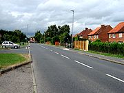
Barlby is a linear village
in North Yorkshire
, England. It lies to the north-east of the market town of Selby
, and is bordered to the west by the River Ouse
and to the east by the A19
Barlby bypass. Across the bypass is Barlby's smaller sister village, Osgodby with which it forms the civil parish
of Barlby with Osgodby
.
 Seen from the air, Barlby is long and thin, roughly three miles in length, and runs along the old route of the A19. Although it is classified as a single village, it consists of two distinct areas, Barlby Hilltop, at the north end of the village, and Barlby Bridge which lies slightly to the south west. The building of new estates in recent years has meant, however, that the division between them has blurred somewhat.
Barlby Hilltop, contains Hilltop Primary School, the Post Office
, a library, the Craig Bonner memorial centre, the late nineteenth century church, and Barlby High School, which also serves students from the surrounding villages of Osgodby, Riccall
, Kelfield
, Escrick
, Cliffe
, North Duffield
, South Duffield, Hemingbrough
and Bubwith
. Despite its name, it is not really on much of a hill, but is slightly higher than Barlby Bridge.
A brief stretch of road separates 'Hilltop' from 'Bridge', which takes its name from the old toll bridge at the southernmost end of the village. This is the boundary with Selby, and in fact Barlby Bridge is practically a suburb of the town - it is much closer to Selby than it is to the Hilltop end of the village. Barlby Bridge also has a primary school, as well as two of the village's major employers, BOCM Pauls
, which produces animal feed, and Greencore Foods.
Traditionally, Barlby's population was split between the coal mining
and farming communities, but with the closure of many mines and the changes in the agricultural sector, the professions of 'Barlbarians' are now far more diverse.
, the village is vulnerable to flooding, and was particularly badly hit in November 2000, when about half of it was submerged resulting in loss of power for two weeks as the main sub station in the area been destroyed. Prince Charles was also noted for visiting Barlby when the area flooded the worst areas were that of the primary school, George Terrace and the recently finished housing estate. Most of Barlby sites are higher than the river bank but the lower areas of Barlby were the worst hit by the Floods. The primary school out-building were completely ruined, the park was unusable for about a year and the houses in and around the riverbank were uninhabitable for months and it took weeks to get the electric fixed to all areas. The army was based in Barlby High with the big helicopters taking sand bags to try to keep the water back.
The Environment Agency has completed work to substantially upgrade the flood defences in the area.
Footballer
Russell Howarth
, who attended the high school in the mid-90s, was a youth international for the England
football team.
Linear village
In geography, a linear village, or linear settlement, is a small to medium-sized settlement that is formed around a transport route, such as a road, river, or canal. Wraysbury, a village in Berkshire, is one of the longest villages in England....
in North Yorkshire
North Yorkshire
North Yorkshire is a non-metropolitan or shire county located in the Yorkshire and the Humber region of England, and a ceremonial county primarily in that region but partly in North East England. Created in 1974 by the Local Government Act 1972 it covers an area of , making it the largest...
, England. It lies to the north-east of the market town of Selby
Selby
Selby is a town and civil parish in North Yorkshire, England. Situated south of the city of York, along the course of the River Ouse, Selby is the largest and, with a population of 13,012, most populous settlement of the wider Selby local government district.Historically a part of the West Riding...
, and is bordered to the west by the River Ouse
River Ouse, Yorkshire
The River Ouse is a river in North Yorkshire, England. The river is formed from the River Ure at Cuddy Shaw Reach near Linton-on-Ouse, about 6 miles downstream of the confluence of the River Swale with the River Ure...
and to the east by the A19
A19 road
The A19 is a major road in England running approximately parallel to and east of the A1 road, although the two roads meet at the northern end of the A19, the two roads originally met at the southern end of the A19 in Doncaster but the old route of the A1 was changed to the A638. From Sunderland...
Barlby bypass. Across the bypass is Barlby's smaller sister village, Osgodby with which it forms the civil parish
Civil parish
In England, a civil parish is a territorial designation and, where they are found, the lowest tier of local government below districts and counties...
of Barlby with Osgodby
Barlby with Osgodby
Barlby with Osgodby is a civil parish in the Selby district of North Yorkshire, England, just to the north of Selby.The parish covers Barlby and Osgodby and had a population of 4,533 according to the 2001 census....
.
Barlby Hilltop, contains Hilltop Primary School, the Post Office
Post office
A post office is a facility forming part of a postal system for the posting, receipt, sorting, handling, transmission or delivery of mail.Post offices offer mail-related services such as post office boxes, postage and packaging supplies...
, a library, the Craig Bonner memorial centre, the late nineteenth century church, and Barlby High School, which also serves students from the surrounding villages of Osgodby, Riccall
Riccall
Riccall is a village and civil parish situated in the Selby district of North Yorkshire, England, lying 3.5 miles north of Selby and 9 miles to the south of York. It is historically part of the East Riding of Yorkshire. According to the 2001 census the parish had a total population of...
, Kelfield
Kelfield, North Yorkshire
Kelfield is a small village and civil parish in the Selby district of North Yorkshire, England.It is situated on the northern bank of the River Ouse, equidistant between the villages of Riccall, Cawood and Stillingfleet, approximately 5 miles north west of Selby.The village no longer has a school,...
, Escrick
Escrick
Escrick is a village and civil parish in the Selby district of North Yorkshire, England. It is equidistant between Selby and York on what is now the A19 road....
, Cliffe
Cliffe, Selby
Cliffe is a small village and civil parish in the Selby district of North Yorkshire, England. It lies on the A63 trunk road from Selby to Hull and the railway line which also goes to and from those destinations. The railway was opened in 1863 and there was a station at Cliffe although it was named...
, North Duffield
North Duffield
North Duffield is a village and civil parish in the Selby District of North Yorkshire, England. It lies about 7 km northeast of Selby on the A163 road from Selby to Market Weighton. The River Derwent forms the eastern boundary of the parish....
, South Duffield, Hemingbrough
Hemingbrough
Hemingbrough is a small village and civil parish in the Selby district of North Yorkshire, England that is located approximately from Selby and from Howden on the A63....
and Bubwith
Bubwith
Bubwith is a village and civil parish in the East Riding of Yorkshire, England. The village is situated about north east of Selby, and north of Goole. It is situated on the east bank of the River Derwent, west of which is the Selby district of North Yorkshire...
. Despite its name, it is not really on much of a hill, but is slightly higher than Barlby Bridge.
A brief stretch of road separates 'Hilltop' from 'Bridge', which takes its name from the old toll bridge at the southernmost end of the village. This is the boundary with Selby, and in fact Barlby Bridge is practically a suburb of the town - it is much closer to Selby than it is to the Hilltop end of the village. Barlby Bridge also has a primary school, as well as two of the village's major employers, BOCM Pauls
BOCM Pauls
BOCM Pauls Limited is a British animal feed company, established in 1992 by the amalgamation of two existing businesses.BOCM Pauls manufactures and sells animal feed in the United Kingdom and abroad. It offers feed for farm animals, pets and game birds...
, which produces animal feed, and Greencore Foods.
Traditionally, Barlby's population was split between the coal mining
Coal mining
The goal of coal mining is to obtain coal from the ground. Coal is valued for its energy content, and since the 1880s has been widely used to generate electricity. Steel and cement industries use coal as a fuel for extraction of iron from iron ore and for cement production. In the United States,...
and farming communities, but with the closure of many mines and the changes in the agricultural sector, the professions of 'Barlbarians' are now far more diverse.
Notable events and people
Situated as it is in the Vale of YorkYork
York is a walled city, situated at the confluence of the Rivers Ouse and Foss in North Yorkshire, England. The city has a rich heritage and has provided the backdrop to major political events throughout much of its two millennia of existence...
, the village is vulnerable to flooding, and was particularly badly hit in November 2000, when about half of it was submerged resulting in loss of power for two weeks as the main sub station in the area been destroyed. Prince Charles was also noted for visiting Barlby when the area flooded the worst areas were that of the primary school, George Terrace and the recently finished housing estate. Most of Barlby sites are higher than the river bank but the lower areas of Barlby were the worst hit by the Floods. The primary school out-building were completely ruined, the park was unusable for about a year and the houses in and around the riverbank were uninhabitable for months and it took weeks to get the electric fixed to all areas. The army was based in Barlby High with the big helicopters taking sand bags to try to keep the water back.
The Environment Agency has completed work to substantially upgrade the flood defences in the area.
Footballer
Football (soccer)
Association football, more commonly known as football or soccer, is a sport played between two teams of eleven players with a spherical ball...
Russell Howarth
Russell Howarth
Russell Michael Howarth is an English former footballer who played as a goalkeeper.Howarth started his career with the youth system of hometown club York City in 1996 while a schoolboy, before becoming a trainee in 1998...
, who attended the high school in the mid-90s, was a youth international for the England
England
England is a country that is part of the United Kingdom. It shares land borders with Scotland to the north and Wales to the west; the Irish Sea is to the north west, the Celtic Sea to the south west, with the North Sea to the east and the English Channel to the south separating it from continental...
football team.
External links
- The Ordnance SurveyOrdnance SurveyOrdnance Survey , an executive agency and non-ministerial government department of the Government of the United Kingdom, is the national mapping agency for Great Britain, producing maps of Great Britain , and one of the world's largest producers of maps.The name reflects its creation together with...
grid referenceGrid referenceGrid references define locations on maps using Cartesian coordinates. Grid lines on maps define the coordinate system, and are numbered to provide a unique reference to features....
for Barlby Hilltop is - The Ordnance SurveyOrdnance SurveyOrdnance Survey , an executive agency and non-ministerial government department of the Government of the United Kingdom, is the national mapping agency for Great Britain, producing maps of Great Britain , and one of the world's largest producers of maps.The name reflects its creation together with...
grid referenceGrid referenceGrid references define locations on maps using Cartesian coordinates. Grid lines on maps define the coordinate system, and are numbered to provide a unique reference to features....
for Barlby Bridge is - http://news.bbc.co.uk/1/hi/uk/1036851.stm BBC news story for the November 2000 flooding of Barlby.