

Bannered routes of U.S. Route 17
Encyclopedia
A total of at least twenty-three bannered routes of U.S. Route 17
have existed.
was a truck bypass designed to keep trucks from entering Downtown Kissimmee. It began where U.S. Route 17-92 turned from John Young Parkway
onto West Emmett Street, and continued north in a straight line along former Osceola County Road 525 until it reached U.S. Route 192
, where both routes multiplexed eastbound until they reunited with the US 17/92 multiplex at North Main Street and the Orange Blossom Trail, where US 441 joined US 17-92 north to Orlando. The route existed from sometime during the 1980's until 1999, when it was decommissioned and became part of mainline US 17-92.
, then heads north along the eastern edge of Interstate 4
along a road called Wymore Road. The road then turn east along Orange CR 438A and terminates at US 17-92 in Maitland, Florida
.
, United States
, built partially to freeway standards. It runs northeast from an intersection with Roosevelt Boulevard
(U.S. Highway 17/SR 15), running parallel with the nearby McDuff Avenue (State Road 129), to a partial interchange
with I-10.
The road is designated as a spur of State Road 15
, and was formerly numbered State Road 15A
. It has also been - and may still be - an unsigned U.S. Highway 17 Alternate, which originally continued east on I-10 and north on Interstate 95 to return to US 17 north of the Trout River
.
 Roosevelt Expressway is the bypass built as a spur of Interstate 10, which converted US 17 into a limited access Expressway north of Blanding Boulevard (SR 21), bypassing the Post Street/College Street route that Roosevelt Boulevard that goes through the Riverside-Avondale historic district, passing by McDuff Avenue (SR 129
) to Interstate 10 eastbound. The expressway is accessible southbound via I-10 west as a left exit (exit 361).
books as Expressway. It is part of the Blue Star Memorial Highway, and named for President Franklin D. Roosevelt.
In early 2006, the Florida Department of Transportation
applied to the American Association of State Highway and Transportation Officials
to reroute US 17 via the Roosevelt Expressway, I-10, I-95 and U.S. Highway 23. If this is accepted, US 17 Alternate will be eliminated. As of March 2007, it appears that US 17 has been rerouted. US 17 goes north on the Roosevelt Expressway, to east Interstate 10 (SR 8), north Interstate 95, and east on Union Street (US 23) until Main Street and picking back up on its original course.
.
was a route that existed from the 1950s to the 1990s. The route was constructed to provide motorists with a controlled highway alternative to U.S. Highway 17, which was a more rural route, via the newly constructed Eugene Talmadge Bridge. Originally US 17A was intended to become the new US 17 route, but the state of South Carolina
disagreed with the re-routing. US 17A was undersigned with Georgia Route 25 Alternate.
In the late 1980s, the Eugene Talmadge Memorial Bridge needed to be taken down due to structural damage from ships which had crashed into the pilings. In its place, a much bigger, taller bridge was built. This bridge had pylons which could be seen for miles in all directions. In addition, an elevated road was built in back of the Savannah College of Art and Design
campus, over Louisville Road, and eventually hooking up with Interstate 16
. Now motorists had a direct, controlled route to travel to from Georgia to South Carolina without having to travel through urban Savannah. In addition this new bridge was signed as Georgia Route 404 Spur, as Interstate 16
was also signed as Georgia Route 404. The state now wished once again to re-route US 17 over the Eugene Talmadge Bridge. This time, South Carolina complied, and US 17 was re-routed north over the bridge into South Carolina. Other re-routings took place, and they are listed on this page. In addition, a new route was commissioned along part of the old US 17/GA 25 route, which was labeled State Route 25 Connector.
of U.S. Route 17
. From the parent route, it travels from Murrells Inlet
north to Briarcliffe Acres
. Traveling southbound, it connects with the bypass route at the Horry
/Georgetown county line but does not end; the business route continues along the waterfront of Murrells Inlet
until rejoining the mainline route near Garden City
. The road is also a major route during the Bi-Lo Marathon weekend; miles 2-6 and also 19-21 run through this highway during the marathon.
, which splits from Business US 17 in the north to travel to Whiteville, NC and splits in the south to travel to Holden Beach; this concurrency is also a wrong-way concurrency. There are about to repave this road very soon.
of Brunswick County. This 7.5 miles (12.1 km) route is also called the Old Ocean Highway and passes through the center of Bolivia near its northern terminus.
was the old routing of US 17 through the port city before the partial completion of the Wilmington Bypass
, which in part is also designated as Interstate 140
. Currently, US 17 follows US 421
northbound to its intersection with the Wilmington Bypass, where it joins I-140 eastbound to I-40
and continues to meet its business route's northern termini near Kirkland. The U.S. Highway 17 Truck designation was removed from Military Cutoff Road and Oleander Drive upon the opening of the bypass.
This business route has its southern terminus on Eagle Island (location of the USS North Carolina battleship
) in Brunswick County. Crossing the Cape Fear River
over the Cape Fear Memorial Bridge
along with US 76
and US 421
, the business route of US 17 enters the city of Wilmington. In downtown, Business US 17 leaves US 76 and makes a left unto South 3rd Street. Business US 17 follows the road until it reaches Downtown Wilmington, making a right unto Market Street. Traveling in an easterly direction, Business US 17 crosses US 117
/NC 132 (which provides access to the eastern terminus of I-40
) and US 74
(which provides access to Wrightsville Beach
). Business US 17 darts northeast through Ogden
and Kirkland before returning to its parent route near the New Hanover/Pender
county line.
 The Southern end of this section of US 17 Business route branches from US 17 at the intersection with US 13. It turns into West Main Street at Williamston and reconnects with US 13/17 at the Northern end.
.
at the intersection of New Hope Road.
opened, bypassing a kink in US 17's routing on its way to George Washington Highway Chesapeake, Virginia
and further into the Hampton Roads metropolitan area.
The Elizabeth City bypass was designated as US 17 Bypass, however, the former US 17 Bypass route within Elizabeth City was not given a "Business" designation like other former US 17 bypass routes in North Carolina, instead being retained simply as Mainline US 17. The oldest alignment of US 17 along Ehringhaus and Road Streets through central Elizabeth City holds the US 17 Business title, starting with the southern terminus at the Ehringhaus and mainline 17 junction, traveling east along Ehringhaus and north along Road Street, re-merging with mainline US 17, Truck Business US 17 and US 158.
 Truck Business US 17 is a classification that appears to be unique to Elizabeth City, North Carolina
.
In 2002 a new US 17 Bypass was completed west of Elizabeth City, offering a shortcut to motorists wishing to avoid the often congested former bypass, being that NCDOT had failed in 1969 to acquire right-of-way giving rise to commercial strips along the route. The old Hughes Boulevard bypass was stripped of its Bypass classification and demoted to simply (Main-line) US 17.
The alignment of US 17 Business along Ehringhaus and Road Streets, in place since at least the late 60s to early 1970s remained in place, as did the alignment of US 158 entering the city from the Camden Causeway to the east, following Elizabeth Street downtown and joining Main-line US 17 north out of the city.
Interestingly, a fourth classification for US 17 emerged within Elizabeth City in the form of Truck Business US 17, which follows the above route of US 158 from the Camden Causeway, having its northern terminus where US 17 Business re-merges with the Main-line US 17.
, and US BUS 17 and NC 343 rejoin US 17 almost instantly.
carries the US Route 17 Business designation north from the Dominion Boulevard intersection to Deep Creek, where US 17 Business crosses the canal on a small drawbridge, before proceeding north to rejoin US Route 17 at Interstate 64
(Exit 296).
. One block after the wye Virginia Secondary Route 618 joins the two routes from the intersection of Lovers Retreat Lane. At the intersection of General Puller Highway VA 33 turns right SSR 618 continues north onto Oakes Landing Road and BUS US 17 turns left. This segment also contains the name "School Street," and runs west until reaching mainline US 17 once again.
, begins at the intersection of US 17 and Virginia State Route 2
southeast of Fredericksburg, where they both become Tidewater Trail. From there the road passes by Fredericksburg Country Club, Shannon Airport and the Fredericksburg Agricultural Fairgrounds. Within the city limits, Tidewater Trail becomes Dixon Street and crosses under the Blue and Gray Parkway
interchange, then curves right before splitting onto southbound Princess Anne Street and northbound Caroline Street. Both streets cross under the Fredericksburg (VRE station), where US BUS 1 joins US BUS 17 along the same parallel one-way streets, until they reach Herndon Street and become a two-way street again at Princess Anne Street. US Bus 1 & 17 continues to run northwest until they reach US 1 where US BUS 1 terminates, but US BUS 17 joins and cross the Rappahannock River
, and enters Falmouth. US BUS 17 leaves US 1 at the west end of Virginia State Route 218
where it runs northwest onto Warrenton Road before finally terminating at the north end of the I-95
/US 17
multiplex at Exit 133-B.
joins the two Business routes as US BUS Route 211 runs east along Waterloo Street and US 211-BUS 17/29 become Broadview Avenue. As the triplex curves right, and intersects Roebling Street, it becomes Lee Highway, and US Bus 17 makes a left turn onto Broadview Avenue, a name it will keep until the intersection of Foxcroft Road and becomes James Madison Highway before terminating at the interchange with mainline US Route 17.
runs northeast from Exit 27 on Interstate 66
, partially along Virginia State Route 55
(Free State Road, West Main Street), then turns southeast onto Winchester Road as it reunites with US 17 at Exit 28 on I-66.
and Virginia
from 1926 to 1933, and may have been the only hyphenated route designation in the U.S. Highway system. According to some sources, the route may or may not have been signed as "17-1" in the field, though it was included on several contemporary maps of the then-new highway system. It met its parent, U.S. Route 17
, in Wilmington, North Carolina
. Much of the North Carolina routing is also now paralleled by I-40
.
The former route of US 17-1 now carries the following designations:
U.S. Route 17
U.S. Route 17 or U.S. Highway 17 is a north–south United States highway. The highway spans the southeastern United States and is close to the Atlantic Coast for much of its length. The highway's southern terminus is at Punta Gorda, Florida, at an intersection with U.S. Route 41...
have existed.
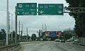
Kissimmee, Florida
U.S. Truck Route 17-92 in Kissimmee, FloridaKissimmee, Florida
Kissimmee is a city in Osceola County, Florida, United States. As of the 2010 census, the population was 59,682. It is the county seat of Osceola County...
was a truck bypass designed to keep trucks from entering Downtown Kissimmee. It began where U.S. Route 17-92 turned from John Young Parkway
John Young Parkway
State Road 423, known for most of its length as John Young Parkway, and Lee Road east of Orange Blossom Trail, is a four- and six-lane surface road in the U.S. state of Florida. SR 423 is completely inside Orlando, Florida and runs from SR 408 north to U.S...
onto West Emmett Street, and continued north in a straight line along former Osceola County Road 525 until it reached U.S. Route 192
U.S. Route 192
U.S. Route 192 is an east–west route of the United States Numbered Highway system in central Florida. It runs 75.04 miles from U.S. Route 27 in Citrus Ridge, Lake County, east past Walt Disney World and through Kissimmee, St. Cloud and Melbourne, to end at State Road A1A in Indialantic, one...
, where both routes multiplexed eastbound until they reunited with the US 17/92 multiplex at North Main Street and the Orange Blossom Trail, where US 441 joined US 17-92 north to Orlando. The route existed from sometime during the 1980's until 1999, when it was decommissioned and became part of mainline US 17-92.
Orlando, Florida
Though U.S. Truck Route 17-92 is officially designated the Orlando Truck Route for US 17-92, the actual location is north of Orladno. It is designed to divert truck traffic away from a low railroad bridge that carries Amtrak's Silver Service Trains as well as CSX freight trains. The route begins west along southbound Florida State Road 423(Lee Avenue) in Winter Park, FloridaWinter Park, Florida
Winter Park is a suburban city in Orange County, Florida, United States. The population was 24,090 at the 2000 census. According to the U.S. Census Bureau's 2006 estimates, the city had a population of 28,083. It is part of the Orlando–Kissimmee Metropolitan Statistical Area...
, then heads north along the eastern edge of Interstate 4
Interstate 4
Interstate 4 is a intrastate Highway located entirely within the state of Florida, United States. It goes from Interstate 275 in Tampa, Florida to Interstate 95 at Daytona Beach, Florida . It also has the Florida Department of Transportation designation of State Road 400, but only a small...
along a road called Wymore Road. The road then turn east along Orange CR 438A and terminates at US 17-92 in Maitland, Florida
Maitland, Florida
Maitland is a suburban city in Orange County, Florida, United States, part of the Greater Metro Orlando area. The population was 12,019 at the 2000 census. As of 2006, the population recorded by the U.S. Census Bureau is 14,172...
.
Jacksonville, Florida
The Roosevelt Expressway is a spur of Interstate 10 (SR 8) west of downtown Jacksonville, FloridaJacksonville, Florida
Jacksonville is the largest city in the U.S. state of Florida in terms of both population and land area, and the largest city by area in the contiguous United States. It is the county seat of Duval County, with which the city government consolidated in 1968...
, United States
United States
The United States of America is a federal constitutional republic comprising fifty states and a federal district...
, built partially to freeway standards. It runs northeast from an intersection with Roosevelt Boulevard
Roosevelt Boulevard (Jacksonville)
Roosevelt Boulevard is a six lane highway on the west side of Jacksonville, Florida. It takes US 17 and SR 15, from the Duval county line just south Interstate 295, until its northern end at Willow Branch Avenue, with the road itself becoming one of the incarnations of College Street in the...
(U.S. Highway 17/SR 15), running parallel with the nearby McDuff Avenue (State Road 129), to a partial interchange
Interchange (road)
In the field of road transport, an interchange is a road junction that typically uses grade separation, and one or more ramps, to permit traffic on at least one highway to pass through the junction without directly crossing any other traffic stream. It differs from a standard intersection, at which...
with I-10.
The road is designated as a spur of State Road 15
State Road 15 (Florida)
State Road 15 is part of the Florida State Road System. It runs from SR 80/SR 880 at Belle Glade north along the east shore of Lake Okeechobee to Okeechobee. Then it runs north to SR 500 at Holopaw, and northwest along SR 500 to Ashton State Road 15 (commonly SR 15) is part of the Florida State...
, and was formerly numbered State Road 15A
State Road 15A (Florida)
Several former sections of SR 15A are covered under their current numbers:SR 15A forms a western bypass for SR 15 around DeLand. It joins into North Woodland Boulevarde, north of DeLand and South Woodland Boulevarde, south of DeLand. It continues northeast from its northern end as CR 15A to SR 11...
. It has also been - and may still be - an unsigned U.S. Highway 17 Alternate, which originally continued east on I-10 and north on Interstate 95 to return to US 17 north of the Trout River
Trout River (Florida)
The Trout River is a tributary of the St. Johns River in Duval County, Florida. Located entirely within Jacksonville, the river is brackish in its lower section. The widest point of the river is near the St. Johns River, where it is across...
.
Route description
Florida State Road 129
State Road 129, also known as McDuff Avenue, is a north-south road in western Jacksonville, Florida.-Route description:SR 129 begins at US 17/SR 15, intersecting with SR 228 one block north of the southern terminus...
) to Interstate 10 eastbound. The expressway is accessible southbound via I-10 west as a left exit (exit 361).
History
The current design was preferred over the proposed River Oaks Freeway, which would have decimated the Avondale district. The partial interchanges with Blanding and I-10 reflect the nature of the original need of a bypass system. Intended to stimulate commerce and encourage connectivity to Jacksonville's downtown to and from the suburbs and Orange Park, while streamlining commutes and lessening the impact such travel was to potentially have on Jacksonville's oldest areas in the southwest side of town by removing high volume and choatic redevelopment from the streets of Avondale and Lakeside Park, the area east of the Roosevelt Expressway is now protected in the form of a zoning overlay largely allowed by the basic design of this alternate route. Roosevelt Expressway has been signed in the last number of years as Roosevelt Boulevard, even though it's still in the JTAJacksonville Transportation Authority
The Jacksonville Transportation Authority is the independent agency responsible for public transit in the city of Jacksonville, Florida, and roadway infrastructure that connects northeast Florida. However, they do not maintain any roadways.-History:...
books as Expressway. It is part of the Blue Star Memorial Highway, and named for President Franklin D. Roosevelt.
In early 2006, the Florida Department of Transportation
Florida Department of Transportation
The Florida Department of Transportation is a decentralized agency charged with the establishment, maintenance, and regulation of public transportation in the state of Florida. The department was formed in 1969. It absorbed the powers of the Florida State Road Department...
applied to the American Association of State Highway and Transportation Officials
American Association of State Highway and Transportation Officials
AASHTO, the American Association of State Highway and Transportation Officials, is a standards setting body which publishes specifications, test protocols and guidelines which are used in highway design and construction throughout the United States...
to reroute US 17 via the Roosevelt Expressway, I-10, I-95 and U.S. Highway 23. If this is accepted, US 17 Alternate will be eliminated. As of March 2007, it appears that US 17 has been rerouted. US 17 goes north on the Roosevelt Expressway, to east Interstate 10 (SR 8), north Interstate 95, and east on Union Street (US 23) until Main Street and picking back up on its original course.
Major junctions
The entire route is located in Jacksonville, Duval CountyDuval County, Florida
Duval County is a county located in the U.S. state of Florida. As of 2010, the population was 864,263. Its county seat is Jacksonville, with which the Duval County government has been consolidated since 1968...
.
| Mile | Destinations | Notes |
|---|---|---|
| 0.0 | Southern terminus | |
| 1.1 | Northern teminus |
Savannah, Georgia
U.S. Route 17 Alternate in Savannah, GeorgiaSavannah, Georgia
Savannah is the largest city and the county seat of Chatham County, in the U.S. state of Georgia. Established in 1733, the city of Savannah was the colonial capital of the Province of Georgia and later the first state capital of Georgia. Today Savannah is an industrial center and an important...
was a route that existed from the 1950s to the 1990s. The route was constructed to provide motorists with a controlled highway alternative to U.S. Highway 17, which was a more rural route, via the newly constructed Eugene Talmadge Bridge. Originally US 17A was intended to become the new US 17 route, but the state of South Carolina
South Carolina
South Carolina is a state in the Deep South of the United States that borders Georgia to the south, North Carolina to the north, and the Atlantic Ocean to the east. Originally part of the Province of Carolina, the Province of South Carolina was one of the 13 colonies that declared independence...
disagreed with the re-routing. US 17A was undersigned with Georgia Route 25 Alternate.
In the late 1980s, the Eugene Talmadge Memorial Bridge needed to be taken down due to structural damage from ships which had crashed into the pilings. In its place, a much bigger, taller bridge was built. This bridge had pylons which could be seen for miles in all directions. In addition, an elevated road was built in back of the Savannah College of Art and Design
Savannah College of Art and Design
SCAD, the Savannah College of Art and Design, is a private, accredited and degree-granting university with locations in Savannah and Atlanta, Georgia, Hong Kong, and Lacoste, France.-History:...
campus, over Louisville Road, and eventually hooking up with Interstate 16
Interstate 16
Interstate 16 , also known as Jim Gillis Historic Savannah Parkway or State Route 404 , is an intrastate Interstate Highway located entirely within the state of Georgia, United States...
. Now motorists had a direct, controlled route to travel to from Georgia to South Carolina without having to travel through urban Savannah. In addition this new bridge was signed as Georgia Route 404 Spur, as Interstate 16
Interstate 16
Interstate 16 , also known as Jim Gillis Historic Savannah Parkway or State Route 404 , is an intrastate Interstate Highway located entirely within the state of Georgia, United States...
was also signed as Georgia Route 404. The state now wished once again to re-route US 17 over the Eugene Talmadge Bridge. This time, South Carolina complied, and US 17 was re-routed north over the bridge into South Carolina. Other re-routings took place, and they are listed on this page. In addition, a new route was commissioned along part of the old US 17/GA 25 route, which was labeled State Route 25 Connector.
Original Intersections
From South to North.- US 17A/GA 25A begun at the intersection between US 17/GA 25 and Stiles Avenue in Savannah, heading up Stiles Avenue.
- US 17A/GA 25A then continued through the entirety of Stiles Avenue, past Gwinnett Street.
- Stiles Road ends on Old Louisville Road (now Louisville Road). US 17A/GA 25A then moves eastward on Old Louisville Road.
- Only .4 miles later, Old Louisville Road meets W. Boundary Street. US 17A/GA 25A continued north on W. Boundary Street.
- .3 miles later, W. Boundary Street ends on York Street (now Oglethorpe Avenue). US 17A/GA 25A continues northbound on York St. over the Eugene Talmadge Memorial Bridge and into South CarolinaSouth CarolinaSouth Carolina is a state in the Deep South of the United States that borders Georgia to the south, North Carolina to the north, and the Atlantic Ocean to the east. Originally part of the Province of Carolina, the Province of South Carolina was one of the 13 colonies that declared independence...
. - 8 miles later, US 17A reunited with the original US 17.
New US 17 related re-routings
- New US Highway 17: From Coastal Highway/Ogeechee Road's intersection with Interstate 516Interstate 516Interstate 516 is a 6.49-mile long auxiliary Interstate Highway near the southeastern, coastal Georgia city of Savannah as a spur route of Interstate 16. I-516 was formerly signed State Route 21 and even early as State Route 26 Loop...
, the new US 17 runs northbound on I-516, then travels eastward on I-16, only to spur off on the newly erected GA S404/Eugene Talmadge Bridge, across the Savannah River and into South Carolina. Due to neglegence, US 17 highway roadsigns still remain standing on Coastal Highway in Garden City and Port Wentworth, as well as on Ogeechee Road in Savannah. - Georgia Route 25: Originally, GA 25 undersigned US 17 throughout its run in Georgia. GA 25 was re-routed up I-516 along US 17, but for the first time ever, was split off at the I-16 interchange. As US 17 now heads down I-16, GA 25 continues up I-516 northward until the final exit off Burnsed Blvd./GA C26 in Garden CityGarden City, GeorgiaGarden City is a city in Chatham County, Georgia, United States. It lies along the Savannah River just northwest of Savannah. As of the 2010 census, the city had a population of 8,778...
, to where it travels a mere hundred feet northward hitting Main Street. At this point, GA 25 has reunited with its original route on Main Street/Coastal Highway, which it remains a part of, only now without US 17. - Georgia Route 25A: While US 17A was completely decommissioned, GA 25A was merely re-routed along the new US 17 beginning at the I-516/I-16 intersection where US 17 and GA 25 split. This specific route is unsigned.
- US Highway 80/Georgia Route 26: Originally cosigned with US 17/GA 25 through Savannah via Montgomery Drive and Bay Street, US 80/GA 26 was halted early on Bay Street at its intersection with E. Lathrop Avenue. The road now continues southward down E. Lathrop to its intersection at Augusta Ave, then slightly eastward towards the Interstate 516 exit. US 80/GA 26 hops on I-516 southbound until it hops off on the Ogeechee Road/Coastal Highway exit along with US 17/GA 25. While US 17/GA 25 continues southwest, US 80/GA 26 continues in the opposite direction until it meets with Victory Drive. The routes then turn on Victory Drive east to Montgomery St., the route's original turning point. The rest of the route to Tybee Island remains unchanged.
Myrtle Beach Business Route
U.S. Route 17 Business, also known as Kings Highway, is a 22.9 mile (36.85 km) business routeBusiness route
A business route in the United States and Canada is a short special route connected to a parent numbered highway at its beginning, then routed through the central business district of a nearby city or town, and finally reconnecting with the same parent numbered highway again at its...
of U.S. Route 17
U.S. Route 17 in South Carolina
In the U.S. state of South Carolina, U.S. Route 17 is a north–south highway located near the Atlantic Ocean. The route enters the state from Georgia at the Savannah River and serves Charleston and Myrtle Beach before entering North Carolina near Calabash.-Route description:US 17 enters into...
. From the parent route, it travels from Murrells Inlet
Murrells Inlet, South Carolina
Murrells Inlet is a small fishing village in Horry County, South Carolina, United States that is considered to be the "Seafood Capital of South Carolina". The population was 5,519 at the 2000 census. It was once primarily a fishing village, but has grown substantially in modern time, along with the...
north to Briarcliffe Acres
Briarcliffe Acres, South Carolina
Briarcliffe Acres is a town in Horry County, South Carolina, United States that is between Myrtle Beach and North Myrtle Beach. The population was 470 at the 2000 census.-Geography:Briarcliffe Acres is located at...
. Traveling southbound, it connects with the bypass route at the Horry
Horry County, South Carolina
Horry County is a county located in the U.S. state of South Carolina. This name honored Revolutionary War Hero, Peter Horry. Brigadier General Horry was born in South Carolina sometime around 1743 and started his distinguished military career in 1775 as one of 20 captains the Provincial Congress...
/Georgetown county line but does not end; the business route continues along the waterfront of Murrells Inlet
Murrells Inlet, South Carolina
Murrells Inlet is a small fishing village in Horry County, South Carolina, United States that is considered to be the "Seafood Capital of South Carolina". The population was 5,519 at the 2000 census. It was once primarily a fishing village, but has grown substantially in modern time, along with the...
until rejoining the mainline route near Garden City
Garden City, South Carolina
Garden City, sometimes known as Garden City Beach, is a census-designated place in Horry County, South Carolina, United States. While Garden City is sometimes considered to be a city it is not incorporated and does not yet have a city council or mayor. The population was 9,357 at the 2000 census...
. The road is also a major route during the Bi-Lo Marathon weekend; miles 2-6 and also 19-21 run through this highway during the marathon.
Myrtle Beach Bypass Route
Shallotte, North Carolina
The southernmost Business US 17 was the former routing of US 17 through the heart of Shalotte before a bypass was constructed to the west. The loop is 3.8 miles (6.1 km) in length and has the street name Main Street for its entire length. The middle segment is also concurrent with NC 130North Carolina Highway 130
North Carolina Highway 130 is a state highway in North Carolina that begins at the intersection with U.S. 74 Business in Maxton in an east direction to Ocean View Boulevard in Holden Beach, traversing Robeson, Columbus, and Brunswick counties.-Route description:NC Highway 130 begins at US 74 Bus....
, which splits from Business US 17 in the north to travel to Whiteville, NC and splits in the south to travel to Holden Beach; this concurrency is also a wrong-way concurrency. There are about to repave this road very soon.
Bolivia, North Carolina
North of Shallotte's Business US 17 and just past the community of Supply, another business loop of US 17 forms just west of Bolivia, the small county seatCounty seat
A county seat is an administrative center, or seat of government, for a county or civil parish. The term is primarily used in the United States....
of Brunswick County. This 7.5 miles (12.1 km) route is also called the Old Ocean Highway and passes through the center of Bolivia near its northern terminus.
Wilmington, North Carolina
The Business US 17 in WilmingtonWilmington, North Carolina
Wilmington is a port city in and is the county seat of New Hanover County, North Carolina, United States. The population is 106,476 according to the 2010 Census, making it the eighth most populous city in the state of North Carolina...
was the old routing of US 17 through the port city before the partial completion of the Wilmington Bypass
Interstate 140 (North Carolina)
Interstate 140 is a part of the Interstate Highway System in the US state of North Carolina. It is a spur route that will run for upon its completion within both New Hanover and Brunswick Counties in serving as a bypass of Wilmington...
, which in part is also designated as Interstate 140
Interstate 140 (North Carolina)
Interstate 140 is a part of the Interstate Highway System in the US state of North Carolina. It is a spur route that will run for upon its completion within both New Hanover and Brunswick Counties in serving as a bypass of Wilmington...
. Currently, US 17 follows US 421
U.S. Route 421 in North Carolina
U.S. Route 421 traverses approximately across North Carolina; from Fort Fisher, on a peninsula between the Atlantic and Cape Fear River, to the Tennessee state line near the community of Zionville....
northbound to its intersection with the Wilmington Bypass, where it joins I-140 eastbound to I-40
Interstate 40 in North Carolina
Interstate 40 runs through the state of North Carolina from the Tennessee state line in the west to its eastern terminus in Wilmington.-Pigeon River Gorge:...
and continues to meet its business route's northern termini near Kirkland. The U.S. Highway 17 Truck designation was removed from Military Cutoff Road and Oleander Drive upon the opening of the bypass.
This business route has its southern terminus on Eagle Island (location of the USS North Carolina battleship
USS North Carolina (BB-55)
USS North Carolina was the lead ship of her class of battleship and the fourth in the United States Navy to be named in honor of this U.S. state. She was the first new-construction U.S. battleship to enter service during World War II, participating in every major naval offensive in the Pacific...
) in Brunswick County. Crossing the Cape Fear River
Cape Fear River
The Cape Fear River is a long blackwater river in east central North Carolina in the United States. It flows into the Atlantic Ocean near Cape Fear, from which it takes its name. The overall water quality of the river is continuously measured and monitored by and conducted by the , , and the...
over the Cape Fear Memorial Bridge
Cape Fear Memorial Bridge
The Cape Fear Memorial Bridge is a steel vertical-lift bridge in North Carolina. It carries U.S. Route 17 Business, U.S. Route 76, and U.S. Route 421 across the Cape Fear River between Brunswick County and New Hanover County. It also carried U.S. Route 74 until that designation was shifted to the...
along with US 76
U.S. Route 76
U.S. Route 76 is an east–west United States highway that runs for from Chattanooga, Tennessee to Wrightsville Beach, North Carolina.-Tennessee:...
and US 421
U.S. Route 421 in North Carolina
U.S. Route 421 traverses approximately across North Carolina; from Fort Fisher, on a peninsula between the Atlantic and Cape Fear River, to the Tennessee state line near the community of Zionville....
, the business route of US 17 enters the city of Wilmington. In downtown, Business US 17 leaves US 76 and makes a left unto South 3rd Street. Business US 17 follows the road until it reaches Downtown Wilmington, making a right unto Market Street. Traveling in an easterly direction, Business US 17 crosses US 117
U.S. Route 117
U.S. Route 117 was a north–south US Highway that ran for from Norlina, North Carolina to Virginia. Established in 1927, US 117 traveled from Norlina, through the towns of Warrenton, Roanoke Rapids, and Murfreesboro; from there it went north into Virginia. In 1932, US 117 was removed from this...
/NC 132 (which provides access to the eastern terminus of I-40
Interstate 40 in North Carolina
Interstate 40 runs through the state of North Carolina from the Tennessee state line in the west to its eastern terminus in Wilmington.-Pigeon River Gorge:...
) and US 74
U.S. Route 74
U.S. Route 74 is an east–west United States highway that runs for from Cleveland, Tennessee to Wrightsville Beach, North Carolina.-Tennessee:Established in 1987, US-74 western terminus is exit 20 on I-75 in Cleveland...
(which provides access to Wrightsville Beach
Wrightsville Beach, North Carolina
Wrightsville Beach is a town in New Hanover County, North Carolina, United States. Wrightsville Beach is just east of Wilmington and is part of the Wilmington Metropolitan Statistical Area. The population was 2,593 at the 2000 census...
). Business US 17 darts northeast through Ogden
Ogden, North Carolina
Ogden is a census-designated place in New Hanover County, North Carolina, United States. It is both a suburb of the city of Wilmington and part of the Wilmington Metropolitan Statistical Area...
and Kirkland before returning to its parent route near the New Hanover/Pender
Pender County, North Carolina
-Demographics:As of the census of 2000, there were 41,082 people, 16,054 households, and 11,719 families residing in the county. The population density was 47 people per square mile . There were 20,798 housing units at an average density of 24 per square mile...
county line.
Major Intersections
| County | Location | Destinations | Notes |
|---|---|---|---|
| New Hanover New Hanover County, North Carolina -Demographics:As of the census of 2000, there were 160,307 people, 68,183 households, and 41,591 families residing in the county. The population density was 806 people per square mile . There were 79,616 housing units at an average density of 400 per square mile... |
Scotts Hill | Northern terminus | |
| Wilmington Wilmington, North Carolina Wilmington is a port city in and is the county seat of New Hanover County, North Carolina, United States. The population is 106,476 according to the 2010 Census, making it the eighth most populous city in the state of North Carolina... |
Military Cutoff Rd. | ||
| Full interchange | |||
| 3rd St. North | |||
| US 76 & 421 overlap | |||
| Front Street | Signed as (north) and (south);North, South and Eastbound exit only | ||
| Cape Fear River Cape Fear River The Cape Fear River is a long blackwater river in east central North Carolina in the United States. It flows into the Atlantic Ocean near Cape Fear, from which it takes its name. The overall water quality of the river is continuously measured and monitored by and conducted by the , , and the... |
Cape Fear Memorial Bridge Cape Fear Memorial Bridge The Cape Fear Memorial Bridge is a steel vertical-lift bridge in North Carolina. It carries U.S. Route 17 Business, U.S. Route 76, and U.S. Route 421 across the Cape Fear River between Brunswick County and New Hanover County. It also carried U.S. Route 74 until that designation was shifted to the... |
||
| Brunswick Brunswick County, North Carolina -External links:*******.... |
Leland Leland, North Carolina Leland is a town in Brunswick County, North Carolina, United States. The population was 1,938 at the 2000 census. It is part of the Wilmington Metropolitan Statistical Area... |
Southern terminus | |
Jacksonville, North Carolina
Like all the other business routes in the state, US 17 Business in Jacksonville was the former alignment of US 17. This business route was commissioned after the completion of the Jacksonville Bypass, which fully opened December 13, 2006. US 17, along with NC 24(which piggy-backs US 17 for 3 miles), was signed along this newly built freeway. The loop through the city along Wilmington Highway and Marine Boulevard is about 4.5 miles (7.2 km) in length.Washington, North Carolina
On March 23. 2010, a new 17 bypass opened just west of town. This new road also bypasses the town of Chocowinity. The section of 17 which runs through the two towns is now signed as Business 17.Williamston, North Carolina
Windsor, North Carolina
Though US Business 13 and US Business 17 leave together at the south end near Windsor, US Business 13 instantly brances off on its own to go closer to downtown Windsor. US Business 13 runs east and west along Water Street, then on South King Street along a wrong-way concurrency with North Carolina Highway 308. After NC 308 moves south onto Cooper Hill Road, US BUS 17 moves back to the northeast before eventually reuniting with US 17 in Merry HillMerry Hill, North Carolina
Merry Hill is a rural area that is composed of mostly farm land. Within the town there are two schools, , and . John P. Law Elementary School was shut down in 2006 due to a diversity issue. Lawrence Academy was founded in 1968 and is located on Avoca Farm Road. This small private institution...
.
Hertford, North Carolina
Though the southern end of this section of US Route 17 Business exists primarily in Hertford taking the concurrency of NC 37 with it, the north end stands alone in WinfallWinfall, North Carolina
Winfall is a town in Perquimans County, North Carolina, United States. The population was 589 at the 2008 census. It is part of the Elizabeth City, North Carolina Micropolitan Statistical Area.-Geography:Winfall is located at ....
at the intersection of New Hope Road.
Elizabeth City, North Carolina
The second northernmost US 17 Business route in North Carolina is found in the Elizabeth City area in Pasquotank County. In 2002, an extremely time efficient bypass highway to the west of Elizabeth City, North CarolinaElizabeth City, North Carolina
Elizabeth City is a city in Pasquotank County and Camden County in the State of North Carolina. With a population of 18,683 at the 2010 census, Elizabeth City is the county seat of Pasquotank County....
opened, bypassing a kink in US 17's routing on its way to George Washington Highway Chesapeake, Virginia
Chesapeake, Virginia
As of the census of 2000, there were 199,184 people, 69,900 households, and 54,172 families residing in the city. The population density was 584.6 people per square mile . There were 72,672 housing units at an average density of 213.3 per square mile...
and further into the Hampton Roads metropolitan area.
The Elizabeth City bypass was designated as US 17 Bypass, however, the former US 17 Bypass route within Elizabeth City was not given a "Business" designation like other former US 17 bypass routes in North Carolina, instead being retained simply as Mainline US 17. The oldest alignment of US 17 along Ehringhaus and Road Streets through central Elizabeth City holds the US 17 Business title, starting with the southern terminus at the Ehringhaus and mainline 17 junction, traveling east along Ehringhaus and north along Road Street, re-merging with mainline US 17, Truck Business US 17 and US 158.
Elizabeth City, North Carolina
Elizabeth City is a city in Pasquotank County and Camden County in the State of North Carolina. With a population of 18,683 at the 2010 census, Elizabeth City is the county seat of Pasquotank County....
.
In 2002 a new US 17 Bypass was completed west of Elizabeth City, offering a shortcut to motorists wishing to avoid the often congested former bypass, being that NCDOT had failed in 1969 to acquire right-of-way giving rise to commercial strips along the route. The old Hughes Boulevard bypass was stripped of its Bypass classification and demoted to simply (Main-line) US 17.
The alignment of US 17 Business along Ehringhaus and Road Streets, in place since at least the late 60s to early 1970s remained in place, as did the alignment of US 158 entering the city from the Camden Causeway to the east, following Elizabeth Street downtown and joining Main-line US 17 north out of the city.
Interestingly, a fourth classification for US 17 emerged within Elizabeth City in the form of Truck Business US 17, which follows the above route of US 158 from the Camden Causeway, having its northern terminus where US 17 Business re-merges with the Main-line US 17.
South Mills, North Carolina
The northernmost US Business 17 can be found at the northern terminus of NC 343 in South Mills. The south end of US Business 17 branches off to the east of US 17 towards North Carolina Highway 343North Carolina Highway 343
NC 343 is a north/south state highway in coastal North Carolina; it is entirely in Camden County.-Route description:NC 343. The highway's northern terminus is at the intersection of US 17 just north of South Mills, North Carolina. NC 343 travels southeasternward paralleling the Pasquotank River...
, and US BUS 17 and NC 343 rejoin US 17 almost instantly.
Chesapeake, Virginia
An old alignment of US Route 17 along the Dismal Swamp CanalDismal Swamp Canal
The Dismal Swamp Canal is located along the eastern edge of the Great Dismal Swamp in Virginia and North Carolina in the United States. It is the oldest continually operating man-made canal in the United States, opened in 1805...
carries the US Route 17 Business designation north from the Dominion Boulevard intersection to Deep Creek, where US 17 Business crosses the canal on a small drawbridge, before proceeding north to rejoin US Route 17 at Interstate 64
Interstate 64
Interstate 64 is an Interstate Highway in the Midwestern and Southeastern United States. Its western terminus is at I-70, U.S. 40, and U.S. 61 in Wentzville, Missouri. Its eastern terminus is at an interchange with I-264 and I-664 at Bowers Hill in Chesapeake, Virginia. As I-64 is concurrent with...
(Exit 296).
Gloucester, Virginia
US Route 17 Business through Gloucester consists of a 2.5 miles (4 km) loop, Main Street, that travels through the historic courthouse district, intersecting State Routes 3 and 14. VA 14 multiplexes with US 17 Business on the northern leg back to US 17. Main Street is likely a former alignment of US Route 17, due to several US 17 shields on it that lack a Business banner.Saluda, Virginia
U.S. Route 17 Business in Saluda branches off of mainline US 17(Tidewater Trail) to the northeast at Gloucester Road along with a concurrency with Virginia State Route 33Virginia State Route 33
Virginia State Route 33 is a primary state highway in the U.S. state of Virginia. The state highway runs from U.S. Route 33 and US 250 in Richmond, Virginia east to Chesapeake Boulevard in Stingray Point...
. One block after the wye Virginia Secondary Route 618 joins the two routes from the intersection of Lovers Retreat Lane. At the intersection of General Puller Highway VA 33 turns right SSR 618 continues north onto Oakes Landing Road and BUS US 17 turns left. This segment also contains the name "School Street," and runs west until reaching mainline US 17 once again.
Fredericksburg, Virginia
U.S. Business Route 17 through the vicinity of FredericksburgFredericksburg, Virginia
Fredericksburg is an independent city in the Commonwealth of Virginia located south of Washington, D.C., and north of Richmond. As of the 2010 census, the city had a population of 24,286...
, begins at the intersection of US 17 and Virginia State Route 2
Virginia State Route 2
Virginia State Route 2 is a primary state highway in the U.S. state of Virginia. The state highway runs from U.S. Route 1 and US 301 in Richmond north to US 1 Business, US 17 Business, and SR 3 Business in Fredericksburg. SR 2 connects Richmond and Fredericksburg via Bowling Green...
southeast of Fredericksburg, where they both become Tidewater Trail. From there the road passes by Fredericksburg Country Club, Shannon Airport and the Fredericksburg Agricultural Fairgrounds. Within the city limits, Tidewater Trail becomes Dixon Street and crosses under the Blue and Gray Parkway
Virginia State Route 3
State Route 3 is a primary state highway in the U.S. state of Virginia that extends from the town of Culpeper south and eastwardly to Gloucester in Virginia's Middle Peninsula region...
interchange, then curves right before splitting onto southbound Princess Anne Street and northbound Caroline Street. Both streets cross under the Fredericksburg (VRE station), where US BUS 1 joins US BUS 17 along the same parallel one-way streets, until they reach Herndon Street and become a two-way street again at Princess Anne Street. US Bus 1 & 17 continues to run northwest until they reach US 1 where US BUS 1 terminates, but US BUS 17 joins and cross the Rappahannock River
Rappahannock River
The Rappahannock River is a river in eastern Virginia, in the United States, approximately in length. It traverses the entire northern part of the state, from the Blue Ridge Mountains in the west, across the Piedmont, to the Chesapeake Bay, south of the Potomac River.An important river in American...
, and enters Falmouth. US BUS 17 leaves US 1 at the west end of Virginia State Route 218
Virginia State Route 218
Virginia State Route 218 is a primary state highway in the U.S. state of Virginia. The state highway runs from U.S. Route 1 and US 17 Business in Falmouth east to SR 205 in Tetotum...
where it runs northwest onto Warrenton Road before finally terminating at the north end of the I-95
Interstate 95 in Virginia
In the Commonwealth of Virginia, Interstate 95 runs through the state. It runs concurrently for with Interstate 64 in Richmond, and meets the northern terminus of Interstate 85 in Petersburg. Though Interstate 95 was originally planned to go straight through Washington, D.C., it was instead...
/US 17
U.S. Route 17 in Virginia
U.S. Route 17 is a part of the U.S. Highway System that runs from Punta Gorda, Florida to Winchester, Virginia. In Virginia, the U.S. Highway runs from the North Carolina state line in Chesapeake north to its northern terminus at US 11, US 50, and US 522 in Winchester. US 17 is a major highway...
multiplex at Exit 133-B.
Warrenton, Virginia
U.S. Business Route 17 in Warrenton, Virginia is also multiplexed with U.S. Business Route 15 and U.S. Business Route 29, at least at the southern end. After James Madison Highway becomes Shirley Avenue, US Bus 15 leaves this concurrency at Falmouth Street. U.S. Route 211U.S. Route 211
U.S. Route 211 is a spur of US 11 in the U.S. state of Virginia. Known for most of its length as Lee Highway, the U.S. Highway runs from Interstate 81 and Virginia State Route 211 in New Market east to US 15 Business, US 29 Business, and US 211 Business in Warrenton...
joins the two Business routes as US BUS Route 211 runs east along Waterloo Street and US 211-BUS 17/29 become Broadview Avenue. As the triplex curves right, and intersects Roebling Street, it becomes Lee Highway, and US Bus 17 makes a left turn onto Broadview Avenue, a name it will keep until the intersection of Foxcroft Road and becomes James Madison Highway before terminating at the interchange with mainline US Route 17.
Marshall, Virginia
U.S. Business Route 17 through the vicinity of Marshall, VirginiaMarshall, Virginia
Marshall is an unincorporated village and census-designated place located in the hunt country of northwestern Fauquier County, Virginia. The population as of the 2010 Census was 1,480. Marshall was originally known as Salem. The town became Marshall after a short-lived incorporation...
runs northeast from Exit 27 on Interstate 66
Interstate 66
Interstate 66 is an Interstate Highway in the eastern United States. As indicated by its even route number, it runs in an east–west direction. Its western terminus is at Middletown, Virginia, at an intersection with Interstate 81; its eastern terminus is in Washington, D.C., at an...
, partially along Virginia State Route 55
Virginia State Route 55
Virginia State Route 55 is a primary state highway in the U.S. state of Virginia. Known for most of its length as John Marshall Highway, the state highway runs from the West Virginia state line, where the highway continues as West Virginia Route 55 , east to U.S. Route 29 in Gainesville...
(Free State Road, West Main Street), then turns southeast onto Winchester Road as it reunites with US 17 at Exit 28 on I-66.
U.S. Route 17-1
U.S. Route 17-1 was a designated highway in North CarolinaNorth Carolina
North Carolina is a state located in the southeastern United States. The state borders South Carolina and Georgia to the south, Tennessee to the west and Virginia to the north. North Carolina contains 100 counties. Its capital is Raleigh, and its largest city is Charlotte...
and Virginia
Virginia
The Commonwealth of Virginia , is a U.S. state on the Atlantic Coast of the Southern United States. Virginia is nicknamed the "Old Dominion" and sometimes the "Mother of Presidents" after the eight U.S. presidents born there...
from 1926 to 1933, and may have been the only hyphenated route designation in the U.S. Highway system. According to some sources, the route may or may not have been signed as "17-1" in the field, though it was included on several contemporary maps of the then-new highway system. It met its parent, U.S. Route 17
U.S. Route 17
U.S. Route 17 or U.S. Highway 17 is a north–south United States highway. The highway spans the southeastern United States and is close to the Atlantic Coast for much of its length. The highway's southern terminus is at Punta Gorda, Florida, at an intersection with U.S. Route 41...
, in Wilmington, North Carolina
Wilmington, North Carolina
Wilmington is a port city in and is the county seat of New Hanover County, North Carolina, United States. The population is 106,476 according to the 2010 Census, making it the eighth most populous city in the state of North Carolina...
. Much of the North Carolina routing is also now paralleled by I-40
Interstate 40 in North Carolina
Interstate 40 runs through the state of North Carolina from the Tennessee state line in the west to its eastern terminus in Wilmington.-Pigeon River Gorge:...
.
The former route of US 17-1 now carries the following designations:
- North Carolina Highway 11
- North Carolina Highway 24
- U.S. Route 117U.S. Route 117U.S. Route 117 was a north–south US Highway that ran for from Norlina, North Carolina to Virginia. Established in 1927, US 117 traveled from Norlina, through the towns of Warrenton, Roanoke Rapids, and Murfreesboro; from there it went north into Virginia. In 1932, US 117 was removed from this...
- U.S. Route 301U.S. Route 301U.S. Route 301 is a spur of U.S. Route 1 running through the South Atlantic States. It currently runs 1,099 miles from Glasgow, Delaware at U.S. Route 40 to Sarasota, Florida. It passes through the states of Delaware, Maryland, Virginia, North Carolina, South Carolina, Georgia, and Florida...