
Baldwin, Pennsylvania
Encyclopedia
Baldwin is a borough in Allegheny County
, Pennsylvania
, United States
, and is part of the Pittsburgh Metro Area
. The population was 19,767 at the 2010 census.
and Hays
, reaching all the way to the Monongahela River
. It then forms the south bank of the river almost to the Glenwood Bridge
, effectively surrounding Hays on three sides.
According to the United States Census Bureau
, the borough has a total area of 5.9 square miles (15.3 km²), of which, 5.8 square miles (15 km²) of it is land and 0.1 square mile (0.258998811 km²) of it is water. Its average elevation is 1214 feet (370 m) above sea level .
.
of 2000, there were 19,999 people, 8,193 households, and 5,776 families residing in the borough. The population density
was 3,465.5 people per square mile (1,338.2/km²). There were 8,883 housing units at an average density of 1,539.3 per square mile (594.4/km²). The racial makeup of the borough was 96.20% White, 2.42% African American, 0.05% Native American, 0.56% Asian, 0.01% Pacific Islander, 0.17% from other races
, and 0.61% from two or more races. Hispanic or Latino of any race were 0.65% of the population.
There were 8,193 households out of which 27.3% had children under the age of 18 living with them, 56.7% were married couples
living together, 10.5% had a female householder with no husband present, and 29.5% were non-families. 26.4% of all households were made up of individuals and 13.7% had someone living alone who was 65 years of age or older. The average household size was 2.41 and the average family size was 2.92.
In the borough the population was spread out with 21.1% under the age of 18, 6.4% from 18 to 24, 26.7% from 25 to 44, 24.9% from 45 to 64, and 21.0% who were 65 years of age or older. The median age was 43 years. For every 100 females there were 90.1 males. For every 100 females age 18 and over, there were 86.5 males.
The median income for a household in the borough was $40,752, and the median income for a family was $48,503. Males had a median income of $39,086 versus $28,458 for females. The per capita income
for the borough was $19,918. About 3.9% of families and 5.3% of the population were below the poverty line, including 7.4% of those under age 18 and 3.8% of those age 65 or over.
Allegheny County, Pennsylvania
Allegheny County is a county in the southwestern part of the U.S. state of Pennsylvania. As of the 2010 census, the population was 1,223,348; making it the second most populous county in Pennsylvania, following Philadelphia County. The county seat is Pittsburgh...
, Pennsylvania
Pennsylvania
The Commonwealth of Pennsylvania is a U.S. state that is located in the Northeastern and Mid-Atlantic regions of the United States. The state borders Delaware and Maryland to the south, West Virginia to the southwest, Ohio to the west, New York and Ontario, Canada, to the north, and New Jersey to...
, United States
United States
The United States of America is a federal constitutional republic comprising fifty states and a federal district...
, and is part of the Pittsburgh Metro Area
Pittsburgh Metro Area
The Pittsburgh Metropolitan Area is the metropolitan area surrounding the city of Pittsburgh, Pennsylvania. It is renowned for its industries including steel, glass and oil; moreover, its economy also thrives on healthcare, education, technology, robotics, financial services and more recently film...
. The population was 19,767 at the 2010 census.
Geography
Baldwin is located at 40°21′26"N 79°58′10"W. A thin strip of land which is still part of Baldwin stretches north along Becks run, separating St. ClairSt. Clair (Pittsburgh)
St. Clair is a neighborhood in Pittsburgh, Pennsylvania in the United States. The neighborhood was the last remnant of Lower St. Clair Township to be annexed by the City of Pittsburgh in 1920.Most of the St. Clair neighborhood is composed of St...
and Hays
Hays (Pittsburgh)
Hays is a neighborhood in the 31st Ward of southeastern Pittsburgh, Pennsylvania. It is represented on by the representative of . It occupies ZIP codes 15227, 15207, and 15236. It is named after James H...
, reaching all the way to the Monongahela River
Monongahela River
The Monongahela River is a river on the Allegheny Plateau in north-central West Virginia and southwestern Pennsylvania in the United States...
. It then forms the south bank of the river almost to the Glenwood Bridge
Glenwood Bridge
The Glenwood Bridge is a cantilever bridge in Pittsburgh, Pennsylvania, which carries Pennsylvania Route 885 over the Monongahela River. It started construction on June 3, 1958 and was completed in 1966 to replace an old decayed unsafe iron bridge built in 1894 which carried Pittsburgh Railways...
, effectively surrounding Hays on three sides.
According to the United States Census Bureau
United States Census Bureau
The United States Census Bureau is the government agency that is responsible for the United States Census. It also gathers other national demographic and economic data...
, the borough has a total area of 5.9 square miles (15.3 km²), of which, 5.8 square miles (15 km²) of it is land and 0.1 square mile (0.258998811 km²) of it is water. Its average elevation is 1214 feet (370 m) above sea level .
Surrounding communities
- North – ArlingtonArlington (Pittsburgh)Arlington is a south neighborhood in Pittsburgh, Pennsylvania. The zip code used by residents is 15210, and has representation on Pittsburgh City Council by the council member for District 3 . The Pittsburgh Bureau of Fire houses 22 engine in Arlington. The city has discussed the possibility of...
(a Pittsburgh neighborhood) - North – South Side Flats (a Pittsburgh neighborhood)
- North east – HaysHays (Pittsburgh)Hays is a neighborhood in the 31st Ward of southeastern Pittsburgh, Pennsylvania. It is represented on by the representative of . It occupies ZIP codes 15227, 15207, and 15236. It is named after James H...
(a Pittsburgh neighborhood) - East – West MifflinWest Mifflin, PennsylvaniaWest Mifflin is a borough in Allegheny County, Pennsylvania, United States, located southeast of downtown Pittsburgh. The population was 20,313 at the 2010 census....
(an Allegheny county boroughBorough (Pennsylvania)In the U.S. Commonwealth of Pennsylvania, a borough is a self-governing municipal entity that is usually smaller than a city. There are 958 boroughs in Pennsylvania. All municipalities in Pennsylvania are classified as either cities, boroughs, or townships...
) - South east – Pleasant HillsPleasant Hills, PennsylvaniaPleasant Hills is a borough in Allegheny County, Pennsylvania, United States. As of the 2010 census, the population was 8,268.-Geography:Pleasant Hills is located at ....
(an Allegheny county boroughBorough (Pennsylvania)In the U.S. Commonwealth of Pennsylvania, a borough is a self-governing municipal entity that is usually smaller than a city. There are 958 boroughs in Pennsylvania. All municipalities in Pennsylvania are classified as either cities, boroughs, or townships...
) - South – South Park (an Allegheny county townshipTownship (Pennsylvania)A township in the Commonwealth of Pennsylvania, a state of the United States of America, is one of four types of municipalities in the state . Townships were established based on convenient geographical boundaries and vary in size from six to forty square miles...
) - South west – Bethel ParkBethel Park, PennsylvaniaBethel Park is a home rule municipality in Allegheny County, Pennsylvania, United States, and is part of the Pittsburgh Metro Area, approximately 7 miles southwest of Pittsburgh...
(an Allegheny county boroughBorough (Pennsylvania)In the U.S. Commonwealth of Pennsylvania, a borough is a self-governing municipal entity that is usually smaller than a city. There are 958 boroughs in Pennsylvania. All municipalities in Pennsylvania are classified as either cities, boroughs, or townships...
) - West – WhitehallWhitehall, Allegheny County, PennsylvaniaWhitehall is a borough in Allegheny County, Pennsylvania, United States. The population was 13,944 at the 2010 census.-History:The Whitehall is probably named after Silas D. Prior's tavern on Brownsville Road, which was re-named White Hall in the 1850s...
(an Allegheny county boroughBorough (Pennsylvania)In the U.S. Commonwealth of Pennsylvania, a borough is a self-governing municipal entity that is usually smaller than a city. There are 958 boroughs in Pennsylvania. All municipalities in Pennsylvania are classified as either cities, boroughs, or townships...
) - West – BrentwoodBrentwood, PennsylvaniaBrentwood is a borough in Allegheny County, Pennsylvania, United States, and is part of the Pittsburgh Metro Area. The population was 9,643 at the 2010 census.-Geography and climate:Brentwood is located at ....
(an Allegheny county boroughBorough (Pennsylvania)In the U.S. Commonwealth of Pennsylvania, a borough is a self-governing municipal entity that is usually smaller than a city. There are 958 boroughs in Pennsylvania. All municipalities in Pennsylvania are classified as either cities, boroughs, or townships...
) - North west – CarrickCarrick (Pittsburgh)Carrick is a south neighborhood of Pittsburgh, Pennsylvania in the United States. It is served by two zip codes, 15210 and 15227, and has representation on Pittsburgh City Council by the council member for District 4 with a part in District 3.Located between the suburbs of the South Hills and...
(a Pittsburgh neighborhood) - North north west – St. ClairSt. Clair (Pittsburgh)St. Clair is a neighborhood in Pittsburgh, Pennsylvania in the United States. The neighborhood was the last remnant of Lower St. Clair Township to be annexed by the City of Pittsburgh in 1920.Most of the St. Clair neighborhood is composed of St...
(a Pittsburgh neighborhood)
History
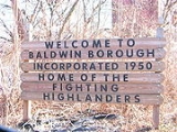
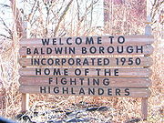
Baldwin Borough was incorporated on October 27, 1950, from Baldwin TownshipBaldwin Township, Pennsylvania
Baldwin Township is a township in Allegheny County, Pennsylvania, United States. The population was 1,992 at the 2010 census.-Geography:According to the United States Census Bureau, the township has a total area of , all of it land...
.
Demographics
As of the censusCensus
A census is the procedure of systematically acquiring and recording information about the members of a given population. It is a regularly occurring and official count of a particular population. The term is used mostly in connection with national population and housing censuses; other common...
of 2000, there were 19,999 people, 8,193 households, and 5,776 families residing in the borough. The population density
Population density
Population density is a measurement of population per unit area or unit volume. It is frequently applied to living organisms, and particularly to humans...
was 3,465.5 people per square mile (1,338.2/km²). There were 8,883 housing units at an average density of 1,539.3 per square mile (594.4/km²). The racial makeup of the borough was 96.20% White, 2.42% African American, 0.05% Native American, 0.56% Asian, 0.01% Pacific Islander, 0.17% from other races
Race (United States Census)
Race and ethnicity in the United States Census, as defined by the Federal Office of Management and Budget and the United States Census Bureau, are self-identification data items in which residents choose the race or races with which they most closely identify, and indicate whether or not they are...
, and 0.61% from two or more races. Hispanic or Latino of any race were 0.65% of the population.
There were 8,193 households out of which 27.3% had children under the age of 18 living with them, 56.7% were married couples
Marriage
Marriage is a social union or legal contract between people that creates kinship. It is an institution in which interpersonal relationships, usually intimate and sexual, are acknowledged in a variety of ways, depending on the culture or subculture in which it is found...
living together, 10.5% had a female householder with no husband present, and 29.5% were non-families. 26.4% of all households were made up of individuals and 13.7% had someone living alone who was 65 years of age or older. The average household size was 2.41 and the average family size was 2.92.
In the borough the population was spread out with 21.1% under the age of 18, 6.4% from 18 to 24, 26.7% from 25 to 44, 24.9% from 45 to 64, and 21.0% who were 65 years of age or older. The median age was 43 years. For every 100 females there were 90.1 males. For every 100 females age 18 and over, there were 86.5 males.
The median income for a household in the borough was $40,752, and the median income for a family was $48,503. Males had a median income of $39,086 versus $28,458 for females. The per capita income
Per capita income
Per capita income or income per person is a measure of mean income within an economic aggregate, such as a country or city. It is calculated by taking a measure of all sources of income in the aggregate and dividing it by the total population...
for the borough was $19,918. About 3.9% of families and 5.3% of the population were below the poverty line, including 7.4% of those under age 18 and 3.8% of those age 65 or over.