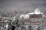
Arteaga, Coahuila
Encyclopedia
Arteaga is a city in the Mexican state of Coahuila
.
It serves as the administrative centre for the surrounding municipality of the same name
.
Arteaga is located at 25°25′58"N 101°50′24"W, at a height of 1660 metres (5,446.2 ft) above sea level. It stands some 14 kilometres (8.7 mi) east of state capital Saltillo
, on Federal Highways 57 and 54
.
The municipality covers a total surface area of 1818.6 square kilometres (702.2 sq mi) and, in 1995, reported a total population of 18,907. In addition to the municipal seat, it contains the settlements of San Antonio de las Alazanas, El Tunal
, San Juan de los Dolores, Huachichil, Los Lirios, Mesa de Tablas, Bella Unión, Escobedo, and Jamé.
The area was first inhabited by settlers from Tlaxcala
in 1580, who named it San Isidro de las Palomas.
On 29 December 1866 it was renamed in honour of General José María Arteaga Magallanes, a 19th-century national hero and governor of the state of Querétaro de Arteaga.
Coahuila
Coahuila, formally Coahuila de Zaragoza , officially Estado Libre y Soberano de Coahuila de Zaragoza is one of the 31 states which, with the Federal District, comprise the 32 Federal Entities of Mexico...
.
It serves as the administrative centre for the surrounding municipality of the same name
Arteaga (municipality of Coahuila)
Arteaga is a one of the 38 municipalities of Coahuila, in north-eastern Mexico. The municipal seat lies at Arteaga. The municipality covers an area of 1818.6 km².As of 2005, the municipality had a total population of 19,622....
.
Arteaga is located at 25°25′58"N 101°50′24"W, at a height of 1660 metres (5,446.2 ft) above sea level. It stands some 14 kilometres (8.7 mi) east of state capital Saltillo
Saltillo
Saltillo is the capital city of the northeastern Mexican state of Coahuila and the municipal seat of the municipality of the same name. The city is located about 400 km south of the U.S. state of Texas, and 90 km west of Monterrey, Nuevo León....
, on Federal Highways 57 and 54
Mexican Federal Highway
Mexican Federal Highways, are roads maintained and built by the federal government of Mexico, through the Secretariat of Communications and Transportation ....
.
The municipality covers a total surface area of 1818.6 square kilometres (702.2 sq mi) and, in 1995, reported a total population of 18,907. In addition to the municipal seat, it contains the settlements of San Antonio de las Alazanas, El Tunal
El Tunal
El Tunal is a village and rural municipality in Salta Province in northwestern Argentina.-References:...
, San Juan de los Dolores, Huachichil, Los Lirios, Mesa de Tablas, Bella Unión, Escobedo, and Jamé.
The area was first inhabited by settlers from Tlaxcala
Tlaxcala
Tlaxcala officially Estado Libre y Soberano de Tlaxcala is one of the 31 states which along with the Federal District comprise the 32 federative entities of Mexico. It is divided into 60 municipalities and its capital city is Tlaxcala....
in 1580, who named it San Isidro de las Palomas.
On 29 December 1866 it was renamed in honour of General José María Arteaga Magallanes, a 19th-century national hero and governor of the state of Querétaro de Arteaga.

