

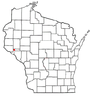
Arkansaw, Wisconsin
Encyclopedia
Unincorporated area
In law, an unincorporated area is a region of land that is not a part of any municipality.To "incorporate" in this context means to form a municipal corporation, a city, town, or village with its own government. An unincorporated community is usually not subject to or taxed by a municipal government...
census-designated place
Census-designated place
A census-designated place is a concentration of population identified by the United States Census Bureau for statistical purposes. CDPs are delineated for each decennial census as the statistical counterparts of incorporated places such as cities, towns and villages...
in the eastern portion of the town of Waterville
Waterville, Wisconsin
Waterville is a town in Pepin County, Wisconsin, United States. The population was 859 at the 2000 census. The unincorporated community of Arkansaw is located within the eastern portion of the town.-Geography:...
, in Pepin County, Wisconsin
Wisconsin
Wisconsin is a U.S. state located in the north-central United States and is part of the Midwest. It is bordered by Minnesota to the west, Iowa to the southwest, Illinois to the south, Lake Michigan to the east, Michigan to the northeast, and Lake Superior to the north. Wisconsin's capital is...
, United States
United States
The United States of America is a federal constitutional republic comprising fifty states and a federal district...
. Located approximately 3 miles west of Durand
Durand, Wisconsin
Durand is a city in Pepin County, Wisconsin, United States. The population was 1,968 at the 2000 census. The city is located within the Town of Durand and is also the county seat....
, it has the ZIP code
ZIP Code
ZIP codes are a system of postal codes used by the United States Postal Service since 1963. The term ZIP, an acronym for Zone Improvement Plan, is properly written in capital letters and was chosen to suggest that the mail travels more efficiently, and therefore more quickly, when senders use the...
of 54721. As of the 2010 census
United States Census, 2010
The Twenty-third United States Census, known as Census 2010 or the 2010 Census, is the current national census of the United States. National Census Day was April 1, 2010 and is the reference date used in enumerating individuals...
, its population was 177. From 1881 to 1886, the community was the county seat
County seat
A county seat is an administrative center, or seat of government, for a county or civil parish. The term is primarily used in the United States....
of Pepin County.
History
Arkansaw was founded in the early 1850s at a crossing of Arkansaw Creek, a tributary of the Eau Galle RiverEau Galle River
The Eau Galle River is a tributary of the Chippewa River in western Wisconsin in the United States. It is about 35 mi long . Via the Chippewa River, it is part of the Mississippi River watershed.-Course:The Eau Galle River rises in southeastern St...
. Initially built around lumbering, the first sawmill
Sawmill
A sawmill is a facility where logs are cut into boards.-Sawmill process:A sawmill's basic operation is much like those of hundreds of years ago; a log enters on one end and dimensional lumber exits on the other end....
was opened in the community in 1852.
The community was originally built near the center of 3 dams within a mile of each other on Arkansaw Creek. All three were wiped out in a flood in 1907. Arkansaw Creek was named in honor of the Arkansas River
Arkansas River
The Arkansas River is a major tributary of the Mississippi River. The Arkansas generally flows to the east and southeast as it traverses the U.S. states of Colorado, Kansas, Oklahoma, and Arkansas. The river's initial basin starts in the Western United States in Colorado, specifically the Arkansas...
. Today, the course of the creek runs through Arkansaw Creek Park.
Geography
The community lies at the junction of U.S. Route 10U.S. Route 10
U.S. Route 10 is an east–west United States highway formed in 1926. Though it never became the cross-country highway suggested by the "0" as the last digit of its route number, U.S...
and Pepin County Trunk Highways D, N, O, and X. It has an area of {[convert|0.720|mi2|km2}}; 0.712 mi2 of this is land, and 0.008 mi2 is water.
Religion
The community is home to three churches: Catholic, MethodistMethodism
Methodism is a movement of Protestant Christianity represented by a number of denominations and organizations, claiming a total of approximately seventy million adherents worldwide. The movement traces its roots to John Wesley's evangelistic revival movement within Anglicanism. His younger brother...
and Community of Christ
Community of Christ
The Community of Christ, known from 1872 to 2001 as the Reorganized Church of Jesus Christ of Latter Day Saints , is an American-based international Christian church established in April 1830 that claims as its mission "to proclaim Jesus Christ and promote communities of joy, hope, love, and peace"...
.
Notable people
- Lucius Roy HolbrookLucius Roy HolbrookLucius Roy Holbrook was a Major General who commanded of the United States Army's Philippine Department from 1936 to 1938....
- U.S. Army Major General - Willard Ames HolbrookWillard Ames HolbrookWillard Ames Holbrook was a Major General in the United States Army.-Career:Holbrook graduated from the United States Military Academy in 1885 and was assigned to the 1st Cavalry Regiment. Later he would be assigned to the 7th Cavalry Regiment. During the Spanish-American War, Holbrook would be...
- U.S. Army Major General