

Altair, São Paulo
Encyclopedia
| Map | ||
|---|---|---|
 |
||
| Statistics | ||
| State: | São Paulo São Paulo (state) São Paulo is a state in Brazil. It is the major industrial and economic powerhouse of the Brazilian economy. Named after Saint Paul, São Paulo has the largest population, industrial complex, and economic production in the country. It is the richest state in Brazil... |
|
| Metropolitan Regions: | São José do Rio Preto | |
| Founded: | 1959 | |
| Location Location (geography) The terms location and place in geography are used to identify a point or an area on the Earth's surface or elsewhere. The term 'location' generally implies a higher degree of can certainty than "place" which often has an ambiguous boundary relying more on human/social attributes of place identity... : |
20°31′S 49°04′W | |
| Area Area Area is a quantity that expresses the extent of a two-dimensional surface or shape in the plane. Area can be understood as the amount of material with a given thickness that would be necessary to fashion a model of the shape, or the amount of paint necessary to cover the surface with a single coat... : |
317.832 km² | |
| Population Population A population is all the organisms that both belong to the same group or species and live in the same geographical area. The area that is used to define a sexual population is such that inter-breeding is possible between any pair within the area and more probable than cross-breeding with individuals... : |
3,979 (2004) | |
| Population density Population density Population density is a measurement of population per unit area or unit volume. It is frequently applied to living organisms, and particularly to humans... : |
12.52/km² | |
| Postal code: | 15430-xxx | |
| Area/distance code: | (00)55-17 | |
| Website: | www.altair.sp.gov.br | |
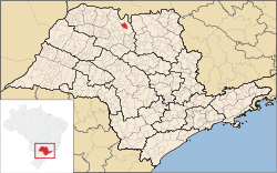
Altair is a city in the state of São Paulo
São Paulo (state)
São Paulo is a state in Brazil. It is the major industrial and economic powerhouse of the Brazilian economy. Named after Saint Paul, São Paulo has the largest population, industrial complex, and economic production in the country. It is the richest state in Brazil...
in Brazil
Brazil
Brazil , officially the Federative Republic of Brazil , is the largest country in South America. It is the world's fifth largest country, both by geographical area and by population with over 192 million people...
. The latitude is 20.37 South and to one 49.03 longitude
Longitude
Longitude is a geographic coordinate that specifies the east-west position of a point on the Earth's surface. It is an angular measurement, usually expressed in degrees, minutes and seconds, and denoted by the Greek letter lambda ....
West. The population in 2004 is 3,679. The area is 317.832 km². The neighboring municipalities are Icém
Icém
Icém is a municipality in the northern part of the state of São Paulo in Brazil. It is also known as Princesa do Vale, or "Princess of the Valley." Icem is situated near the important urban centers of .-Transportation:Icém is served by two important highways, the BR-153, and SP-322...
to the north and Olímpia
Olímpia
Olímpia is a municipality in the northern part of the state of São Paulo, Brazil. The population, measured in 2010 by the IBGE, is 50,024 inhabitants. The city has an area of ....
to the east.