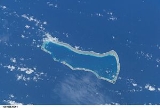
Ailinginae Atoll
Encyclopedia
Ailinginae Atoll is a coral atoll of 25 islands in the Pacific Ocean, on the northern end of the Ralik Chain
of the Marshall Islands
. Its total land area is only 2.8 square kilometres (1.1 sq mi), but it encloses a lagoon of 105.96 square kilometres (40.9 sq mi). It is located approximately 13 kilometres (8.1 mi) west of Rongelap Atoll
. The landscape is low-lying with only the top few meters above sea level. The two entrances into the lagoon are 'Mogiri Pass' and 'Eniibukku Pass'. These are 0.9 and 0.3 miles wide respectively.
The average temperature of these islands is about 27 °C during daytime and slightly warmer during night-time due to cold weather associated with rain showers. The rainy season here is from September through November. The island is covered with scrub, grasses and some stands of Casuarina
trees.
of the Empire of Japan
. Following the end of World War II, it came under the control of the United States as part of the Trust Territory of the Pacific Islands
until the independence of the Marshall Islands in 1986. Ailinginae Atoll has been uninhabited since 1954 when the few islanders were evacuated due to nuclear fallout fears from the Castle Bravo
at Bikini Atoll
to the northwest.
Ralik Chain
The Ralik Chain is a chain of islands within the island nation of the Marshall Islands. Ralik means "sunset". It lies just to the west of the country's other island chain, the Ratak Chain...
of the Marshall Islands
Marshall Islands
The Republic of the Marshall Islands , , is a Micronesian nation of atolls and islands in the middle of the Pacific Ocean, just west of the International Date Line and just north of the Equator. As of July 2011 the population was 67,182...
. Its total land area is only 2.8 square kilometres (1.1 sq mi), but it encloses a lagoon of 105.96 square kilometres (40.9 sq mi). It is located approximately 13 kilometres (8.1 mi) west of Rongelap Atoll
Rongelap Atoll
Rongelap Atoll or Namorik Atoll is a coral atoll of 61 islands in the Pacific Ocean, and forms a legislative district of the Ralik Chain of the Marshall Islands. Its total land area is only , but it encloses a lagoon with an area of...
. The landscape is low-lying with only the top few meters above sea level. The two entrances into the lagoon are 'Mogiri Pass' and 'Eniibukku Pass'. These are 0.9 and 0.3 miles wide respectively.
The average temperature of these islands is about 27 °C during daytime and slightly warmer during night-time due to cold weather associated with rain showers. The rainy season here is from September through November. The island is covered with scrub, grasses and some stands of Casuarina
Casuarina
Casuarina is a genus of 17 species in the family Casuarinaceae, native to Australasia, southeast Asia, and islands of the western Pacific Ocean. It was once treated as the sole genus in the family, but has been split into three genera .They are evergreen shrubs and trees growing to 35 m tall...
trees.
History
Ailinginae Atoll was claimed by the Empire of Germany along with the rest of the Marshall Islands in 1884. After World War I, the island came under the South Pacific MandateSouth Pacific Mandate
The was the Japanese League of Nations mandate consisting of several groups of islands in the Pacific Ocean which came under the administration of Japan after the defeat of the German Empire in World War I.-Early history:Under the terms of the Anglo-Japanese Alliance, after the start of World...
of the Empire of Japan
Empire of Japan
The Empire of Japan is the name of the state of Japan that existed from the Meiji Restoration on 3 January 1868 to the enactment of the post-World War II Constitution of...
. Following the end of World War II, it came under the control of the United States as part of the Trust Territory of the Pacific Islands
Trust Territory of the Pacific Islands
The Trust Territory of the Pacific Islands was a United Nations trust territory in Micronesia administered by the United States from 1947 to 1986.-History:...
until the independence of the Marshall Islands in 1986. Ailinginae Atoll has been uninhabited since 1954 when the few islanders were evacuated due to nuclear fallout fears from the Castle Bravo
Castle Bravo
Castle Bravo was the code name given to the first U.S. test of a dry fuel thermonuclear hydrogen bomb device, detonated on March 1, 1954 at Bikini Atoll, Marshall Islands, as the first test of Operation Castle. Castle Bravo was the most powerful nuclear device ever detonated by the United States ,...
at Bikini Atoll
Bikini Atoll
Bikini Atoll is an atoll, listed as a World Heritage Site, in the Micronesian Islands of the Pacific Ocean, part of Republic of the Marshall Islands....
to the northwest.
See also
- Also contaminated by Castle Bravo test: Rongelap AtollRongelap AtollRongelap Atoll or Namorik Atoll is a coral atoll of 61 islands in the Pacific Ocean, and forms a legislative district of the Ralik Chain of the Marshall Islands. Its total land area is only , but it encloses a lagoon with an area of...
, Utirik AtollUtirik AtollUtirik Atoll or Utrik Atoll is a coral atoll of 10 islands in the Pacific Ocean, and forms a legislative district of the Ratak Chain of the Marshall Islands. Its total land area is only , but it encloses a lagoon with an area of...
, Rongerik AtollRongerik AtollRongerik Atoll or Rongdrik Atoll is a coral atoll of 17 islands in the Pacific Ocean, and is located in the Ralik Chain of the Marshall Islands, approximately east of Bikini Atoll. Its total land area is only , but it encloses a lagoon of .-History:Rongerik Atoll was claimed by the Empire of...

