
Adel, Georgia
Encyclopedia
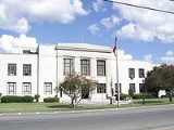
Adel is a city in Cook County
, Georgia
, United States
. As of the 2010 census, the city had a population of 5,344. The city is the county seat
of Cook County
. The original name of the city was Puddleville. The city's first postmaster, Joel "Uncle Jack" Parrish, wanted to change the name of the city. It is believed that he saw the name "Philadelphia" on a crocus sack, struck out the first and last four letters to create the present name of Adel.
According to the United States Census Bureau
, the city has a total area of 8 square miles (20.7 km²), of which, 7.9 square miles (20.5 km²) of it is land and 0.1 square mile (0.258998811 km²) of it (1.25%) is water.
of 2000, there were 5,307 people, 1,958 households, and 1,335 families residing in the city. The population density
was 674.1 people per square mile (260.4/km²). There were 2,164 housing units at an average density of 274.9 per square mile (106.2/km²). The racial makeup of the city was 47.97% White, 48.92% African American, 0.08% Native American, 0.75% Asian, 0.09% Pacific Islander, 1.43% from other races
, and 0.75% from two or more races. Hispanic or Latino of any race were 3.79% of the population.
There were 1,958 households out of which 33.9% had children under the age of 18 living with them, 43.0% were married couples
living together, 20.8% had a female householder with no husband present, and 31.8% were non-families. 27.9% of all households were made up of individuals and 12.3% had someone living alone who was 65 years of age or older. The average household size was 2.60 and the average family size was 3.17.
In the city the population was spread out with 29.4% under the age of 18, 9.4% from 18 to 24, 26.1% from 25 to 44, 20.0% from 45 to 64, and 15.2% who were 65 years of age or older. The median age was 34 years. For every 100 females there were 86.3 males. For every 100 females age 18 and over, there were 83.5 males.
The median income for a household in the city was $23,908, and the median income for a family was $27,318. Males had a median income of $25,927 versus $19,688 for females. The per capita income
for the city was $13,425. About 23.5% of families and 27.4% of the population were below the poverty line, including 36.6% of those under age 18 and 29.2% of those age 65 or over.
holds grades pre-school to grade twelve, that consists of a preschool, elementary schools, middle school, and a high school. The district has 188 full-time teachers and over 3,215 students.
Cook County, Georgia
Cook County is a county located in the U.S. state of Georgia. The constitutional amendment to create the county was proposed July 30, 1918, and ratified November 5, 1918. As of 2010, the population is 17,212. The county seat is Adel...
, Georgia
Georgia (U.S. state)
Georgia is a state located in the southeastern United States. It was established in 1732, the last of the original Thirteen Colonies. The state is named after King George II of Great Britain. Georgia was the fourth state to ratify the United States Constitution, on January 2, 1788...
, United States
United States
The United States of America is a federal constitutional republic comprising fifty states and a federal district...
. As of the 2010 census, the city had a population of 5,344. The city is the county seat
County seat
A county seat is an administrative center, or seat of government, for a county or civil parish. The term is primarily used in the United States....
of Cook County
Cook County, Georgia
Cook County is a county located in the U.S. state of Georgia. The constitutional amendment to create the county was proposed July 30, 1918, and ratified November 5, 1918. As of 2010, the population is 17,212. The county seat is Adel...
. The original name of the city was Puddleville. The city's first postmaster, Joel "Uncle Jack" Parrish, wanted to change the name of the city. It is believed that he saw the name "Philadelphia" on a crocus sack, struck out the first and last four letters to create the present name of Adel.
Geography
Adel is located at 31°8′18"N 83°25′33"W (31.138466, -83.425944).According to the United States Census Bureau
United States Census Bureau
The United States Census Bureau is the government agency that is responsible for the United States Census. It also gathers other national demographic and economic data...
, the city has a total area of 8 square miles (20.7 km²), of which, 7.9 square miles (20.5 km²) of it is land and 0.1 square mile (0.258998811 km²) of it (1.25%) is water.
Demographics
As of the censusCensus
A census is the procedure of systematically acquiring and recording information about the members of a given population. It is a regularly occurring and official count of a particular population. The term is used mostly in connection with national population and housing censuses; other common...
of 2000, there were 5,307 people, 1,958 households, and 1,335 families residing in the city. The population density
Population density
Population density is a measurement of population per unit area or unit volume. It is frequently applied to living organisms, and particularly to humans...
was 674.1 people per square mile (260.4/km²). There were 2,164 housing units at an average density of 274.9 per square mile (106.2/km²). The racial makeup of the city was 47.97% White, 48.92% African American, 0.08% Native American, 0.75% Asian, 0.09% Pacific Islander, 1.43% from other races
Race (United States Census)
Race and ethnicity in the United States Census, as defined by the Federal Office of Management and Budget and the United States Census Bureau, are self-identification data items in which residents choose the race or races with which they most closely identify, and indicate whether or not they are...
, and 0.75% from two or more races. Hispanic or Latino of any race were 3.79% of the population.
There were 1,958 households out of which 33.9% had children under the age of 18 living with them, 43.0% were married couples
Marriage
Marriage is a social union or legal contract between people that creates kinship. It is an institution in which interpersonal relationships, usually intimate and sexual, are acknowledged in a variety of ways, depending on the culture or subculture in which it is found...
living together, 20.8% had a female householder with no husband present, and 31.8% were non-families. 27.9% of all households were made up of individuals and 12.3% had someone living alone who was 65 years of age or older. The average household size was 2.60 and the average family size was 3.17.
In the city the population was spread out with 29.4% under the age of 18, 9.4% from 18 to 24, 26.1% from 25 to 44, 20.0% from 45 to 64, and 15.2% who were 65 years of age or older. The median age was 34 years. For every 100 females there were 86.3 males. For every 100 females age 18 and over, there were 83.5 males.
The median income for a household in the city was $23,908, and the median income for a family was $27,318. Males had a median income of $25,927 versus $19,688 for females. The per capita income
Per capita income
Per capita income or income per person is a measure of mean income within an economic aggregate, such as a country or city. It is calculated by taking a measure of all sources of income in the aggregate and dividing it by the total population...
for the city was $13,425. About 23.5% of families and 27.4% of the population were below the poverty line, including 36.6% of those under age 18 and 29.2% of those age 65 or over.
Cook County School District
The Cook County School DistrictCook County School District
The Cook County School District is a public school district in Cook County, Georgia, USA, based in Adel, Georgia. It serves the communities of Adel, Cecil, Lenox, and Sparks, Georgia.-Schools:...
holds grades pre-school to grade twelve, that consists of a preschool, elementary schools, middle school, and a high school. The district has 188 full-time teachers and over 3,215 students.
- Cook Elementary School
- Cook County Preschool
- Cook County Middle School
- Cook County High School