
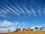
Adair, Oklahoma
Encyclopedia
Adair is a town in Mayes County
, Oklahoma
, United States
. The population was 790 at the 2010 census
, compared to 704 at the 2000 census
. Named for two prominent Cherokee
brothers, the town was established in 1883 and opened a Cherokee
school.
brothers, William Penn Adair
and Dr. Walter Thompson Adair. It was established on March 15, 1883, and incorporated in 1897. William Penn Adair lived in the area off and on for 17 years beginning in the late 1860s.
In the 1880s, a Cherokee school was started, and opened up to white students around the time of Oklahoma statehood.
As the train approached, four men approached the night operator at the station and ordered him to "flag down" the train. As the train pulled to a stand-still two members of the gang bordered the engine while the others covered the conductor and train men. The station operator was taken to the express car, were he ordered the messenger inside to open up. When the messenger refused, the train's fireman was ordered to break open the door with his pick. Once inside the bandits were quick in rifling the safe of its contents.
Unknown to the gang was the special detachment of eight railroad guards that was on the train. In command was J. J. Kinney, chief of railroad detectives and Capt. J. H. LaFlore, chief of the Cherokee Indian police. Upon seeing that the robbery was happening the guards unloaded from the train on the east side of the train - the opposite side of the depot. Several of the bandits had been positioned on that side and a brief gun battle took place.
With their work in the train finished and the gun battle insignia, the bandits proceeded to make their get-away. With bullets whistling about, the bandits made their way down through town. Doctors W. L. Goff and Youngblood had been sitting on the porch of the drug store near the depot. Both men were hit by stray shots several times. Dr Goff's wound proved to be fatal.
Also wounded were Capt. Kinney and Capt. LaFlore. Their wounds were not serious and both men recovered.
The railroad and express company promptly offered rewards "for the capture and conviction" of $5,000 for each participant in the robbery.
. The city lies in the northeastern portion of the state known as "Green Country" and is not far from the borders of Kansas
, Missouri
, and Arkansas
. Adair's geographic coordinates
are 36°26′13"N 95°15′45"W (36.436910, -95.262546) with an elevation of 640 ft (195.1 m) above sea level
. According to the United States Census Bureau
, the town has a total area of 4.5 square miles (11.7 km²), all of it land.
As of the census
of 2000, there were 704 people, 272 households, and 199 families residing in the town. The population density
was 155.8 people per square mile (60.1/km²). There were 314 housing units at an average density of 69.5 per square mile (26.8/km²). The racial makeup of the town was 69.46% White, 0.14% African American, 23.86% Native American, 0.71% from other races
, and 5.82% from two or more races. Hispanic or Latino of any race were 1.28% of the population.
There were 272 households out of which 36.8% had children under the age of 18 living with them, 57.7% were married couples
living together, 12.1% had a female householder with no husband present, and 26.8% were non-families. 23.2% of all households were made up of individuals and 8.5% had someone living alone who was 65 years of age or older. The average household size was 2.59 and the average family size was 3.06.
In the town the population was spread out with 27.6% under the age of 18, 10.8% from 18 to 24, 26.1% from 25 to 44, 23.4% from 45 to 64, and 12.1% who were 65 years of age or older. The median age was 34 years. For every 100 females there were 90.3 males. For every 100 females age 18 and over, there were 91.7 males.
The median income for a household in the town was $35,250, and the median income for a family was $38,500. Males had a median income of $31,313 versus $17,500 for females. The per capita income
for the town was $14,388. About 10.5% of families and 12.3% of the population were below the poverty line, including 22.2% of those under age 18 and 2.8% of those age 65 or over.
Mayes County, Oklahoma
Mayes County is a county located in the U.S. state of Oklahoma. It was named for Samuel Houston Mayes, Principal Chief of the Cherokee Nation from 1895 to 1899. According to the 2010 census the population was 41,259, a 7.5 percent increase from 2000, when the population was 38,369...
, Oklahoma
Oklahoma
Oklahoma is a state located in the South Central region of the United States of America. With an estimated 3,751,351 residents as of the 2010 census and a land area of 68,667 square miles , Oklahoma is the 28th most populous and 20th-largest state...
, United States
United States
The United States of America is a federal constitutional republic comprising fifty states and a federal district...
. The population was 790 at the 2010 census
United States Census, 2010
The Twenty-third United States Census, known as Census 2010 or the 2010 Census, is the current national census of the United States. National Census Day was April 1, 2010 and is the reference date used in enumerating individuals...
, compared to 704 at the 2000 census
United States Census, 2000
The Twenty-second United States Census, known as Census 2000 and conducted by the Census Bureau, determined the resident population of the United States on April 1, 2000, to be 281,421,906, an increase of 13.2% over the 248,709,873 persons enumerated during the 1990 Census...
. Named for two prominent Cherokee
Cherokee
The Cherokee are a Native American people historically settled in the Southeastern United States . Linguistically, they are part of the Iroquoian language family...
brothers, the town was established in 1883 and opened a Cherokee
Cherokee
The Cherokee are a Native American people historically settled in the Southeastern United States . Linguistically, they are part of the Iroquoian language family...
school.
History
Adair is named after two CherokeeCherokee
The Cherokee are a Native American people historically settled in the Southeastern United States . Linguistically, they are part of the Iroquoian language family...
brothers, William Penn Adair
William Penn Adair
William Penn Adair was a Cherokee leader and Confederate colonel.-Background:William Penn Adair was born on April 15, 1830 in the old Cherokee Nation in New Echota, Georgia. His parents were George Washington Adair and Martha Adair. He attended Cherokee schools in Indian Territory, studying law....
and Dr. Walter Thompson Adair. It was established on March 15, 1883, and incorporated in 1897. William Penn Adair lived in the area off and on for 17 years beginning in the late 1860s.
In the 1880s, a Cherokee school was started, and opened up to white students around the time of Oklahoma statehood.
Dalton Gang Train Robbery
In what was their most daring deed to date, on Thursday July 14, 1892, eight members of the Dalton Gang held up the Missouri, Kansas, & Texas train at Adair, I.T.As the train approached, four men approached the night operator at the station and ordered him to "flag down" the train. As the train pulled to a stand-still two members of the gang bordered the engine while the others covered the conductor and train men. The station operator was taken to the express car, were he ordered the messenger inside to open up. When the messenger refused, the train's fireman was ordered to break open the door with his pick. Once inside the bandits were quick in rifling the safe of its contents.
Unknown to the gang was the special detachment of eight railroad guards that was on the train. In command was J. J. Kinney, chief of railroad detectives and Capt. J. H. LaFlore, chief of the Cherokee Indian police. Upon seeing that the robbery was happening the guards unloaded from the train on the east side of the train - the opposite side of the depot. Several of the bandits had been positioned on that side and a brief gun battle took place.
With their work in the train finished and the gun battle insignia, the bandits proceeded to make their get-away. With bullets whistling about, the bandits made their way down through town. Doctors W. L. Goff and Youngblood had been sitting on the porch of the drug store near the depot. Both men were hit by stray shots several times. Dr Goff's wound proved to be fatal.
Also wounded were Capt. Kinney and Capt. LaFlore. Their wounds were not serious and both men recovered.
The railroad and express company promptly offered rewards "for the capture and conviction" of $5,000 for each participant in the robbery.
Geography
Adair lies 10 miles (16.1 km) north of Pryor, Oklahoma on U.S. Highway 69 in Mayes County, OklahomaMayes County, Oklahoma
Mayes County is a county located in the U.S. state of Oklahoma. It was named for Samuel Houston Mayes, Principal Chief of the Cherokee Nation from 1895 to 1899. According to the 2010 census the population was 41,259, a 7.5 percent increase from 2000, when the population was 38,369...
. The city lies in the northeastern portion of the state known as "Green Country" and is not far from the borders of Kansas
Kansas
Kansas is a US state located in the Midwestern United States. It is named after the Kansas River which flows through it, which in turn was named after the Kansa Native American tribe, which inhabited the area. The tribe's name is often said to mean "people of the wind" or "people of the south...
, Missouri
Missouri
Missouri is a US state located in the Midwestern United States, bordered by Iowa, Illinois, Kentucky, Tennessee, Arkansas, Oklahoma, Kansas and Nebraska. With a 2010 population of 5,988,927, Missouri is the 18th most populous state in the nation and the fifth most populous in the Midwest. It...
, and Arkansas
Arkansas
Arkansas is a state located in the southern region of the United States. Its name is an Algonquian name of the Quapaw Indians. Arkansas shares borders with six states , and its eastern border is largely defined by the Mississippi River...
. Adair's geographic coordinates
Geographic coordinate system
A geographic coordinate system is a coordinate system that enables every location on the Earth to be specified by a set of numbers. The coordinates are often chosen such that one of the numbers represent vertical position, and two or three of the numbers represent horizontal position...
are 36°26′13"N 95°15′45"W (36.436910, -95.262546) with an elevation of 640 ft (195.1 m) above sea level
Sea level
Mean sea level is a measure of the average height of the ocean's surface ; used as a standard in reckoning land elevation...
. According to the United States Census Bureau
United States Census Bureau
The United States Census Bureau is the government agency that is responsible for the United States Census. It also gathers other national demographic and economic data...
, the town has a total area of 4.5 square miles (11.7 km²), all of it land.
Climate
Adair sees more sunny days than the average U.S. city and a great deal less snowfall. Late spring is the wettest time of the year for the city, while winter is the driest.Demographics
As of 2010 Adair had a population of 790. The racial and ethnic composition of the population was 72.4% white, 0.1% black or African American, 18.9% Native American, 0.6% reporting some other race and 8.0% reporting two or more races. 3.5% of the population was Hispanic or Latino.As of the census
Census
A census is the procedure of systematically acquiring and recording information about the members of a given population. It is a regularly occurring and official count of a particular population. The term is used mostly in connection with national population and housing censuses; other common...
of 2000, there were 704 people, 272 households, and 199 families residing in the town. The population density
Population density
Population density is a measurement of population per unit area or unit volume. It is frequently applied to living organisms, and particularly to humans...
was 155.8 people per square mile (60.1/km²). There were 314 housing units at an average density of 69.5 per square mile (26.8/km²). The racial makeup of the town was 69.46% White, 0.14% African American, 23.86% Native American, 0.71% from other races
Race (United States Census)
Race and ethnicity in the United States Census, as defined by the Federal Office of Management and Budget and the United States Census Bureau, are self-identification data items in which residents choose the race or races with which they most closely identify, and indicate whether or not they are...
, and 5.82% from two or more races. Hispanic or Latino of any race were 1.28% of the population.
There were 272 households out of which 36.8% had children under the age of 18 living with them, 57.7% were married couples
Marriage
Marriage is a social union or legal contract between people that creates kinship. It is an institution in which interpersonal relationships, usually intimate and sexual, are acknowledged in a variety of ways, depending on the culture or subculture in which it is found...
living together, 12.1% had a female householder with no husband present, and 26.8% were non-families. 23.2% of all households were made up of individuals and 8.5% had someone living alone who was 65 years of age or older. The average household size was 2.59 and the average family size was 3.06.
In the town the population was spread out with 27.6% under the age of 18, 10.8% from 18 to 24, 26.1% from 25 to 44, 23.4% from 45 to 64, and 12.1% who were 65 years of age or older. The median age was 34 years. For every 100 females there were 90.3 males. For every 100 females age 18 and over, there were 91.7 males.
The median income for a household in the town was $35,250, and the median income for a family was $38,500. Males had a median income of $31,313 versus $17,500 for females. The per capita income
Per capita income
Per capita income or income per person is a measure of mean income within an economic aggregate, such as a country or city. It is calculated by taking a measure of all sources of income in the aggregate and dividing it by the total population...
for the town was $14,388. About 10.5% of families and 12.3% of the population were below the poverty line, including 22.2% of those under age 18 and 2.8% of those age 65 or over.