
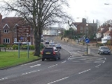
A602 road
Encyclopedia
The A602 is a road linking Hitchin
in Hertfordshire
, England
, with A10 at Ware in Hertfordshire
, via Stevenage
.
The course of the road has changed significantly since the 1960s with the construction of several bypasses and relief roads.
In Hitchin, the road starts at a junction with the A505
, and follows a relief road round the south of the town centre, before re-joining the course of the original route for 0.9 miles (1.4 km).
The village of Little Wymondley
is bypassed by a dual carriageway route to the A1 junction at Corey's Mill.
In Stevenage
, the road takes two courses through the town - the first is a concurrency with the A1 round the new town to the junction at Langley Sidings. The second is a route through the town itself, following closely the route of the old Great North Road. The two routes converge and form a northern bypass for the suburb of Broadwater (the old Hertford Road through Broadwater has been closed to motor vehicles since the 1990s, to prevent rat-running).
The next 3 km of road is the only remaining original piece of the route, travelling through the villages of Bragbury End
and Hooks Cross. The next feature is a roundabout, and the road once again diverges from its original course and takes a left to bypass the village of Watton-at-Stone
. At the eastern end of the Watton-at-Stone bypass (constructed in the late 1980s) it reaches another roundabout.
In the 1970s, the road continued from this point straight ahead down what is now the A119
to Hertford
, and then travelled along the course of what is now the B1197 through Hertford Heath
to Hoddesdon
. With the opening of the A10 Hoddesdon and Ware bypass in the late 1970s, the A602 temporarily terminated at the A414
in Hertford. In 1987, with the opening of the Tonwell
bypass, the road was completely re-routed along the course of the B1001 from Watton-at-Stone to meet the modern A10 at Ware. The B1001 itself remains for a short distance, linking the modern A10 with the old road in the town centre (now known as the A1170).
Hitchin
Hitchin is a town in Hertfordshire, England, with an estimated population of 30,360.-History:Hitchin is first noted as the central place of the Hicce people mentioned in a 7th century document, the Tribal Hidage. The tribal name is Brittonic rather than Old English and derives from *siccā, meaning...
in Hertfordshire
Hertfordshire
Hertfordshire is a ceremonial and non-metropolitan county in the East region of England. The county town is Hertford.The county is one of the Home Counties and lies inland, bordered by Greater London , Buckinghamshire , Bedfordshire , Cambridgeshire and...
, England
England
England is a country that is part of the United Kingdom. It shares land borders with Scotland to the north and Wales to the west; the Irish Sea is to the north west, the Celtic Sea to the south west, with the North Sea to the east and the English Channel to the south separating it from continental...
, with A10 at Ware in Hertfordshire
Hertfordshire
Hertfordshire is a ceremonial and non-metropolitan county in the East region of England. The county town is Hertford.The county is one of the Home Counties and lies inland, bordered by Greater London , Buckinghamshire , Bedfordshire , Cambridgeshire and...
, via Stevenage
Stevenage
Stevenage is a town and borough in Hertfordshire, England. It is situated to the east of junctions 7 and 8 of the A1, and is between Letchworth Garden City to the north, and Welwyn Garden City to the south....
.
The course of the road has changed significantly since the 1960s with the construction of several bypasses and relief roads.
In Hitchin, the road starts at a junction with the A505
A505 road
The A505 is an A-class road in the United Kingdom. It follows part of the route of the Icknield Way and the corresponding Icknield Way Path.-Bedfordshire:...
, and follows a relief road round the south of the town centre, before re-joining the course of the original route for 0.9 miles (1.4 km).
The village of Little Wymondley
Little Wymondley
Little Wymondley is a village situated between Hitchin and Stevenage in Hertfordshire. Paradoxically, it is larger than its near neighbour Great Wymondley...
is bypassed by a dual carriageway route to the A1 junction at Corey's Mill.
In Stevenage
Stevenage
Stevenage is a town and borough in Hertfordshire, England. It is situated to the east of junctions 7 and 8 of the A1, and is between Letchworth Garden City to the north, and Welwyn Garden City to the south....
, the road takes two courses through the town - the first is a concurrency with the A1 round the new town to the junction at Langley Sidings. The second is a route through the town itself, following closely the route of the old Great North Road. The two routes converge and form a northern bypass for the suburb of Broadwater (the old Hertford Road through Broadwater has been closed to motor vehicles since the 1990s, to prevent rat-running).
The next 3 km of road is the only remaining original piece of the route, travelling through the villages of Bragbury End
Bragbury End
Bragbury End is a village in Hertfordshire, England....
and Hooks Cross. The next feature is a roundabout, and the road once again diverges from its original course and takes a left to bypass the village of Watton-at-Stone
Watton-at-Stone
Watton-at-Stone is a village in the English county of Hertfordshire, situated midway between the towns of Stevenage and Hertford in the valley of the River Beane. The 2001 census showed a population of 2,272, living in 921 households...
. At the eastern end of the Watton-at-Stone bypass (constructed in the late 1980s) it reaches another roundabout.
In the 1970s, the road continued from this point straight ahead down what is now the A119
A119 road (England)
The A119 road is a road connecting Ware and Watton-at-Stone....
to Hertford
Hertford
Hertford is the county town of Hertfordshire, England, and is also a civil parish in the East Hertfordshire district of the county. Forming a civil parish, the 2001 census put the population of Hertford at about 24,180. Recent estimates are that it is now around 28,000...
, and then travelled along the course of what is now the B1197 through Hertford Heath
Hertford Heath
Hertford Heath is a small village and civil parish near the county town of Hertford in Hertfordshire, England.-Geography:It is located on a heath above the River Lea valley, on its south side...
to Hoddesdon
Hoddesdon
Hoddesdon is a town in the English county of Hertfordshire, situated in the Lea Valley. The town grew up as a coaching stop on the route between Cambridge and London. It is located southeast of Hertford, north of Waltham Cross and southwest of Bishop's Stortford. At its height during the 18th...
. With the opening of the A10 Hoddesdon and Ware bypass in the late 1970s, the A602 temporarily terminated at the A414
A414 road
The A414 is a major road in England. It runs from the A41 at a junction west of Hemel Hempstead in Hertfordshire, through the town to junction 8 of the M1 motorway at Buncefield, and running parallel to the M1 until junction 7, heading south of St Albans, east through Hatfield, Hertford, then...
in Hertford. In 1987, with the opening of the Tonwell
Tonwell
Tonwell is a small village in Bengeo Rural parish, Hertfordshire.The village is situated just off the A602 , having been bypassed in 1987 - making the A10 and therefore London and Cambridge easily accessible by road....
bypass, the road was completely re-routed along the course of the B1001 from Watton-at-Stone to meet the modern A10 at Ware. The B1001 itself remains for a short distance, linking the modern A10 with the old road in the town centre (now known as the A1170).