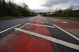
A432 road
Encyclopedia

Bristol
Bristol is a city, unitary authority area and ceremonial county in South West England, with an estimated population of 433,100 for the unitary authority in 2009, and a surrounding Larger Urban Zone with an estimated 1,070,000 residents in 2007...
to Old Sodbury
Old Sodbury
Old Sodbury is a small village in the valley of the River Frome just below and to the west of the Cotswold escarpment and to the east of Chipping Sodbury and Yate in South Gloucestershire, England. The village extends from Chipping Sodbury in the West to the Cotswold Edge in the East and is on the...
. It starts near Lawrence Hill
Lawrence Hill, Bristol
Lawrence Hill is an electoral ward of Bristol, United Kingdom. It takes its name from a small area just to the east of the city centre, and includes the districts of Barton Hill, St Philips Marsh and Redcliffe, Temple Meads and parts of Easton and the Broadmead shopping area.-History:It is the most...
in Bristol (51.459°N 2.576°W) and passes through Eastville
Eastville, Bristol
Eastville is the name of both a council ward in the city of Bristol in the United Kingdom and a suburb of the city that lies within that ward. The Eastville ward covers the areas of Eastville, Crofts End , Stapleton and part of Fishponds...
, Fishponds, Downend
Downend, South Gloucestershire
Downend is a suburb of Bristol in South Gloucestershire, England. It is located to the North East of Bristol and bordered by the Bristol City suburb of Fishponds to its south west and the South Gloucestershire suburbs of Staple Hill to the south, Frenchay to the west and Mangotsfield to the East...
, Coalpit Heath
Coalpit Heath
Coalpit Heath is a small village in the parish of Westerleigh, South Gloucestershire, England, south of Yate and east of Frampton Cotterell in South Gloucestershire.-Background:...
, Yate
Yate
Yate is a town in South Gloucestershire, England, at the southwest extremity of the Cotswold Hills, 12 miles northeast of the city of Bristol. At the 2001 census the population was 21,789. The town of Chipping Sodbury is continuous with Yate to the east...
and Chipping Sodbury
Chipping Sodbury
Chipping Sodbury is a market town in the county of South Gloucestershire, south-west England, founded in the 12th century by William Crassus . The villages of Old Sodbury and Little Sodbury are nearby...
before terminating at a junction with the A46
A46 road
The A46 is an A road in England. It starts east of Bath, Somerset and ends in Cleethorpes, North East Lincolnshire, but it does not form a continuous route. Large portions of the old road have been lost, bypassed, or replaced by motorway development...
just to the east of Old Sodbury (51.528°N 2.343°W). It is dual carriageway
Dual carriageway
A dual carriageway is a class of highway with two carriageways for traffic travelling in opposite directions separated by a central reservation...
for 0.5 mile (0.80467 km) when bypassing the busy Chipping Sodbury high street.
See also
- British road numbering scheme

