

A4032 road
Encyclopedia

Bristol
Bristol is a city, unitary authority area and ceremonial county in South West England, with an estimated population of 433,100 for the unitary authority in 2009, and a surrounding Larger Urban Zone with an estimated 1,070,000 residents in 2007...
that starts at the end of the M32
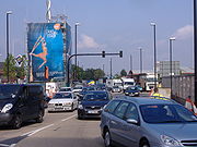
M32 motorway
The M32 is a motorway in South Gloucestershire and Bristol, England. It provides a link from Bristol city centre to the M4 and is part of the Bristol Parkway. At about , it is one of Britain's shortest motorways...
, as a trunk road and terminates in a junction with the A4044 at the edge of Bristol city centre
Bristol city centre
Bristol city centre is the commercial, cultural and business centre of Bristol, England. It is the area south of the central ring road and north of the Floating Harbour, bounded north by St Pauls and Easton, east by Temple Meads and Redcliffe, and west by Clifton and Canon's Marsh...
.
See also
- British road numbering scheme