
A340 road
Encyclopedia
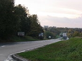
The A340 is a major road in the south of England
, portions of which are known as the Aldermaston Road, Tadley Hill, Basingstoke Road and Tidmarsh Road.
, Hampshire
, it runs west, forming the western side of the Basingstoke ringroad, before swinging north to Tadley
and then enters Berkshire
. It passes the gates of the Atomic Weapons Establishment
at Aldermaston
, before passing through the village of Aldermaston itself and then joining the A4 at Aldermaston Wharf
. After approximately 2.5 miles (4 km) north-east, the A340 runs further north to Pangbourne
, to the west of Reading
. This section of the road is thought to follow the Roman road from Calleva Atrebatum (about 7 miles (11.3 km) to the south).
England
England is a country that is part of the United Kingdom. It shares land borders with Scotland to the north and Wales to the west; the Irish Sea is to the north west, the Celtic Sea to the south west, with the North Sea to the east and the English Channel to the south separating it from continental...
, portions of which are known as the Aldermaston Road, Tadley Hill, Basingstoke Road and Tidmarsh Road.
Route
Starting in the south of BasingstokeBasingstoke
Basingstoke is a town in northeast Hampshire, in south central England. It lies across a valley at the source of the River Loddon. It is southwest of London, northeast of Southampton, southwest of Reading and northeast of the county town, Winchester. In 2008 it had an estimated population of...
, Hampshire
Hampshire
Hampshire is a county on the southern coast of England in the United Kingdom. The county town of Hampshire is Winchester, a historic cathedral city that was once the capital of England. Hampshire is notable for housing the original birthplaces of the Royal Navy, British Army, and Royal Air Force...
, it runs west, forming the western side of the Basingstoke ringroad, before swinging north to Tadley
Tadley
Tadley is a town and civil parish in the English county of Hampshire.During the 1950s and 1960s, the Atomic Weapons Research Establishment , now known as AWE, became the area's largest employer, and a large number of houses were built during this period to accommodate AWRE workers...
and then enters Berkshire
Berkshire
Berkshire is a historic county in the South of England. It is also often referred to as the Royal County of Berkshire because of the presence of the royal residence of Windsor Castle in the county; this usage, which dates to the 19th century at least, was recognised by the Queen in 1957, and...
. It passes the gates of the Atomic Weapons Establishment
Atomic Weapons Establishment
The Atomic Weapons Establishment is responsible for the design, manufacture and support of warheads for the United Kingdom's nuclear deterrent. AWE plc is responsible for the day-to-day operations of AWE...
at Aldermaston
Aldermaston
Aldermaston is a rural village, civil parish and electoral ward in Berkshire, South-East England. In the 2001 United Kingdom Census, the parish had a population of 927. The village is on the southern edge of the River Kennet flood plain, near the Hampshire county boundary...
, before passing through the village of Aldermaston itself and then joining the A4 at Aldermaston Wharf
Aldermaston Wharf
Aldermaston Wharf is a small settlement situated north-northwest of Aldermaston in the West Berkshire district, part of the English county of Berkshire. The Kennet and Avon Canal and Great Western Railway pass through it and Aldermaston railway station and Aldermaston Lock are located here. The A4...
. After approximately 2.5 miles (4 km) north-east, the A340 runs further north to Pangbourne
Pangbourne
Pangbourne is a large village and civil parish on the River Thames in the English county of Berkshire. Pangbourne is the home of the independent school, Pangbourne College.-Location:...
, to the west of Reading
Reading, Berkshire
Reading is a large town and unitary authority area in England. It is located in the Thames Valley at the confluence of the River Thames and River Kennet, and on both the Great Western Main Line railway and the M4 motorway, some west of London....
. This section of the road is thought to follow the Roman road from Calleva Atrebatum (about 7 miles (11.3 km) to the south).
See also
Great Britain road numbering schemeGreat Britain road numbering scheme
The Great Britain road numbering scheme is a numbering scheme used to classify and identify all roads in Great Britain. Each road is given a single letter, which represents the road's category, and a subsequent number, with a length of between 1 and 4 digits. Originally introduced to arrange...