

U.S. Route 73
Encyclopedia
U.S. Route 73 is a north–south United States highway that runs for 112 miles (180 km) from northeast Kansas
to southeast Nebraska
. The highway's southern terminus is Bonner Springs, Kansas
at Interstate 70
. Its northern terminus is near Dawson, Nebraska
at U.S. Highway 75.
 U.S. Route 73 begins at I-70 in Kansas City
in a concurrency with U.S. Route 24, U.S. Route 40, and K-7
. Two miles north of its terminus, US 24 and US 40 turn west, while US 73 continues north with K-7. It continues north with K-7 through Lansing
, where it intersects K-5
. US 73 and K-7 then continue through Leavenworth
. It goes northwesterly from Leavenworth, meeting K-192 near Lowemont and at Atchison
, turns west. At Atchison, it loses K-7 and is briefly concurrent with U.S. Route 59. It goes west and turns northwest near Lancaster
at its intersection with K-9
. It goes through Huron
and begins a concurrency with K-20 near Everest
. It goes west into Horton
and intersects U.S. Route 159. The two highways continue north together and meet U.S. Route 36 at Hiawatha
. After a brief northwesterly routing through Reserve
, US-73 and US-159 turn north and enter Nebraska.
still concurrent with U.S. Route 159. They run north into Falls City and separate. Shortly after leaving Falls City, US 73 turns west, passes through Verdon
, and ends at U.S. Route 75
just north of Dawson
.
at an intersection with U.S. Highway 75. From the creation of the highway in 1926 until 1935, US 73 was split between Oswego, Kansas
and Horton, Kansas
. US 73E followed modern US 160 from Oswego to Columbus
, then modern US 69 to Kansas City, where it then latched onto what is now US 73. The US 73E designated then went from Kansas City to Horton. US 73W followed the route of modern U.S. Route 59
from Oswego to K-39, K-39 west to Chanute
, modern U.S. Route 169
from Chanute to Garnett
, modern US 59 again from Garnett to Nortonville
, and then modern U.S. Route 159
from Nortonville to Horton
. In 1935, US 73 was truncated at Kansas City
with the modern designations taking over the old routes and US 69 taking over the Atoka-Oswego segment. In Kansas City, US 73 previously followed U.S. Route 24
into downtown Kansas City, Kansas
, terminating at the Intercity Viaduct
(Lewis and Clark Viaduct), before Interstate 435
was completed. After I-435 was completed, US 73 ended at its intersection with I-435.
Nebraska also had a split highway, with the split between Tekamah
and Winnebago
between 1935 and 1957. US 73E went north through Decatur
along the current route of U.S. Route 75
, while US 73W went west from Tekamah along current Nebraska Highway 32
to Oakland
, then north from Oakland in a concurrency with U.S. Route 77
.
The original northern terminus was south of Auburn, Nebraska
, near Howe, Nebraska. US 73 went east through Howe, then south to Stella, Nebraska
, then east through Shubert, Nebraska
, then south to the current highway. In 1932, the highway was extended to South Sioux City, Nebraska
. In 1965, the route was shortened to Winnebago, Nebraska
. In 1984, U.S. 75 was removed from western Iowa along Interstate 29
and placed on U.S. 73's route, superseding it through Omaha, Nebraska
and truncating the highway to its present northern terminus near Dawson, Nebraska
.
On December 1, 2008, the southern terminus was rerouted, along with US 24 and US 40, southward along K-7 to its new terminus at I-70.
Kansas
Kansas is a US state located in the Midwestern United States. It is named after the Kansas River which flows through it, which in turn was named after the Kansa Native American tribe, which inhabited the area. The tribe's name is often said to mean "people of the wind" or "people of the south...
to southeast Nebraska
Nebraska
Nebraska is a state on the Great Plains of the Midwestern United States. The state's capital is Lincoln and its largest city is Omaha, on the Missouri River....
. The highway's southern terminus is Bonner Springs, Kansas
Bonner Springs, Kansas
Bonner Springs is a river city in Johnson, Leavenworth, and Wyandotte counties in the U.S. state of Kansas. It is a suburb in the Kansas City, Missouri Metropolitan Area. The vast majority of the city, which lies in Wyandotte County, is part of the "Unified Government" which contains Kansas City,...
at Interstate 70
Interstate 70
Interstate 70 is an Interstate Highway in the United States that runs from Interstate 15 near Cove Fort, Utah, to a Park and Ride near Baltimore, Maryland. It was the first Interstate Highway project in the United States. I-70 approximately traces the path of U.S. Route 40 east of the Rocky...
. Its northern terminus is near Dawson, Nebraska
Dawson, Nebraska
Dawson is a village in Richardson County, Nebraska, United States. The population was 209 at the 2000 census.-Geography:Dawson is located at ....
at U.S. Highway 75.
Kansas
Kansas City, Kansas
Kansas City is the third-largest city in the state of Kansas and is the county seat of Wyandotte County. It is a suburb of Kansas City, Missouri, and is the third largest city in the Kansas City Metropolitan Area. The city is part of a consolidated city-county government known as the "Unified...
in a concurrency with U.S. Route 24, U.S. Route 40, and K-7
K-7 (Kansas highway)
K-7 is a state highway in the U.S. state of Kansas. It is mostly a small country highway winding its way through the Osage Questas and Glaciated Regions of eastern Kansas, although a portion of the highway passes through the Kansas City metropolitan area. Significant portions of the highway overlap...
. Two miles north of its terminus, US 24 and US 40 turn west, while US 73 continues north with K-7. It continues north with K-7 through Lansing
Lansing, Kansas
Lansing is a city situated along the Missouri River in the eastern part of Leavenworth County, located in northeast Kansas, in the Central United States. As of the 2010 census, the city population was 11,265...
, where it intersects K-5
K-5 (Kansas highway)
K-5 is a state highway in northeastern Kansas. Remaining completely in the Kansas City metropolitan area, it connects Leavenworth to Kansas City.-Route description:...
. US 73 and K-7 then continue through Leavenworth
Leavenworth, Kansas
Leavenworth is the largest city and county seat of Leavenworth County, in the U.S. state of Kansas and within the Kansas City, Missouri Metropolitan Area. Located in the northeast portion of the state, it is on the west bank of the Missouri River. As of the 2010 census, the city population was...
. It goes northwesterly from Leavenworth, meeting K-192 near Lowemont and at Atchison
Atchison, Kansas
Atchison is a city situated along the Missouri River in the eastern part of Atchison County, located in northeast Kansas, in the Central United States. As of the 2010 census, the city population was 11,021. It is the county seat and most populous city of Atchison County...
, turns west. At Atchison, it loses K-7 and is briefly concurrent with U.S. Route 59. It goes west and turns northwest near Lancaster
Lancaster, Kansas
Lancaster is a city in Atchison County, Kansas, in the United States. As of the 2000 census, the city had a population of 291.-Geography:Lancaster is located at ....
at its intersection with K-9
K-9 (Kansas highway)
K-9 is a state highway in the U.S. state of Kansas. The highway goes east–west through Kansas. It has its western terminus south of Dresden at an intersection with K-123 and an eastern terminus at its junction with U.S. Route 73 near Lancaster....
. It goes through Huron
Huron, Kansas
Huron is a city in Atchison County, Kansas, United States. The population was 87 at the 2000 census.-Geography:Huron is located at .According to the United States Census Bureau, the city has a total area of , all of it land....
and begins a concurrency with K-20 near Everest
Everest, Kansas
Everest is a city in Brown County, Kansas, United States. The population was 314 at the 2000 census. Everest was named in honor of Colonel Aaron S. Everest, an attorney for the Central Branch Union Pacific Railroad...
. It goes west into Horton
Horton, Kansas
Horton is a city in Brown County, Kansas, United States. The population was 1,967 at the 2000 census.-Geography:Horton is located at...
and intersects U.S. Route 159. The two highways continue north together and meet U.S. Route 36 at Hiawatha
Hiawatha, Kansas
Hiawatha is the largest city and county seat of Brown County, Kansas, United States. As of the 2010 census, the city population was 3,172. It is the largest city on U.S. Route 36 between St. Joseph, Missouri, and Denver, Colorado.Hiawatha is named after a poem by Henry Wadsworth Longfellow...
. After a brief northwesterly routing through Reserve
Reserve, Kansas
Reserve is a city in Brown County, Kansas, United States. The population was 100 at the 2000 census.-Geography:Reserve is located at . According to the United States Census Bureau, the city has a total area of , all of it land....
, US-73 and US-159 turn north and enter Nebraska.
Nebraska
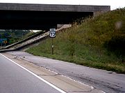
U.S. Route 73 enters Nebraska south of Falls CityFalls City, Nebraska
Falls City is a city in Richardson County, Nebraska, United States. The population was 4,671 at the 2000 census. It is the county seat of Richardson County.-Geography:Falls City is located at ....
still concurrent with U.S. Route 159. They run north into Falls City and separate. Shortly after leaving Falls City, US 73 turns west, passes through Verdon
Verdon, Nebraska
Verdon is a village in Richardson County, Nebraska, United States. The population was 223 at the 2000 census.-Geography:Verdon is located at ....
, and ends at U.S. Route 75
U.S. Route 75
U.S. Route 75 is a north–south U.S. Highway. The highway's northern terminus is in Kittson County, Minnesota, at the Canadian border, where it continues as Manitoba Highway 75 on the other side of a closed border crossing. Its southern terminus is at Interstate 30 and Interstate 45 in Dallas,...
just north of Dawson
Dawson, Nebraska
Dawson is a village in Richardson County, Nebraska, United States. The population was 209 at the 2000 census.-Geography:Dawson is located at ....
.
History
The original southern terminus was at Atoka, OklahomaAtoka, Oklahoma
Atoka is a city in Atoka County, Oklahoma, United States. The population was 3,052 at the 2010 census. It is the county seat of Atoka County.-Geography:Atoka is located at ....
at an intersection with U.S. Highway 75. From the creation of the highway in 1926 until 1935, US 73 was split between Oswego, Kansas
Oswego, Kansas
Oswego is a city in and the county seat of Labette County, Kansas, United States,, and situated along the Neosho River. As of the 2010 census, the city population was 1,829.-History:...
and Horton, Kansas
Horton, Kansas
Horton is a city in Brown County, Kansas, United States. The population was 1,967 at the 2000 census.-Geography:Horton is located at...
. US 73E followed modern US 160 from Oswego to Columbus
Columbus, Kansas
Columbus is the second largest city and county seat of Cherokee County, Kansas, United States, 15 miles south-southwest of Pittsburg, Kansas. As of the 2010 census, the city population was 3,312.-History:...
, then modern US 69 to Kansas City, where it then latched onto what is now US 73. The US 73E designated then went from Kansas City to Horton. US 73W followed the route of modern U.S. Route 59
U.S. Route 59
U.S. Route 59 is a north–south United States highway . A latecomer to the U.S. numbered route system, U.S. 59 is now a border-to-border route, Part of NAFTA Corridor Highway System. It parallels U.S. Route 75 for nearly its entire route, never much more than away, until it veers southwest...
from Oswego to K-39, K-39 west to Chanute
Chanute, Kansas
Chanute is a city in Neosho County, Kansas, United States. Founded on January 1, 1873, it was named after railroad engineer and aviation pioneer Octave Chanute. As of the 2010 census, the city population was 9,119...
, modern U.S. Route 169
U.S. Route 169
U.S. Route 169 currently runs for 966 miles from the city of Virginia, Minnesota to Tulsa, Oklahoma at U.S. Route 64.-Oklahoma:U.S. Highway 169 is a major south–north highway spanning in Oklahoma. The southern terminus for US-169 is Memorial Drive...
from Chanute to Garnett
Garnett, Kansas
Garnett is a city in and the county seat of Anderson County, Kansas, United States. As of the 2010 census, the city population was 3,415.-Geography:Garnett is located at...
, modern US 59 again from Garnett to Nortonville
Nortonville, Kansas
Nortonville is a city in Jefferson County, Kansas, United States. The population was 620 at the 2000 census. It is part of the Topeka, Kansas Metropolitan Statistical Area.-Geography:Nortonville is located at ....
, and then modern U.S. Route 159
U.S. Route 159
U.S. Highway 159 is a "child" route of U.S. Highway 59. It currently runs for 85 miles from Nortonville, Kansas at U.S. Highway 59 to New Point, Missouri at U.S. Highway 59. The highway permits through traffic on U.S. 59 to bypass the cities of Atchison, Kansas and Saint Joseph,...
from Nortonville to Horton
Horton, Kansas
Horton is a city in Brown County, Kansas, United States. The population was 1,967 at the 2000 census.-Geography:Horton is located at...
. In 1935, US 73 was truncated at Kansas City
Kansas City, Kansas
Kansas City is the third-largest city in the state of Kansas and is the county seat of Wyandotte County. It is a suburb of Kansas City, Missouri, and is the third largest city in the Kansas City Metropolitan Area. The city is part of a consolidated city-county government known as the "Unified...
with the modern designations taking over the old routes and US 69 taking over the Atoka-Oswego segment. In Kansas City, US 73 previously followed U.S. Route 24
U.S. Route 24
U.S. Route 24 is one of the original United States highways of 1926. It originally ran from Pontiac, Michigan, in the east to Kansas City, Missouri, in the west. Today, the highway's eastern terminus is west of Clarkston, Michigan, at an intersection with I-75 and its western terminus is near...
into downtown Kansas City, Kansas
Kansas City, Kansas
Kansas City is the third-largest city in the state of Kansas and is the county seat of Wyandotte County. It is a suburb of Kansas City, Missouri, and is the third largest city in the Kansas City Metropolitan Area. The city is part of a consolidated city-county government known as the "Unified...
, terminating at the Intercity Viaduct
Intercity Viaduct
The Intercity Viaduct is an automobile and pedestrian crossing of the Kansas River in the United States. Designed by Waddell and Redrick, this four lane, two level deck truss bridge was built in 1907. It rises above the West Bottoms, and several sets of railroad tracks...
(Lewis and Clark Viaduct), before Interstate 435
Interstate 435
Interstate 435 is an Interstate Highway beltway that encircles much of the Kansas City, Missouri Metropolitan Area in the states of Kansas and Missouri, USA.- Route description :...
was completed. After I-435 was completed, US 73 ended at its intersection with I-435.
Nebraska also had a split highway, with the split between Tekamah
Tekamah, Nebraska
Tekamah is a city in Burt County, Nebraska, United States. The population was 1,736 at the 2010 census. It is the county seat of Burt County.-History:...
and Winnebago
Winnebago, Nebraska
Winnebago is a village in Thurston County, Nebraska, United States. The population was 768 at the 2000 census.-Geography:Winnebago is located at...
between 1935 and 1957. US 73E went north through Decatur
Decatur, Nebraska
Decatur is a village in Burt County, Nebraska, United States. The population was 618 at the 2000 census. This town is named after one of its incorporators, Stephen Decatur, who claimed to be the nephew of war hero Stephen Decatur, Jr....
along the current route of U.S. Route 75
U.S. Route 75
U.S. Route 75 is a north–south U.S. Highway. The highway's northern terminus is in Kittson County, Minnesota, at the Canadian border, where it continues as Manitoba Highway 75 on the other side of a closed border crossing. Its southern terminus is at Interstate 30 and Interstate 45 in Dallas,...
, while US 73W went west from Tekamah along current Nebraska Highway 32
Nebraska Highway 32
Nebraska Highway 32 is a United States highway in Nebraska. It runs for through east central and eastern Nebraska. Its western terminus is at Nebraska Highway 14 in Petersburg. Its eastern terminus is at U.S. Highway 75 in Tekamah.-Route description:...
to Oakland
Oakland, Nebraska
Oakland is a city in Burt County, Nebraska, United States. The population was 1,367 at the 2000 census. Oakland continues to build on its strong foundation with its bi-annual Swedish Festival and is known by its proclamation from the Swedish Consul-General and Nebraska Governor as the "Swedish...
, then north from Oakland in a concurrency with U.S. Route 77
U.S. Route 77
U.S. Route 77 is a north–south United States highway. It is unsigned in and around Dallas, Texas. Its historic segment through South Dakota and Minnesota was decommissioned with the advent of Interstate 29 but otherwise the route has been spared the decommissioning that has shortened other US...
.
The original northern terminus was south of Auburn, Nebraska
Auburn, Nebraska
Auburn is a city in Nemaha County, Nebraska, United States. The population was 3,350 at the 2000 census. It is the county seat of Nemaha County. The City of Auburn is actually an incorporation of two towns. Calvert and Sheridan combined to form Auburn in 1882, in part to have the voting power to...
, near Howe, Nebraska. US 73 went east through Howe, then south to Stella, Nebraska
Stella, Nebraska
Stella is a village in Richardson County, Nebraska, United States. The population was 220 at the 2000 census.-Geography:Stella is located at ....
, then east through Shubert, Nebraska
Shubert, Nebraska
Shubert is a village in Richardson County, Nebraska, United States. The population was 252 at the 2000 census.-Geography:Shubert is located at ....
, then south to the current highway. In 1932, the highway was extended to South Sioux City, Nebraska
South Sioux City, Nebraska
-2000 Census:As of the census of 2000, there were 11,925 people, 4,304 households, and 2,961 families residing in the city. Of the 11,925 people, 48.6% are male and 51.4% are female. The population density was 2,431.6 people per square mile . There were 4,557 housing units at an average density of...
. In 1965, the route was shortened to Winnebago, Nebraska
Winnebago, Nebraska
Winnebago is a village in Thurston County, Nebraska, United States. The population was 768 at the 2000 census.-Geography:Winnebago is located at...
. In 1984, U.S. 75 was removed from western Iowa along Interstate 29
Interstate 29
Interstate 29 is an Interstate Highway in the Midwestern United States. I-29 runs from Kansas City, Missouri, at a junction with Interstate 35 and Interstate 70 to the Canadian border near Pembina, North Dakota, where it connects with Manitoba Highway 75 via the short Manitoba Highway 29.-Route...
and placed on U.S. 73's route, superseding it through Omaha, Nebraska
Omaha, Nebraska
Omaha is the largest city in the state of Nebraska, United States, and is the county seat of Douglas County. It is located in the Midwestern United States on the Missouri River, about 20 miles north of the mouth of the Platte River...
and truncating the highway to its present northern terminus near Dawson, Nebraska
Dawson, Nebraska
Dawson is a village in Richardson County, Nebraska, United States. The population was 209 at the 2000 census.-Geography:Dawson is located at ....
.
On December 1, 2008, the southern terminus was rerouted, along with US 24 and US 40, southward along K-7 to its new terminus at I-70.