

U.S. Route 287 in Texas
Encyclopedia

U.S. state
A U.S. state is any one of the 50 federated states of the United States of America that share sovereignty with the federal government. Because of this shared sovereignty, an American is a citizen both of the federal entity and of his or her state of domicile. Four states use the official title of...
of Texas
Texas
Texas is the second largest U.S. state by both area and population, and the largest state by area in the contiguous United States.The name, based on the Caddo word "Tejas" meaning "friends" or "allies", was applied by the Spanish to the Caddo themselves and to the region of their settlement in...
, U.S. Highway 287 is a U.S. Highway that begins on the Gulf Coast in Port Arthur
Port Arthur, Texas
-Demographics:As of the 2000 census, there were 57,755 people, 21,839 households, and 14,675 families residing in the city. The population density was 696.5 people per square mile . There were 24,713 housing units at an average density of 298.0 per square mile...
and heads north through Fort Worth
Fort Worth, Texas
Fort Worth is the 16th-largest city in the United States of America and the fifth-largest city in the state of Texas. Located in North Central Texas, just southeast of the Texas Panhandle, the city is a cultural gateway into the American West and covers nearly in Tarrant, Parker, Denton, and...
, northwest to Childress
Childress, Texas
Childress is a city in Childress County, Texas, United States. The population was 6,778 at the 2000 census. It is the county seat of Childress County. Like the county, the city is named for George Campbell Childress, a native of Nashville, Tennessee, who was the principal author of the Texas...
, Clarendon
Clarendon, Texas
Clarendon is a city in Donley County, Texas, United States. The population was 1,974 at the 2000 census. The county seat of Donley County, Clarendon is located on United States Highway 287 in the Texas Panhandle some sixty miles east of Amarillo. It was established in 1878 by Methodist clergyman L.H...
, and Amarillo
Amarillo, Texas
Amarillo is the 14th-largest city, by population, in the state of Texas, the largest in the Texas Panhandle, and the seat of Potter County. A portion of the city extends into Randall County. The population was 190,695 at the 2010 census...
in the Texas Panhandle
Texas Panhandle
The Texas Panhandle is a region of the U.S. state of Texas consisting of the northernmost 26 counties in the state. The panhandle is a rectangular area bordered by New Mexico to the west and Oklahoma to the north and east...
and into Oklahoma
Oklahoma
Oklahoma is a state located in the South Central region of the United States of America. With an estimated 3,751,351 residents as of the 2010 census and a land area of 68,667 square miles , Oklahoma is the 28th most populous and 20th-largest state...
near Kerrick
Kerrick, Texas
Kerrick is an unincorporated community in Dallam County, Texas, United States. It lies in the extreme northeastern part of the county near the Oklahoma state line.-External links:**...
.
Route description
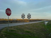
US 287 crosses into Texas at KerrickKerrick, Texas
Kerrick is an unincorporated community in Dallam County, Texas, United States. It lies in the extreme northeastern part of the county near the Oklahoma state line.-External links:**...
and continues southeast through to Stratford
Stratford, Texas
Stratford is a city in Sherman County, Texas, United States. The population was 1,991 at the 2000 census. It is the county seat of Sherman County...
, where it takes a more southerly turn. In Dumas
Dumas, Texas
Dumas is a city in Moore County, Texas, United States. The population was 13,747 at the 2000 census. It is the county seat of Moore County. Located approximately fifty miles north of Amarillo, the city is named for...
, US 287 merges with its "parent route", US 87, and continues its south/southeasterly path as a co-signed route to Amarillo
Amarillo, Texas
Amarillo is the 14th-largest city, by population, in the state of Texas, the largest in the Texas Panhandle, and the seat of Potter County. A portion of the city extends into Randall County. The population was 190,695 at the 2010 census...
.
After passing through the heart of downtown Amarillo, US 87 splits off to the south to merge with I-27, and US 287 merges with I-40 and continues co-signed with the interstate until just west of Rick Husband Amarillo International Airport
Rick Husband Amarillo International Airport
Rick Husband Amarillo International Airport is a public airport located six miles east of the central business district of Amarillo, a city in Potter and Randall Counties, Texas, United States...
, where it veers to the southeast toward Claude
Claude, Texas
Claude is a city in Armstrong County, Texas, United States. The population was 1,313 at the 2000 census. Located east of Amarillo, Claude is the county seat of Armstrong County in the south Texas Panhandle...
, the seat of Armstrong County
Armstrong County, Texas
Armstrong County is a county located in the U.S. state of Texas, and was formed in 1876 from Bexar County. It is part of the Amarillo metropolitan area. As of 2000, the population is 2,148. Its county seat is Claude. Armstrong is named for one of several Texas pioneer families named Armstrong...
.
US 287 follows this east-southeasterly path through Clarendon
Clarendon, Texas
Clarendon is a city in Donley County, Texas, United States. The population was 1,974 at the 2000 census. The county seat of Donley County, Clarendon is located on United States Highway 287 in the Texas Panhandle some sixty miles east of Amarillo. It was established in 1878 by Methodist clergyman L.H...
and Childress
Childress, Texas
Childress is a city in Childress County, Texas, United States. The population was 6,778 at the 2000 census. It is the county seat of Childress County. Like the county, the city is named for George Campbell Childress, a native of Nashville, Tennessee, who was the principal author of the Texas...
, where it intersects US Highways 83 and 62. US 287 then proceeds to Vernon
Vernon, Texas
Vernon is a city in Wilbarger County, Texas, United States. As of the 2000 census, the population was 11,660; it was 11,077 in the 2005 census estimate. Vernon is the county seat of Wilbarger County....
, where it merges with (and is briefly co-signed with) US 70 and US 183. After US 70 and US 183 leave the route at Oklaunion
Oklaunion, Texas
Oklaunion is an unincorporated community in Wilbarger County, Texas, United States. According to the Handbook of Texas, the community had an estimated population of 138 in 2000.-Geography:...
and veer to the northeast, US 287 resumes its east-southeasterly track passing through Harrold
Harrold, Texas
Harrold is an unincorporated community in eastern Wilbarger County, Texas, United States.The Harrold Independent School District serves area students, including transfers from Electra and Vernon.-External links:...
and Electra
Electra, Texas
Electra is a city in Wichita County, Texas, United States. It is part of the Wichita Falls, Texas Metropolitan Statistical Area. The United States Census Bureau counted Electra's population as 3,168 at the 2000 census and estimated it to be 2,891 as of 2006...
on its way to Wichita Falls
Wichita Falls, Texas
Wichita Falls is a city in and the county seat of Wichita County, Texas, United States, United States. Wichita Falls is the principal city of the Wichita Falls Metropolitan Statistical Area, which encompasses all of Archer, Clay and Wichita counties. According to the U.S. Census estimate of 2010,...
. On the northwest side of the city US 287 merges with I-44, US 82, and (briefly) US 277. After leaving Wichita Falls, US 82/287 continues as a co-signed route until Henrietta
Henrietta, Texas
Henrietta is a city in and the county seat of Clay County, Texas, United States. It is part of the Wichita Falls, Texas Metropolitan Statistical Area. The population was 3,264 at the 2000 census.-History:...
, where US 82 leaves the route. After merging with US 81 in Bowie
Bowie, Texas
Bowie is a city in Montague County, Texas, United States. The population was 5,219 at the 2000 census.-Geography:According to the United States Census Bureau, Bowie has a total area of , of which, of it is land and of it is water.-Demographics:...
, US 287/81 continues southeast to Fort Worth
Fort Worth, Texas
Fort Worth is the 16th-largest city in the United States of America and the fifth-largest city in the state of Texas. Located in North Central Texas, just southeast of the Texas Panhandle, the city is a cultural gateway into the American West and covers nearly in Tarrant, Parker, Denton, and...
, where it merges with I-35W
Interstate 35W (Texas)
Interstate 35W , an Interstate Highway, is the western half of Interstate 35 where it splits to serve different cities in Texas. I-35 splits into two branch routes, I-35W and I-35E at Hillsboro. I-35W runs north for , carrying its own separate sequence of exit numbers. It runs through Fort Worth...
on the north side of town. Just northwest of this interchange, Business US 287 veers off to the right following the original routing into Saginaw and into downtown Fort Worth while zig zagging its way through city streets to Kennedale and Mansfield before coming out onto the US 287 Freeway south of Interstate 20 near the Ellis County line just north of Midlothian.
Here, US 81 hits its terminus, but US 287 continues, concurrent route with I-35W through to the north end of downtown Fort Worth before splitting off to the southeast and once again picking up its own signage. This stretch of US 287, which runs from downtown to the southeast side of the city, is also known as the Martin Luther King, Jr.
Martin Luther King, Jr.
Martin Luther King, Jr. was an American clergyman, activist, and prominent leader in the African-American Civil Rights Movement. He is best known for being an iconic figure in the advancement of civil rights in the United States and around the world, using nonviolent methods following the...
Freeway. In southeast Fort Worth, US 287 intersects with, and is briefly
co-signed with, I-820 (which then dumps into I-20) before veering to the southeast yet again, where it passes through the extreme western side of Arlington
Arlington, Texas
Arlington is a city in Tarrant County, Texas within the Dallas–Fort Worth metropolitan area. According to the 2010 census results, the city had a population of 365,438, making it the third largest municipality in the Metroplex...
, and then on in to Mansfield
Mansfield, Texas
Mansfield is a city in Ellis, Johnson, and Tarrant counties in the U.S. state of Texas. As of the 2010 census, the population was 56,368.In 2009, CNN/Money Magazine rated Mansfield as one of the "Best Places to Live" in the United States, ranking 24th out of the top 100 places.-History:The first...
and Midlothian
Midlothian, Texas
Midlothian is a city in northwest Ellis County, Texas, United States. It is the hub for the cement industry in North Texas as it is the home to three separate cement production facilities, as well as a steel mill. Midlothian is also a fast growing community with a growth rate of 142% since 2000...
The freeway which previously terminated at the Tarrant/Johnson County line has been extended continuing on into Ellis County to connect with the existing freeway around Waxahachie
Waxahachie, Texas
Waxahachie is a city in Ellis County, Texas, United States, and a southern suburb of Dallas. The population was 21,426 at the 2000 census. It is the county seat of Ellis County....
, which includes a bypass around Midlothian
Midlothian, Texas
Midlothian is a city in northwest Ellis County, Texas, United States. It is the hub for the cement industry in North Texas as it is the home to three separate cement production facilities, as well as a steel mill. Midlothian is also a fast growing community with a growth rate of 142% since 2000...
and an interchange with US 67.
After intersecting with I-35E
Interstate 35E (Texas)
Interstate 35E , an Interstate Highway, is the eastern half of Interstate 35 where it splits to serve different cities in Texas. I-35 splits into two branch routes, I-35W and I-35E at Hillsboro. I-35E runs north for , maintaining I-35's sequence of exit numbers. It runs through Dallas before...
just north of Waxahachie
Waxahachie, Texas
Waxahachie is a city in Ellis County, Texas, United States, and a southern suburb of Dallas. The population was 21,426 at the 2000 census. It is the county seat of Ellis County....
, US 287 continues to the southeast, where it merges with I-45 just south of Ennis
Ennis, Texas
Ennis is a city in Ellis County, Texas, United States, and a southeastern suburb of Dallas. The population was 16,045 at the 2000 census.In 1871, the Houston and Texas Central Railroad purchased of land in Ellis County at a price of , establishing the line's northern terminus. On May 8, 1872,...
and follows the interstate to Corsicana
Corsicana, Texas
Corsicana is a city in Navarro County, Texas, United States. It is located on Interstate 45 some fifty-five miles south of downtown Dallas. The population was 24,485 at the 2000 census...
where it then leaves the route and makes another sharp turn to the east. The highway continues southeastward to Palestine
Palestine, Texas
Palestine is a city in Anderson County, Texas, in the United States. As of the 2000 census, the city population was 17,598, and 18,458 in the 2009 estimate. It is the county seat of Anderson County and is situated in East Texas...
, where it merges with State Highway 19. US 287/SH 19 continues as a co-signed route until Crockett
Crockett, Texas
Crockett is a city in Houston County, Texas, in the United States. As of the 2000 census, the city population was 7,141. It is the county seat of Houston County.- History :...
, where US 287 leaves SH 19 and continues its southeasterly track toward the Texas Gulf Coast
Gulf of Mexico
The Gulf of Mexico is a partially landlocked ocean basin largely surrounded by the North American continent and the island of Cuba. It is bounded on the northeast, north and northwest by the Gulf Coast of the United States, on the southwest and south by Mexico, and on the southeast by Cuba. In...
.
In Woodville
Woodville, Texas
Woodville is a town in Tyler County, Texas, United States. The town is intersected by three U.S. highways: U.S. Highway 69, U.S. Highway 190, and U.S. Highway 287. The population was 2,415 at the 2000 census. It is the county seat of Tyler County...
, US 287 merges with US 69 and takes on a more due-southerly route to Lumberton
Lumberton, Texas
Lumberton is a city in Hardin County, Texas, United States. The population was 11,943 at the 2010 census. Lumberton is home of Village Creek State Park...
, where a co-signed US 69/287 also merges with US 96. The highway then continues to the southeast through Beaumont
Beaumont, Texas
Beaumont is a city in and county seat of Jefferson County, Texas, United States, within the Beaumont–Port Arthur Metropolitan Statistical Area. The city's population was 118,296 at the 2010 census. With Port Arthur and Orange, it forms the Golden Triangle, a major industrial area on the...
with a short stint with Interstate 10 and on to Port Arthur
Port Arthur, Texas
-Demographics:As of the 2000 census, there were 57,755 people, 21,839 households, and 14,675 families residing in the city. The population density was 696.5 people per square mile . There were 24,713 housing units at an average density of 298.0 per square mile...
, where the route terminates at an intersection with State Highway 87.
History
Before 1939, the portion from Oklahoma to Amarillo was SH 9, from Amarillo to Henrietta was SH 5, Henrietta to Fort Worth was SH 2 and US 81, Fort Worth to Ennis SH 34, Ennis to Corsicana was SH 14/US 75, Corsicana to Palestine was SH 22, Palestine to Crockett was SH 19, Crockett and Woodville was SH 106, Woodville to Port Arthur was SH 8. All of these state highways were shortened in the 1939 renumbering. SH 106 was decommissioned. SH 19 was deleted until 1960, when it extended back south.Junction List
| County | Location | # Exit number An exit number is a number assigned to a road junction, usually an exit from a freeway. It is usually marked on the same sign as the destinations of the exit, as well as a sign in the gore.... |
Destinations | Notes |
|---|---|---|---|---|
| Jefferson Jefferson County, Texas Jefferson County is a county located in the state of Texas, United States. As of 2000, the population was 252,051. Its county seat is Beaumont, and it is named for the former U.S... |
Port Arthur Port Arthur, Texas -Demographics:As of the 2000 census, there were 57,755 people, 21,839 households, and 14,675 families residing in the city. The population density was 696.5 people per square mile . There were 24,713 housing units at an average density of 298.0 per square mile... |
South end of US 69 & US 96 overlap South end of Highway |
||
| South end of freeway | ||||
| Jimmy Johnson Boulevard | ||||
| Nederland Nederland, Texas Nederland is a city in Jefferson County, Texas, United States. The population was 17,547 at the 2010 census.The city is adjacent to the Southeast Texas Regional Airport in Port Arthur, which serves the nearby cities of Beaumont and Port Arthur. It is part of the Beaumont–Port Arthur... |
||||
| Nederland Avenue | ||||
| Jerry Ware Drive – Southeast Texas Regional Airport Southeast Texas Regional Airport Jack Brooks Regional Airport , is a public airport located near Port Arthur, Texas, United States, nine miles southeast of the central business district of Beaumont and northeast of Port Arthur... |
||||
| Port Neches Port Neches, Texas Port Neches is a city in Jefferson County, Texas, United States. The population was 13,601 at the 2000 census. It is part of the Beaumont–Port Arthur Metropolitan Statistical Area.- History :... |
Beauxart Gardens Road, Spurlock Road | |||
| Beaumont Beaumont, Texas Beaumont is a city in and county seat of Jefferson County, Texas, United States, within the Beaumont–Port Arthur Metropolitan Statistical Area. The city's population was 118,296 at the 2010 census. With Port Arthur and Orange, it forms the Golden Triangle, a major industrial area on the... |
||||
| – Lamar University Lamar University Lamar University, often referred to as Lamar or LU, is a comprehensive coeducational public research university located in Beaumont, Texas, United States. Lamar confers bachelors, masters and doctoral degrees and is classified as a Doctoral Research University by the Carnegie Commission on Higher... |
||||
| Highland Avenue | ||||
| Florida Avenue, Erie Street | ||||
| 4th Street | ||||
| – Houston | South end of Interstate 10 overlap | |||
| 850 | Washington Boulevard | Southbound exit is via exit 849 | ||
| 851 | ||||
| 852A | Laurel Avenue | Southbound exit and northbound entrance | ||
| 852B | Calder Avenue, Harrison Avenue, Gladys Avenue | |||
| – Lake Charles Lake Charles, Louisiana Lake Charles is the fifth-largest incorporated city in the U.S. state of Louisiana, located on Lake Charles, Prien Lake, and the Calcasieu River. Located in Calcasieu Parish, a major cultural, industrial, and educational center in the southwest region of the state, and one of the most important in... |
North end of Interstate 10 overlap | |||
| Delaware Street | ||||
| 11th Street | Southbound exit and northbound entrance | |||
| Lucas Drive | ||||
| Dowlen Road | ||||
| Lawrence Drive | ||||
| Tram Road | ||||
| Hardin | Cooks Lake Road | |||
| Keith Road – Rose Hill Acres Rose Hill Acres, Texas Rose Hill Acres is a city in Hardin County, Texas, United States. The population was 480 at the 2000 census. The city is little more than two residential neighborhoods situated between Beaumont and Lumberton. It is part of the Beaumont–Port Arthur Metropolitan Statistical Area... |
||||
| No northbound entrance | ||||
| Lumberton Lumberton, Texas Lumberton is a city in Hardin County, Texas, United States. The population was 11,943 at the 2010 census. Lumberton is home of Village Creek State Park... |
Northbound exit and southbound entrance. North end of US 96 overlap. | |||
| North end of freeway | ||||
| Kountze Kountze, Texas Kountze is a city in Hardin County, Texas, United States. The population was 2,115 at the 2000 census. It is the county seat of Hardin County. The city is part of the Beaumont–Port Arthur Metropolitan Statistical Area.... |
||||
| Tyler | Warren | |||
| Woodville Woodville, Texas Woodville is a town in Tyler County, Texas, United States. The town is intersected by three U.S. highways: U.S. Highway 69, U.S. Highway 190, and U.S. Highway 287. The population was 2,415 at the 2000 census. It is the county seat of Tyler County... |
||||
| North end of US 69 overlap | ||||
| Chester Chester, Texas Chester is a town in Tyler County, Texas, United States. The population was 265 at the 2000 census.-Geography:Chester is located at .... |
||||
| Polk | ||||
|-
|Corrigan
Corrigan, Texas
Corrigan is a town in Polk County, Texas in the United States of America. The town was named for Pat Corrigan, a train conductor. The population was 1,721 at the 2000 census.-Geography:Corrigan is located at ....
|
|
|-
|rowspan=7|Trinity
Trinity, Texas
Trinity is a city in Trinity County, Texas, United States. The population was 2,721 at the 2000 census.-Geography:Trinity is located at ....
|
|
|
|-
|rowspan=3|Groveton
Groveton, Texas
Groveton is a city in Trinity County, Texas, United States. The population was 1,107 at the 2000 census. It is the county seat of Trinity County.-Geography:Groveton is located at ....
|
|
|-
|
|
|South end of SH 94 overlap
|-
|
|
|-
|
|
|
|North end of SH 94 overlap
|-
|
|
|
|-
|
|
|
|-
|rowspan=14|Houston
Houston County, Texas
Houston County is a county located in the U.S. state of Texas. As of 2000, the population was 23,185. Its county seat is Crockett. Houston County is named for Samuel Houston, a president of the Republic of Texas and Governor of Texas...
|
|
|
|-
|
|
|
|-
|rowspan=5|Crockett
Crockett, Texas
Crockett is a city in Houston County, Texas, in the United States. As of the 2000 census, the city population was 7,141. It is the county seat of Houston County.- History :...
|
|
|-
|
|
|South end of SH 21 overlap
|-
|
|
|North end of SH 21 overlap
|-
|
|
|South end of SH 19 overlap
|-
|
|
|-
|
|
|
|-
|Latexo
Latexo, Texas
Latexo is a city in Houston County, Texas, United States. The population was 331 at the 2010 census.-History:Just after 1900 the Louisiana Texas Orchard Company purchased surrounding the settlement and platted a town named Latexo, an acronym of the company's name.There have been five schools built...
|
|
|-
|rowspan=5|Grapeland
Grapeland, Texas
Grapeland is a city in Houston County, Texas, United States. The population was 1,451 at the 2000 census.-Geography:Grapeland is located at ....
|
|
|-
|
|
|-
|
|
|-
|
|
|-
|
|
|-
|rowspan=19|Anderson
Anderson County, Texas
Anderson County is a county located in the U.S. state of Texas. As of 2000, the population was 55,109. Its county seat is Palestine. Anderson county was organized in 1846, and is named in honor of Kenneth L. Anderson who had been Vice President of the Republic of Texas.-Geography:According to the...
|
|
|
|South end of SH 294 overlap
|-
|rowspan=2|Elkhart
Elkhart, Texas
Elkhart is a town in Anderson County, Texas, United States. The population was 1,215 at the 2000 census. Elkhart is named for a friendly Native American who assisted the early settlers of the town.-Geography:Elkhart is located at ....
|
|
|-
|
|
|North end of SH 294 overlap
|-
|
|
|
|-
|rowspan=7|Palestine
Palestine, Texas
Palestine is a city in Anderson County, Texas, in the United States. As of the 2000 census, the city population was 17,598, and 18,458 in the 2009 estimate. It is the county seat of Anderson County and is situated in East Texas...
|
|
|-
|
|
|South end of US 84 overlap
|-
|
|
|North end of SH 19 overlap
|-
|
|
|-
|
|
|North end of US 84 overlap
|-
|
|
|South end of SH 19 overlap
|-
|
|
|-
|
|
|
|North end of SH 19 overlap
|-
|
|
|
|-
|
|
|
|-
|
|
|
|-
|
|
|
|-
|
|
|
|-
|
|
|
|-
|Cayuga
Cayuga, Texas
Cayuga is an unincorporated community in northwestern Anderson County, Texas, United States.The Cayuga Independent School District serves area students....
|
|
|-
|Freestone
Freestone County, Texas
Freestone County is a county located in the U.S. state of Texas. As of 2000, the population was 17,867. Its county seat is Fairfield.-Geography:...
|
|
|
|-
|rowspan=15|Navarro
|
|
|
|-
|rowspan=2|Eureka
Eureka, Texas
Eureka is a city in Navarro County, Texas, United States. The population was 340 at the 2000 census.-Geography:Eureka is located at ....
|
|
|-
|
|
|-
|
|
|
|-
|
|
|
|-
|rowspan=5|Corsicana
Corsicana, Texas
Corsicana is a city in Navarro County, Texas, United States. It is located on Interstate 45 some fifty-five miles south of downtown Dallas. The population was 24,485 at the 2000 census...
|
| – Houston
|South end of Interstate 45 overlap
|-
|231
|
|-
|232
|Roane Road, East 5th Avenue
|-
|235B
|
|Southbound exit and northbound entrance
|-
|235A
|Frontage Road
|Signed as exit 235 northbound
|-
|
|237
|Frontage Road
|-
|
|238
|
|-
|
|239
|
|-
|Rice
Rice, Texas
Rice is a city in Navarro County, Texas, United States. The population was 798 at the 2000 census.-Geography:Rice is located at ....
|242
|Calhoun Street – Rice
Rice, Texas
Rice is a city in Navarro County, Texas, United States. The population was 798 at the 2000 census.-Geography:Rice is located at ....
|-
|
|243
|Frontage Road
|-
|rowspan=21|Ellis
Ellis County, Texas
As of the census of 2000, there were 111,360 people, 37,020 households, and 29,653 families residing in the county. The population density was 118 people per square mile . There were 39,071 housing units at an average density of 42 per square mile...
|
|244
|
|-
|Alma
Alma, Texas
Alma is a town in Ellis County, Texas, United States. The population was 302 at the 2000 census.-Geography:Alma is located on Interstate 45 about southeast of Ennis....
|246
|
|-
|
|
| – Dallas
|North end of Interstate 45 overlap
|-
|
|
|
|-
|
|
|
|-
|
|-
|rowspan=2|Ennis
Ennis, Texas
Ennis is a city in Ellis County, Texas, United States, and a southeastern suburb of Dallas. The population was 16,045 at the 2000 census.In 1871, the Houston and Texas Central Railroad purchased of land in Ellis County at a price of , establishing the line's northern terminus. On May 8, 1872,...
|
|
|Interchange
|-
|
|
|-
|rowspan=8|Waxahachie
Waxahachie, Texas
Waxahachie is a city in Ellis County, Texas, United States, and a southern suburb of Dallas. The population was 21,426 at the 2000 census. It is the county seat of Ellis County....
|
|
|Begin freeway
|-
|
|Farley Street, Wyatt Street, Broadhead Road
|-
|
|
|-
|
|
|-
|
|Solon Road
|-
|
|
|-
|
|
|Southbound exit and northbound entrance
|-
|
|
|End freeway
|-
|rowspan=4|Midlothian
Midlothian, Texas
Midlothian is a city in northwest Ellis County, Texas, United States. It is the hub for the cement industry in North Texas as it is the home to three separate cement production facilities, as well as a steel mill. Midlothian is also a fast growing community with a growth rate of 142% since 2000...
|
|, Midlothian Parkway
|Begin freeway
|-
|
|
|-
|
|, Dallas
|-
|
|
|End freeway
|-
|rowspan=7|Mansfield
Mansfield, Texas
Mansfield is a city in Ellis, Johnson, and Tarrant counties in the U.S. state of Texas. As of the 2010 census, the population was 56,368.In 2009, CNN/Money Magazine rated Mansfield as one of the "Best Places to Live" in the United States, ranking 24th out of the top 100 places.-History:The first...
|
|, Dallas/Fort Worth International Airport
|-
|Johnson
Johnson County, Texas
As of the census of 2000, there were 126,811 people, 43,636 households, and 34,428 families residing in the county. The population density was 174 people per square mile . There were 46,269 housing units at an average density of 63 per square mile...
|
|
|Begin freeway
|-
|rowspan=45|Tarrant
Tarrant County, Texas
Tarrant County is a county located in the U.S. state of Texas. As of the 2010 U.S. Census, it had a population of 1,809,034. Its county seat is Fort Worth. Tarrant County is the sixteenth most populous county in the United States and the third most populous in Texas. The county is named in honor...
|
|Heritage Parkway
|-
|
|Broad Street
|-
|
|Walnut Creek Drive
|-
|
|
|-
|
|Turner Warnell Road
|-
|rowspan=5|Arlington
Arlington, Texas
Arlington is a city in Tarrant County, Texas within the Dallas–Fort Worth metropolitan area. According to the 2010 census results, the city had a population of 365,438, making it the third largest municipality in the Metroplex...
|
|Curry Road, Eden Road
|-
|
|Sublett Road
|-
|
|Little School Road, Little Road
|Northbound exit and southbound entrance
|-
|
| – Dallas
|South end of Interstate 20 overlap
|-
|443
|Bowman Springs Road
|
|-
|rowspan=35|Fort Worth
Fort Worth, Texas
Fort Worth is the 16th-largest city in the United States of America and the fifth-largest city in the state of Texas. Located in North Central Texas, just southeast of the Texas Panhandle, the city is a cultural gateway into the American West and covers nearly in Tarrant, Parker, Denton, and...
|
|
|North end of Interstate 20 overlap; south end of Interstate 820 overlap
|-
|33C
|Sun Valley Drive
|-
|33B
|Martin Street, Wilbarger Street
|-
|
|
|North end of Interstate 820 overlap
|-
|
|Village Creek Road
|-
|
|Miller Avenue, Wilbarger Street
|-
|
|Berry Street
|-
|
|Mitchell Boulevard
|-
|
|Cobb Park Road
|Southbound exit and northbound entrance
|-
|
|Rosedale Street
|-
|
|
|Northbound exit for SH 180
|-
|
|
|Southbound exit
|-
|
|, Dallas
|-
|
|I.M. Terrell Way
|Northbound exit only
|-
|
|
|-
|
|
|South end of Interstate 35W overlap
|-
|52A
|
|North end of US 377 overlap; signed as exit 52B northbound
|-
|52B
|
|Southbound exit and northbound entrance
|-
|52C
|Pharr Street
|-
|52D
|Carver Street
|Northbound exit and southbound entrance
|-
|53
|Northside Drive, Yucca Avenue
|-
|54A
|
|Signed as exits 54A (east) and 54B (west) northbound
|-
|54B
|Papurt Street
|Southbound exit and northbound entrance
|-
|54C
|33rd Street, Long Avenue
|Northbound exit and southbound entrance
|-
|56A
|Meacham Boulevard
|-
|56B
|Melody Hills Drive
|Northbound exit and southbound entrance
|-
|57
|
|Signed as exits 57A (east) and 57B (west)
|-
|58
|Western Center Boulevard
|-
|59
|Basswood Boulevard
|-
|
|
|North end of Interstate 35W overlap; south end of US 81 overlap
|-
|
|
|-
|
|
|-
|
|Bonds Ranch Road
|-
|
|West Blue Mound Road
|-
|
|
|End Freeway
|-
|rowspan=16|Wise
Wise County, Texas
As of the census of 2000, there were 48,793 people, 17,178 households, and 13,467 families residing in the county. The population density was 54 people per square mile . There were 19,242 housing units at an average density of 21 per square mile...
|rowspan=4|Rhome
Rhome, Texas
Rhome is a city in Wise County, Texas, United States. The population was 1067 at the 2010 census.-Geography:Rhome is located at ....
|
|
|Begin freeway; south end of SH 114 overlap
|-
|
|
|-
|
|
|North end of SH 114 overlap
|-
|
|
|End freeway
|-
|New Fairview
New Fairview, Texas
New Fairview is a city in Wise County, Texas, United States. The population was 877 at the 2000 census.-Geography:New Fairview is located at ....
|
|
|Interchange
|-
|
|
|
|-
|rowspan=5|Decatur
Decatur, Texas
Decatur is a city located in Wise County, Texas, United States. This city was named after Stephen Decatur, Jr. The population was 5,201 at the 2000 census. A July 1, 2008 U.S. Census Bureau estimate placed the population at 6,432. It is the county seat of Wise County...
|
|
|-
|
|
|Interchange
|-
|
|
|Interchange
|-
|
|
|Interchange
|-
|
|
|-
|
|
|
|-
|rowspan=4|Alvord
Alvord, Texas
Alvord is a town in Wise County, Texas, United States. The population was 1,007 at the 2000 census.Texas Railroad Commissioner Ernest O. Thompson, who also served as a mayor of Amarillo and became an expert on petroleum issues, was born in Alvord in 1892....
|
|
|Begin freeway
|-
|
|Hubbard St
|No southbound exit
|-
|
|
|-
|
|
|End freeway
|-
|rowspan=10|Montague
Montague County, Texas
As of the census of 2000, there were 19,117 people, 7,770 households, and 5,485 families residing in the county. The population density was 20 people per square mile . There were 9,862 housing units at an average density of 11 per square mile...
|
|
|
|South end of freeway
|-
|Sunset
Sunset, Texas
Sunset is an unincorporated community in Montague County, Texas, United States. Until 1900, a surveying error had placed the community in Wise County. The Fort Worth and Denver Railway runs through Sunset...
|
|
|-
|
|
|Frontage Road
|Northbound exit and southbound entrance
|-
|
|
|Lawhorn Road
|-
|
|
|Fruitland Road
|-
|
|
|Wagon Seller Road
|-
|
|
|
|North end of US 81 overlap
|-
|
|
|
|-
|Bowie
Bowie, Texas
Bowie is a city in Montague County, Texas, United States. The population was 5,219 at the 2000 census.-Geography:According to the United States Census Bureau, Bowie has a total area of , of which, of it is land and of it is water.-Demographics:...
|
|
|-
|
|
|
|North end of freeway
|-
|rowspan=10|Clay
Clay County, Texas
As of the census of 2000, there were 11,006 people, 4,323 households, and 3,181 families residing in the county. The population density was 10 people per square mile . There were 4,992 housing units at an average density of 4 per square mile...
|rowspan=2|Bellevue
Bellevue, Texas
Bellevue is a city in Clay County, Texas, United States. It is part of the Wichita Falls, Texas Metropolitan Statistical Area. The population was 386 at the 2000 census.- History :...
|
|
|south end of FM 1288 overlap
|-
|
|
|North end of FM 1288 overlap
|-
|
|
|New York Road
|Southbound exit and entrance
|-
|Henrietta
Henrietta, Texas
Henrietta is a city in and the county seat of Clay County, Texas, United States. It is part of the Wichita Falls, Texas Metropolitan Statistical Area. The population was 3,264 at the 2000 census.-History:...
|
|
|South end of freeway
|-
|
|
|
|-
|Henrietta
Henrietta, Texas
Henrietta is a city in and the county seat of Clay County, Texas, United States. It is part of the Wichita Falls, Texas Metropolitan Statistical Area. The population was 3,264 at the 2000 census.-History:...
|
|
|South end of US 82 overlap; north end of freeway
|-
|
|
|
|-
|Jolly
Jolly, Texas
Jolly is a city in Clay County, Texas, United States. It is part of the Wichita Falls, Texas Metropolitan Statistical Area. The population was 172 at the 2010 census.-Geography:Jolly is located at ....
|
|
|Interchange
|-
|
|
|
|-
|
|
|
|South end of freeway
|-
|rowspan=35|Wichita
Wichita County, Texas
As of the census of 2000, there were 131,664 people, 48,441 households, and 32,891 families residing in the county. The population density was 210 people per square mile . There were 53,304 housing units at an average density of 85 per square mile...
|rowspan=22|Wichita Falls
Wichita Falls, Texas
Wichita Falls is a city in and the county seat of Wichita County, Texas, United States, United States. Wichita Falls is the principal city of the Wichita Falls Metropolitan Statistical Area, which encompasses all of Archer, Clay and Wichita counties. According to the U.S. Census estimate of 2010,...
|
|Fisher Road
|-
|
|
|Northbound exit for SH 79
|-
|
|
|South end of SH 79 overlap
|-
|
|Old Windthorst Road
|-
|
|
|North end of SH 79 overlap; South end of US 281 overlap; left exit
|-
|
|
|-
|
|Galveston Street
|Northbound exit and southbound entrance; northbound exit for US 82/277 (Kell Blvd)
|-
|
|
|North end of US 82 overlap; south end of US 277 overlap
|-
|
|14th-8th Streets – Downtown Wichita Falls
Wichita Falls, Texas
Wichita Falls is a city in and the county seat of Wichita County, Texas, United States, United States. Wichita Falls is the principal city of the Wichita Falls Metropolitan Statistical Area, which encompasses all of Archer, Clay and Wichita counties. According to the U.S. Census estimate of 2010,...
|
|-
!colspan=3|Southwest end of Interstate 44
Interstate 44 in Texas
In the U.S. state of Texas, Interstate 44 has a short but regionally important stretch, connecting Wichita Falls with Oklahoma. Its entire length is concurrent with U.S. Highway 277 and U.S. Highway 281. I-44 provides access to downtown Wichita Falls and Sheppard Air Force Base. The Interstate...
|-
|1A
|
|Southbound exit and northbound entrance
|-
|1B
|Scotland Park
|Northbound exit and southbound entrance
|-
|1C
|Texas Travel Info Center
|-
|1D
|
|-
|2
|Maurine Street
|-
|
| – Lawton
Lawton, Oklahoma
The city of Lawton is the county seat of Comanche County, in the U.S. state of Oklahoma. Located in the southwestern region of Oklahoma approximately southwest of Oklahoma City, it is the principal city of the Lawton Oklahoma Metropolitan Statistical Area...
|North end of Interstate 44, US 277, and US 281 overlap
|-
|3B
| – Sheppard AFB
Sheppard Air Force Base
Sheppard Air Force Base is a United States Air Force base located five miles north of the central business district of Wichita Falls, in Wichita County, Texas, United States. It is the largest training base and most diversified in Air Education and Training Command...
|-
|
|
|-
|
|City View Drive
|-
|
|Wellington Lane
|-
|
|Huntington Lane
|-
|
| – Wichita Valley Airport
|-
|
|
|Rifle Range Road
|-
|
|
|Peterson Road
|-
|rowspan=3|Iowa Park
Iowa Park, Texas
Iowa Park is a city in Wichita County, Texas, United States. It is part of the Wichita Falls, Texas Metropolitan Statistical Area. The population was 6,431 at the 2000 census.-Geography:Iowa Park is located at ....
|
|Bell Road
|-
|
|
|-
|
|
|-
|
|
|Harmony Road
|-
|
|
|Burnet Ranch Road
|North end of freeway
|-
|
|
|
|south end of freeway
|-
|
|
|
|-
|
|
|Midway Church Road
|-
|rowspan=2|Electra
Electra, Texas
Electra is a city in Wichita County, Texas, United States. It is part of the Wichita Falls, Texas Metropolitan Statistical Area. The United States Census Bureau counted Electra's population as 3,168 at the 2000 census and estimated it to be 2,891 as of 2006...
|
|
|-
|
|
|-
|
|
|County Line Road
|Northbound exit for Business 287
|-
|rowspan=19|Wilbarger
Wilbarger County, Texas
*Harrold *Odell *Oklaunion *Vernon-Notable natives and residents:*Jack English Hightower, Memphis, Texas, native; former member of both houses of the Texas State Legislature, and former U.S...
|
|
|
|Southbound exit only; north end of freeway
|-
|rowspan=2|Harrold
Harrold, Texas
Harrold is an unincorporated community in eastern Wilbarger County, Texas, United States.The Harrold Independent School District serves area students, including transfers from Electra and Vernon.-External links:...
|
|
|South end of freeway; no northbound entrance
|-
|
|
|North end of freeway; no southbound entrance
|-
|rowspan=4|Oklaunion
Oklaunion, Texas
Oklaunion is an unincorporated community in Wilbarger County, Texas, United States. According to the Handbook of Texas, the community had an estimated population of 138 in 2000.-Geography:...
|
|
|South end of freeway; southbound exit and entrance
|-
|
| – Davidson
Davidson, Oklahoma
Davidson is a town in Tillman County, Oklahoma, United States. The population was 315 at the 2010 census. The town experienced a minor flood in 1995.-Geography:Davidson is located at ....
|South end of US 70/183 overlap
|-
|
|, County Road 113
|Southbound exit and northbound entrance
|-
|
|
|Southbound exit only
|-
|
|
|
|North end of freeway
|-
|
|
|Frontage Road
|Southbound exit only; south end of freeway
|-
|
|
|
|Northbound exit and entrance
|-
|
|
|
|Left exit northbound
|-
|
|
|
|Northbound exit and southbound entrance
|-
|rowspan=4|Vernon
Vernon, Texas
Vernon is a city in Wilbarger County, Texas, United States. As of the 2000 census, the population was 11,660; it was 11,077 in the 2005 census estimate. Vernon is the county seat of Wilbarger County....
|
|Laurie Street
|-
|
|, Altus
Altus, Oklahoma
Altus is a city in Jackson County, Oklahoma, United States. The population was 19,813 at the 2010 census. It is the county seat of Jackson County....
|North end of US 183 overlap
|-
|
|Bentley Street
|-
|
|
|North end of US 70 overlap; north end of freeway
|-
|
|
|
|Interchange; south end of FM 925 overlap
|-
|
|
|
|North end of FM 925 overlap
|-
|
|
|
|Interchange
|-
|rowspan=13|Hardeman
Hardeman County, Texas
As of the census of 2000, there were 4,724 people, 1,943 households, and 1,319 families residing in the county. The population density was 7 people per square mile . There were 2,358 housing units at an average density of 3 per square mile...
|
|
|
|-
|Chillicothe
Chillicothe, Texas
Chillicothe is a city in Hardeman County, Texas, United States. The population was 798 at the 2000 census.The historical preservationist Myna Potts resides in Chillicothe...
|
|
|-
|
|
|
|-
|
|
|
|-
|
|
|
|-
|rowspan=3|Quanah
Quanah, Texas
Quanah is a city in and the county seat of Hardeman County, Texas, United States, northwest of Fort Worth, and a few miles from the Oklahoma-Texas state line...
|
|, Eldorado
Eldorado, Oklahoma
Eldorado is a town in Jackson County, Oklahoma, United States. The population was 446 at the 2010 census.-Geography:Eldorado is located at .According to the United States Census Bureau, the town has a total area of , all of it land....
|-
|
|
|-
|
|
|-
|
|
|
|Interchange
|-
|
|
|
|-
|
|
|
|-
|
|
|
|-
|
|
|
|-
|rowspan=9|Childress
|
|
|
|South end of FM 1033 overlap
|-
|
|
|
|North end of FM 1033 overlap
|-
|rowspan=4|Childress
Childress, Texas
Childress is a city in Childress County, Texas, United States. The population was 6,778 at the 2000 census. It is the county seat of Childress County. Like the county, the city is named for George Campbell Childress, a native of Nashville, Tennessee, who was the principal author of the Texas...
|
|
|-
|
|
|-
|
|
|-
|
|
|-
|
|
|, County Road 9
|Interchange
|-
|
|
|
|-
|
|
|
|-
|rowspan=6|Hall
|
|
|
|-
|Estelline
Estelline, Texas
Estelline is a town in Hall County, Texas, United States. The population was 168 at the 2000 census. A July 1, 2008 U.S. Census Bureau estimate placed the population at 155.-Geography:...
|
|
|-
|
|
|
|-
|
|
|
|-
|rowspan=2|Memphis
Memphis, Texas
Memphis is a city in Hall County, Texas, in the United States. As of the 2000 census, the population was 2,479. It is the county seat of Hall County.Memphis is the birthplace of former U.S...
|
|
|-
|
|
|-
|rowspan=6|Donley
Donley County, Texas
Donley County is a county located in the U.S. state of Texas. In 2000, its population was 3,828. It is named for Stockton P. Donley, a frontier lawyer. Its county seat is Clarendon....
|Hedley
Hedley, Texas
Hedley is a city in Donley County, Texas, United States. The population was 379 at the 2000 census.-Geography:Hedley is located at .According to the United States Census Bureau, the city has a total area of , all of it land....
|
|
|-
|rowspan=2|Lelia Lake
Lelia Lake, Texas
Lelia Lake is an unincorporated community in central Donley County, Texas, United States. It lies along U.S. Route 287 southeast of the city of Clarendon, the county seat of Donley County. Its elevation is 2,592 feet...
|
|
|-
|
|
|-
|
|
|
|-
|rowspan=2|Clarendon
Clarendon, Texas
Clarendon is a city in Donley County, Texas, United States. The population was 1,974 at the 2000 census. The county seat of Donley County, Clarendon is located on United States Highway 287 in the Texas Panhandle some sixty miles east of Amarillo. It was established in 1878 by Methodist clergyman L.H...
|
|
|South end of SH 70 overlap
|-
|
|
|North end of SH 70
|-
|rowspan=6|Armstrong
Armstrong County, Texas
Armstrong County is a county located in the U.S. state of Texas, and was formed in 1876 from Bexar County. It is part of the Amarillo metropolitan area. As of 2000, the population is 2,148. Its county seat is Claude. Armstrong is named for one of several Texas pioneer families named Armstrong...
|Goodnight
Goodnight, Armstrong County, Texas
Goodnight is an unincorporated community in Armstrong County, Texas, United States. It is located on U.S. Highway 287 and was named for pioneer rancher Charles Goodnight....
|
|
|-
|
|
|
|South end of FM 1151 overlap
|-
|rowspan=2|Claude
Claude, Texas
Claude is a city in Armstrong County, Texas, United States. The population was 1,313 at the 2000 census. Located east of Amarillo, Claude is the county seat of Armstrong County in the south Texas Panhandle...
|
|
|North end of FM 1151 overlap
|-
|
|
|-
|
|
|
|-
|Washburn
Washburn, Texas
Washburn is an unincorporated community in Armstrong County, Texas, United States. It is located along U.S. Highway 287 in northwestern Armstrong County, approximately 20 miles east of Amarillo. According to the Handbook of Texas, the community had an estimated population of 120 in 2000. Washburn...
|
|
|-
|Carson
Carson County, Texas
Carson County is a county located in the U.S. state of Texas. It is part of the Amarillo metropolitan area. In 2000, its population was 6,516. Carson is named for Samuel Price Carson, the first secretary of state of the Republic of Texas. The seat of the county is Panhandle. It was founded in...
!colspan=4|No junctions in Carson County
|-
|rowspan=25|Potter
|
|
|
|-
|
|
|
|-
|rowspan=23|Amarillo
Amarillo, Texas
Amarillo is the 14th-largest city, by population, in the state of Texas, the largest in the Texas Panhandle, and the seat of Potter County. A portion of the city extends into Randall County. The population was 190,695 at the 2010 census...
|
|
|South end of Interstate 40 overlap
|-
|77
|
|-
|76
|
|To Amarillo International Airport, southbound exit to information center
|-
|75
|
|-
|74
|Whitaker Road
|-
|73
|Eastern Street, Bolton Street
|-
|72B
|; Grand Street, Bolton Street
|-
|72A
|Nelson Street, Quarter Horse Drive
|-
|71
|Ross-Osage Street, Arthur Street
|-
|70
|
|-
|
| – Alburquerque
Albuquerque, New Mexico
Albuquerque is the largest city in the state of New Mexico, United States. It is the county seat of Bernalillo County and is situated in the central part of the state, straddling the Rio Grande. The city population was 545,852 as of the 2010 Census and ranks as the 32nd-largest city in the U.S. As...
|North end of Interstate 40 overlap; south end of US 60/87 overlap
|-
|
|
|-
|
|
|-
|
|
|North end of US 60 overlap; south end of freeway
|-
|
|North 24th Avenue
|-
|
|
|Northbound exit and southbound entrance
|-
|
|Hastings Avenue
|-
|
|Central Avenue
|-
|
|
|-
|
|Willow Creek Drive
|-
|
|Cherry Avenue
|-
|
|Mobley Street
|-
|
|
|North end of freeway
|-
|rowspan=5|Moore
|
|
|
|Interchange
|-
|rowspan=2|Dumas
Dumas, Texas
Dumas is a city in Moore County, Texas, United States. The population was 13,747 at the 2000 census. It is the county seat of Moore County. Located approximately fifty miles north of Amarillo, the city is named for...
|
|
|-
|
|
|North end of US 87 overlap
|-
|
|
|
|-
|
|
|
|No northbound exit
|-
|rowspan=5|Sherman
|
|
|
|-
|
|
|
|-
|rowspan=3|Stratford
Stratford, Texas
Stratford is a city in Sherman County, Texas, United States. The population was 1,991 at the 2000 census. It is the county seat of Sherman County...
|
|To
|-
|
|
|-
|
|
|-
|Dallam
|Kerrick
Kerrick, Texas
Kerrick is an unincorporated community in Dallam County, Texas, United States. It lies in the extreme northeastern part of the county near the Oklahoma state line.-External links:**...
|
|
|-
!colspan=5|Continues into Oklahoma
Oklahoma
Oklahoma is a state located in the South Central region of the United States of America. With an estimated 3,751,351 residents as of the 2010 census and a land area of 68,667 square miles , Oklahoma is the 28th most populous and 20th-largest state...
|-
|}
External links
- US 287 southeast of downtown Fort Worth -- from dfwfreeways.info