
St. Paul Street-Calvert Street
Encyclopedia
St. Paul Street and Calvert Street are a one-way pair
of streets in Downtown Baltimore
and areas north. The streets, which are part of Maryland Route 2
, are two of Baltimore's best-known streets in the downtown area.
just south of Coldspring Lane near Loyola College. From this point on, the street runs directly parallel to Charles Street, exactly one block east of Charles Street.
St. Paul Street is two ways until the intersection with 31st Street. Northbound traffic is relegated to a single northbound lane, separated by median, and with metered parallel parking
.
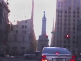
St. Paul Street is exit 4 off the Jones Falls Expressway (I-83).
In the downtown area between Centre and Lexington Streets, St. Paul Street is split into two parallel, nearby streets, one being identified as St. Paul Place. While the more westward of the two intersects with all streets within these blocks, the eastward passes under Orleans Street. The area between the two St. Paul Streets, known as Preston Gardens, replaced a downtown slum
area in 1919 and was landscaped by Thomas Hastings
. The gardens are named after Baltimore politician James H. Preston
, who was mayor and a Speaker
of the Maryland House of Delegates
.
 As St. Paul Street is mostly one-way southbound, Calvert Street, which is directly east of St. Paul, is open to northbound traffic.
Calvert Street begins at Pratt Street
near the Inner Harbor
and continues through the downtown area and various north Baltimore neighborhoods before terminating in Guilford
.
At its railroad crossing near I-83, Calvert Street once had an arch-style bridge
, though not as interesting looking as the one on nearby Howard Street
. The present crossing on Calvert Street is ordinary-looking.
and South Baltimore until its terminus at Wells Street.
Though quite short in length, Light Street is well-known in the area, forming the western boundary of the Inner Harbor
tourist area. The Maryland Science Center
is located on Light Street, and the McCormick Spice Company
between 1889 and 1989 was located on Light Street opposite the Inner Harbor.
Light Street is named for Darby Lux I
, an early Baltimore merchant who had a house on the street.
One-way pair
A one-way pair, one-way couple, or just couplet is a pair of parallel, usually one-way streets that carry opposite directions of a signed route or major traffic flow, or sometimes opposite directions of a bus or streetcar route....
of streets in Downtown Baltimore
Downtown Baltimore
Downtown Baltimore is the section of Baltimore traditionally bounded by Martin Luther King, Jr. Boulevard to the west, Mt. Royal Avenue to the north, President Street to the east and the Inner Harbor area to the south. It consists of four neighborhoods: Westside, City Centre, Inner Harbor, and...
and areas north. The streets, which are part of Maryland Route 2
Maryland Route 2
Maryland Route 2 is the longest state highway in the U.S. state of Maryland. The route runs from Solomons Island in Calvert County north to an intersection with U.S. Route 1 and U.S. Route 40 Truck in Baltimore...
, are two of Baltimore's best-known streets in the downtown area.
St. Paul Street
St. Paul Street begins off Charles StreetMaryland Route 139
Maryland Route 139, known locally for most of its existence as North Charles Street, runs through Baltimore City and through the Towson area of Baltimore County. On the north end it terminates at a traffic circle with Bellona Avenue near Interstate 695 and at the south end it terminates in Federal...
just south of Coldspring Lane near Loyola College. From this point on, the street runs directly parallel to Charles Street, exactly one block east of Charles Street.
St. Paul Street is two ways until the intersection with 31st Street. Northbound traffic is relegated to a single northbound lane, separated by median, and with metered parallel parking
Parallel parking
thumb|250px|right|Parallel-parked cars in [[Washington, D.C.]]thumb|250px|right|A motorist gets assistance parallel-parkingParallel parking is a method of parking a vehicle in line with other parked cars. Cars parked in parallel are in one line, parallel to the curb, with the front bumper of each...
.
St. Paul Street is exit 4 off the Jones Falls Expressway (I-83).
In the downtown area between Centre and Lexington Streets, St. Paul Street is split into two parallel, nearby streets, one being identified as St. Paul Place. While the more westward of the two intersects with all streets within these blocks, the eastward passes under Orleans Street. The area between the two St. Paul Streets, known as Preston Gardens, replaced a downtown slum
Slum
A slum, as defined by United Nations agency UN-HABITAT, is a run-down area of a city characterized by substandard housing and squalor and lacking in tenure security. According to the United Nations, the percentage of urban dwellers living in slums decreased from 47 percent to 37 percent in the...
area in 1919 and was landscaped by Thomas Hastings
Thomas Hastings (architect)
Thomas Hastings was an American architect.- Biography :He was born in New York City to Thomas Samuel Hastings, a Presbyterian minister, and Fanny de Groot. Hastings came from a colonial Yankee background, his ancestor Thomas Hastings having come from the East Anglia region of England to the...
. The gardens are named after Baltimore politician James H. Preston
James H. Preston
James Harry Preston was the Mayor of Baltimore from 1911-1919.-Biography:Preston was born in Harford County, Maryland in 1860. He served in the Maryland House of Delegates from 1890-1894. He briefly served as Speaker of the Maryland House of Delegates in 1894. Preston then served as the Mayor...
, who was mayor and a Speaker
Speaker of the Maryland House of Delegates
The Speaker of the Maryland House of Delegates presides as speaker over the House of Delegates in the state of Maryland in the United States.-List of Speakers of the House of Delegates:- References :*...
of the Maryland House of Delegates
Maryland House of Delegates
The Maryland House of Delegates is the lower house of the General Assembly, the state legislature of the U.S. state of Maryland, and is composed of 141 Delegates elected from 47 districts. The House chamber is located in the state capitol building on State Circle in Annapolis...
.
Notable landmarks
- Penn Station
- Mercy HospitalMercy Medical Center (Baltimore, Maryland)Mercy Medical Center is a hospital located in Baltimore, Maryland. The Tower Building of the hospital opened in 1963 and is located at 301 St. Paul Place....
Calvert Street
Calvert Street begins at Pratt Street
Pratt Street
Pratt Street is a major street in Baltimore. It forms a one-way pair of streets with Lombard Street that run west-east through downtown Baltimore. For most of their route, Pratt Street is one-way in an eastbound direction, and Lombard Street is one way westbound. Both streets begin in west...
near the Inner Harbor
Inner Harbor
The Inner Harbor is a historic seaport, tourist attraction, and iconic landmark of the City of Baltimore, Maryland, United States. Described by the Urban Land Institute in 2009 as “the model for post-industrial waterfront redevelopment around the World.” The Inner Harbor is actually the end of the...
and continues through the downtown area and various north Baltimore neighborhoods before terminating in Guilford
Guilford, Baltimore
Guilford is a neighborhood located in the northern part of Baltimore, Maryland, United States. It is bounded roughly by Coldspring Lane on the north, York Road/Greenmount Avenue on the east, convergence of St. Paul Street and Greenway Street at University Parkway on the south, and Charles Street...
.
At its railroad crossing near I-83, Calvert Street once had an arch-style bridge
Arch bridge
An arch bridge is a bridge with abutments at each end shaped as a curved arch. Arch bridges work by transferring the weight of the bridge and its loads partially into a horizontal thrust restrained by the abutments at either side...
, though not as interesting looking as the one on nearby Howard Street
Howard Street (Baltimore)
Howard Street is a major street that runs north-south through the central part of the city of Baltimore, Maryland. The street, which is approximately 2½ miles in length, begins at the north end of I-395 near Oriole Park at Camden Yards and ends near Johns Hopkins University. At this point, this...
. The present crossing on Calvert Street is ordinary-looking.
Notable landmarks
- Clarence M. Mitchell, Jr. CourthouseBaltimore City Circuit CourthousesThe Baltimore City Circuit Courthouses are located in downtown Baltimore, Maryland. Facing each other in the 100 block of North Calvert Street, the Clarence M. Mitchell, Jr, Courthouse and Courthouse East house the 30 judges of the 8th judicial circuit for the state of Maryland...
- Battle MonumentBattle MonumentThe Battle Monument, located on Calvert Street between Fayette and Lexington Streets in Baltimore, Maryland, commemorates the Battle of Baltimore and honors those who died during the month of September 1814 during the War of 1812...
- Baltimore Sun Building
- Union Memorial HospitalUnion Memorial HospitalUnion Memorial Hospital is a non-profit, acute care teaching hospital located in the North Central section of Baltimore, Maryland....
Light Street
After passing Baltimore Street, St. Paul Street changes its name to Light Street. Light Street becomes a large, two-way street after passing Pratt Street, the point where Calvert Street begins for northbound traffic. Light Street continues through Key Highway, passing through Federal HillFederal Hill
Federal Hill may refer to:in Malaysia* Federal Hill, Kuala Lumpur, Malaysiain the United States :** Federal Hill, a mansion featured on Kentucky's State Quarter and the centerpiece of My Old Kentucky Home State Park in Bardstown, Kentucky...
and South Baltimore until its terminus at Wells Street.
Though quite short in length, Light Street is well-known in the area, forming the western boundary of the Inner Harbor
Inner Harbor
The Inner Harbor is a historic seaport, tourist attraction, and iconic landmark of the City of Baltimore, Maryland, United States. Described by the Urban Land Institute in 2009 as “the model for post-industrial waterfront redevelopment around the World.” The Inner Harbor is actually the end of the...
tourist area. The Maryland Science Center
Maryland Science Center
The Maryland Science Center, located in Baltimore's Inner Harbor, opened to the public in 1976. It includes three levels of exhibits, a planetarium, and an observatory. It was one of the original structures that drove the revitalization of the Baltimore Inner Harbor from its industrial roots to a...
is located on Light Street, and the McCormick Spice Company
McCormick & Company
McCormick & Company manufactures spices, herbs, and flavorings for retail, commercial, and industrial markets. The company began in 1889 in Baltimore, Maryland, United States. One hundred years later, McCormick moved from downtown Baltimore to the suburb of Hunt Valley, Maryland. McCormick has...
between 1889 and 1989 was located on Light Street opposite the Inner Harbor.
Light Street is named for Darby Lux I
Darby Lux I
Capt. Darby Lux I was a mariner, merchant, and Justice of Baltimore County, Maryland.Capt. Lux was the son of an English clergyman. Capt. Lux was born in Kenton Parish, Devonshire, England on June 15, 1695. He was christened on June 30, 1696 in Kenton. Darby immigrated in the early 1720s, and...
, an early Baltimore merchant who had a house on the street.
External links
- Metal Arch Bridges in Maryland, Describes the history of the Calvert Street Bridge