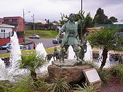
San Francisco de Dos Ríos District, San José Canton
Encyclopedia

Districts of Costa Rica
| The cantons of Costa Rica are subdivided into 473 districts .-References:...
" of San José Canton
San José Canton
San José is the name of the first canton in the province of San José in Costa Rica. The canton covers an area of 44.62 km² and has a population of 386,799 . It includes the national capital city of San José....
, Costa Rica
Costa Rica
Costa Rica , officially the Republic of Costa Rica is a multilingual, multiethnic and multicultural country in Central America, bordered by Nicaragua to the north, Panama to the southeast, the Pacific Ocean to the west and the Caribbean Sea to the east....
, is one of the administrative units surrounding San José
San José, Costa Rica
San José is the capital and largest city of Costa Rica. Located in the Central Valley, San José is the seat of national government, the focal point of political and economic activity, and the major transportation hub of this Central American nation.Founded in 1738 by order of Cabildo de León, San...
downtown (officially composed by the districts of El Carmen, Merced, Hospital and Catedral). The district is primarily residential and industrial. It's also famous for the numerous motel
Motel
A motor hotel, or motel for short, is a hotel designed for motorists, and usually has a parking area for motor vehicles...
s between its boundaries.
Geography and Demography
San Francisco de Dos Ríos lies on the south-east of the canton, between CurridabatCurridabat Canton
Curridabat is the name of the 18th canton in the province of San José in Costa Rica. The canton covers an area of , and has a population of 72,564...
and Desamparados
Desamparados Canton
Desamparados is the name of the 3rd canton in the province of San José in Costa Rica. The canton covers an area of 118.26 km², and has a population of 206,708, making it the third most populated among the 81 cantons of Costa Rica...
cantons (bordering them to the east and to the south respectively) and between the districts of San Sebastián and Zapote (bordering them also to the west and to the north respectively).
The district had 2.68 km² and 23,854 inhabitants on December 31, 2008 (8,900.75 inhabitants per km².)
District Information
San Francisco de Dos Ríos district includes the "barrios" (or neighbourhoods) of Ahogados (part of it), Camelias, Cinco Esquinas, Coopeguaria, El Bosque, El Faro, Fátima, Hispano, San Marino Sur, I Griega, La Cabaña, Lincoln, Lomas de San Francisco, Maalot, Méndez, Pacífica, San Francisco de Dos Ríos (center), Sauces, Saucitos and Zurquí.External links
- Municipalidad de San José. Distrito San Francisco de Dos Ríos – Website of San Jose Mayor, includes a map of the district and related info.

