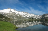
Pic de Néouvielle
Encyclopedia
Pic de Néouvielle is a mountain
in the Néouvielle massif
in the Pyrenees
.
It is located in the commune of Saint-Lary-Soulan
within the department of the Hautes-Pyrénées
, and lies on the border between the Pyrenees National Park
and the Néouvielle National Park. The name Pic de Néouvielle derives from nèu vielha, meaning 'old snow' in the Occitan language; the inhabitants of the vallée d'Aure call the peak la montagne d'Aubert.
The mountain has four corries, some containing small glaciers, separated by sharp granite ridges. Its south face is between 400–500 m high, and dominates the deep valley of the lac de Cap-de-Long. The shapely Pic Ramougn
lies on its east ridge.
The first known ascent of Pic de Néouvielle was made on 10 July 1847 by Vincent de Chausenque and the Barèges
guide Bastien Teinturier.
Mountain
Image:Himalaya_annotated.jpg|thumb|right|The Himalayan mountain range with Mount Everestrect 58 14 160 49 Chomo Lonzorect 200 28 335 52 Makalurect 378 24 566 45 Mount Everestrect 188 581 920 656 Tibetan Plateaurect 250 406 340 427 Rong River...
in the Néouvielle massif
Néouvielle massif
The Néouvielle massif is a group of mountains in the Pyrenees in France notable for its lakes and its microclimate. Much of the massif lies within the Néouvielle National Nature Reserve; this nature reserve was created in 1936 and is the third oldest in France.The name Néouvielle derives from nèu...
in the Pyrenees
Pyrenees
The Pyrenees is a range of mountains in southwest Europe that forms a natural border between France and Spain...
.
It is located in the commune of Saint-Lary-Soulan
Saint-Lary-Soulan
Saint-Lary-Soulan is a commune in the Hautes-Pyrénées department in south-western France.-Geography:Saint-Lary is located in Hautes-Pyrénées 80 km south of the départements capital Tarbes, next to the Le Néouvielle Nature Reserve and the Pyrenees National Park and is a 20 minute drive to...
within the department of the Hautes-Pyrénées
Hautes-Pyrénées
Hautes-Pyrénées is a department in southwestern France. It is part of the Midi-Pyrénées region.-History:...
, and lies on the border between the Pyrenees National Park
Pyrenees National Park
The Pyrénées National Park is a national park located within the French départements of Hautes-Pyrénées and Pyrénées-Atlantiques.Located along the border of France and Spain is a scenic and mountainous landscape offering a variety of outdoor activities including hiking, skiing, mountain climbing...
and the Néouvielle National Park. The name Pic de Néouvielle derives from nèu vielha, meaning 'old snow' in the Occitan language; the inhabitants of the vallée d'Aure call the peak la montagne d'Aubert.
The mountain has four corries, some containing small glaciers, separated by sharp granite ridges. Its south face is between 400–500 m high, and dominates the deep valley of the lac de Cap-de-Long. The shapely Pic Ramougn
Pic Ramougn
Pic Ramougn is a steep, rocky mountain in the Néouvielle massif in the Pyrenees.It is located in the commune of Saint-Lary-Soulan within the department of the Hautes-Pyrénées, and is named after the French politician, geologist and botanist Louis Ramond de Carbonnières. Ramougn is the...
lies on its east ridge.
The first known ascent of Pic de Néouvielle was made on 10 July 1847 by Vincent de Chausenque and the Barèges
Barèges
Barèges is a commune in the Hautes-Pyrénées department in south-western France. It is situated in the valley of the stream Bastan on the former Route nationale 618, the "Route of the Pyrénées."-Economy:...
guide Bastien Teinturier.

