

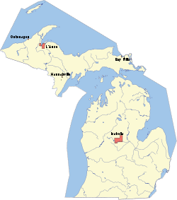
L'Anse Indian Reservation
Encyclopedia
Ojibwa
The Ojibwe or Chippewa are among the largest groups of Native Americans–First Nations north of Mexico. They are divided between Canada and the United States. In Canada, they are the third-largest population among First Nations, surpassed only by Cree and Inuit...
Indians (successor apparent of the L’Anse and Ontonagon Bands). It is located primarily in two non-contiguous sections on either side of the Keweenaw Bay
Keweenaw Bay
Keweenaw Bay is an arm of Lake Superior in North America. It is located adjacent to the Upper Peninsula of the U.S. state of Michigan, to the southeast of the Keweenaw Peninsula. It is also the name of a small community near the bay....
in Baraga County
Baraga County, Michigan
-National protected areas:* Keweenaw National Historical Park * Ottawa National Forest -Demographics:As of the 2000 census, there were 8,746 people, 3,353 households, and 2,223 families residing in the county. The population density was 10 people per square mile . There were 4,631 housing units...
in the Upper Peninsula
Upper Peninsula of Michigan
The Upper Peninsula of Michigan is the northern of the two major land masses that make up the U.S. state of Michigan. It is commonly referred to as the Upper Peninsula, the U.P., or Upper Michigan. It is also known as the land "above the Bridge" linking the two peninsulas. The peninsula is bounded...
of the U.S. state
U.S. state
A U.S. state is any one of the 50 federated states of the United States of America that share sovereignty with the federal government. Because of this shared sovereignty, an American is a citizen both of the federal entity and of his or her state of domicile. Four states use the official title of...
of Michigan
Michigan
Michigan is a U.S. state located in the Great Lakes Region of the United States of America. The name Michigan is the French form of the Ojibwa word mishigamaa, meaning "large water" or "large lake"....
. The largest section lies in northern L'Anse Township
L'Anse Township, Michigan
L'Anse Township is a civil township of Baraga County in the U.S. state of Michigan. As of the 2000 census, the township population was 3,926. Mount Arvon and Mount Curwood, the highest and second highest points in Michigan are located in the township....
and western Arvon Township
Arvon Township, Michigan
Arvon Township is a civil township of Baraga County in the U.S. state of Michigan. As of the 2000 census, the township population was 482.Arvon Township's name is derived from that of the district of Carnarvon in Wales, famous for its slate industry, because of the deposits of slate in the area...
on the east side of Keweenaw Bay, while the smaller section lies in northern Baraga Township
Baraga Township, Michigan
Baraga Township is a civil township of Baraga County in the U.S. state of Michigan. As of the 2000 census, the township population was 3,542. The village of Baraga is located in the southeast corner of the township.-Communities:...
on the west side of Keweenaw Bay. There is also a much smaller (43.07 acre
Acre
The acre is a unit of area in a number of different systems, including the imperial and U.S. customary systems. The most commonly used acres today are the international acre and, in the United States, the survey acre. The most common use of the acre is to measure tracts of land.The acre is related...
) part of the reservation in northern Chocolay Township in northeastern Marquette County
Marquette County, Michigan
-National protected areas:* Hiawatha National Forest * Huron National Wildlife Refuge* Ottawa National Forest -University:Northern Michigan University is a four-year university, established in 1899, located in Marquette, Michigan, on Michigan's Upper Peninsula...
. The total land area of the reservation is 92.132 sq mi (238.622 km²) and there were 3,672 persons residing on its territory as of the 2000 census
United States Census, 2000
The Twenty-second United States Census, known as Census 2000 and conducted by the Census Bureau, determined the resident population of the United States on April 1, 2000, to be 281,421,906, an increase of 13.2% over the 248,709,873 persons enumerated during the 1990 Census...
, of whom more than 69 percent were white people
White people
White people is a term which usually refers to human beings characterized, at least in part, by the light pigmentation of their skin...
and only 24.4 percent of solely Native American heritage. Most of the village of Baraga
Baraga, Michigan
Baraga is a village in Baraga County in the U.S. state of Michigan. The population was 1,285 at the 2000 census. The village is named after Bishop Frederic Baraga....
and part of the village of L'Anse
L'Anse, Michigan
L'Anse is a village in the U.S. state of Michigan and the county seat of Baraga County. The population was 2,107 at the 2000 census. The village is located within L'Anse Township....
are on reservation land.
In 1999, tribal enrollment was 3,159 according to the Bureau of Indian Affairs
Bureau of Indian Affairs
The Bureau of Indian Affairs is an agency of the federal government of the United States within the US Department of the Interior. It is responsible for the administration and management of of land held in trust by the United States for Native Americans in the United States, Native American...
1999 Labor Force Report.
The L’Anse Reservation is both the oldest and largest reservation in Michigan. It was established under the Chippewa Treaty of 1854
Treaty of La Pointe
The Treaty of La Pointe may refer to either of two treaties made and signed in La Pointe, Wisconsin between the United States and the Ojibwe Native American peoples...
. The United States Supreme Court has interpreted this treaty as creating permanent homelands for the Chippewa (Ojibwa Anishnaabeg) signatories to the treaty. The Treaty of 1842
Treaty of La Pointe
The Treaty of La Pointe may refer to either of two treaties made and signed in La Pointe, Wisconsin between the United States and the Ojibwe Native American peoples...
, which ceded lands to the federal government, was one of the largest land cession agreements ever made between the U.S. federal government and Indian tribes. It includes provisions and stipulations that the Chippewa retain their rights to fish, hunt and gather on these ceded lands.
The L’Anse Reservation consists of 54,000 acres (220 km²) with approximately 14,000 acres (57 km²) owned by the tribal community. Two thirds of the land is held in tribal common ownership and the remaining third is owned by Indians in fee, restricted fee, or allotted lands status. The entire reservation encompasses nearly one third of the area of Baraga County.