
.gif)
Antonio Nariño (Bogotá)
Encyclopedia
 Antonio Nariño in Bogotá |
||
| Area: | 4.93 km | |
|---|---|---|
| Population density Density The mass density or density of a material is defined as its mass per unit volume. The symbol most often used for density is ρ . In some cases , density is also defined as its weight per unit volume; although, this quantity is more properly called specific weight... : |
119.565 (2007) | |
| Type of locality: | Urban | |
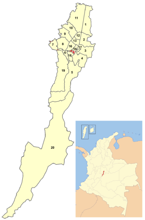
Antonio Nariño is the 15th locality of Bogotá
Bogotá
Bogotá, Distrito Capital , from 1991 to 2000 called Santa Fé de Bogotá, is the capital, and largest city, of Colombia. It is also designated by the national constitution as the capital of the department of Cundinamarca, even though the city of Bogotá now comprises an independent Capital district...
, capital of Colombia
Colombia
Colombia, officially the Republic of Colombia , is a unitary constitutional republic comprising thirty-two departments. The country is located in northwestern South America, bordered to the east by Venezuela and Brazil; to the south by Ecuador and Peru; to the north by the Caribbean Sea; to the...
. It is located in the city's south. It is named after an early Colombian leader, Antonio Nariño
Antonio Nariño
Antonio de la Santísima Concepción Nariño y Álvarez was an ideological Colombian precursor and one of the early political and military leaders of the independence movement in the New Granada - Early political activity :Nariño was born to an aristocratic family...
, who is often referred to as the precursor to the presidency.
Borders
North: Autopista SurNorte-Quito-Sur
Avenida Norte-Quito-Sur or NQS is an arterial road in Bogotá, Colombia that crosses the city from northeast to southwest.The avenue is formed from the union of three old avenues, Avenida Ciudad de Quito, Avenida Novena, and Autopista Sur.-The names:...
, Calle 8 Sur and Avenida Primera, with the localities of Puente Aranda
Puente Aranda
Puente Aranda is the 16th location of the Capital District of the Colombian capital city, Bogotá. It is located in the midwest within the city and was named after an old bridge in the hacienda of Juan Aranda over the "Chinúa River" now called the San Francisco Creek that dates from the 16th...
and Los Mártires
Los Mártires
Los Mártires is the 14th locality of Bogotá, capital of Colombia. It is located near the city's downtown to its west. It takes its name in honor of those who died during the war for independence from Spain...
South: Avenida Primero de Mayo, with the locality of Rafael Uribe Uribe
Rafael Uribe Uribe (Bogotá)
The Rafael Uribe Uribe is the 18th locality of the Capital District in the Colombian capital city Bogotá. It was named after the Liberal General Rafael Uribe Uribe. Historically it has NOT been predominantly a residential area with a very small commercial activity. Since the 1940s urban expansion...
East: Carrera 10ª, with the locality of San Cristóbal
San Cristóbal (Bogotá)
San Cristóbal, is the fourth locality of Bogotá, capital of Colombia. It is located in the south-east of the city.- Borders :North: Santa Fe locality.South: The locality of Usme....
West: Calle 44 Sur, with the locality of Tunjuelito
Tunjuelito
Tunjuelito is the 6th locality of the Capital District of the Colombian capital city, Bogotá. Tunjuelito is located to the south of Bogotá, bordering to the north with the localities of Bosa, Kennedy and Puente Aranda, to the east with the localities of Rafael Uribe Uribe and Usme, to the south...
Hydrology
The locality had several rivers that have been transformed into canals emptying into the Fucha river. It has several parks.There is one major commercial sector in the Restrepo neighborhood, with the balance of the locality consisting of residential areas with small stores and churches.
Transportation
Access: By TransMilenioTransMilenio
TransMilenio is a bus rapid transit system that serves Bogotá, the capital of Colombia. The system opened to the public in December 2000, covering Av. Caracas and Calle 80...
on Avenida Caracas (Restrepo
Restrepo (TransMilenio)
The simple station Restrepo is part of the TransMilenio mass-transit system of Bogotá, Colombia, opened in the year 2000.-Location:The station is located in southern Bogotá, specifically on Avenida Caracas with Calles 19 and 22 sur....
and Fucha
Fucha (TransMilenio)
The simple station Fucha is part of the TransMilenio mass-transit system of Bogotá, Colombia, opened in the year 2000.-Location:The station is located in southern Bogotá, specifically on Avenida Caracas, with Calles 17 and 18A sur....
stations) and Autopista Sur. Normal busses serve Avenida Primera, Primero de Mayo, and Carrera 10.
History
During the 19th century, the territory belonged to the Muequetá indigenous peoples. Large estates were located on the shores of the rivers that crossed it. The process of urbanization was begun in 1920, and was completed over the following 50 years. It was separated as a locality in 1991. The majority of the locality is strata 3 residences.Economy
The Restrepo area is located on Carrera 24 until the Avenida Primero de Mayo, which is the largest commercial area of the locality. A large number of small companies are located here, with the production of low-cost, high-quality shoes among the most notable of industries.Neighborhoods
Important neighborhoods: Restrepo, Policarpa SalavarrietaPolicarpa Salavarrieta
Policarpa Salavarrieta , also known as La Pola, was a Neogranadine seamstress who spied for the Revolutionary Forces during the Spanish Reconquista of the Viceroyalty of New Granada. She was captured by Spanish Royalists and ultimately executed for high treason...
, Luna Park, Villa Mayor, Eduardo Freí, San Antonio, Caracas, Ciudad Berna, Ciudad Jardín, La Fragua, and Santander.